Ocean Hill Section 1 was platted in 1978 with 345 ft deep oceanfront lots. In the 42 years since then the ocean has eroded away more than 100 feet of property and is now threatening decks, pools and homes. The County recognized the problem in 2005 when they raised the Occupancy Tax rate by 50% to allow beach nourishment. This tax increase made rentals more expensive and has raised an additional $60 million in tax revenues, but not a grain of sand has been added to fix our beaches.
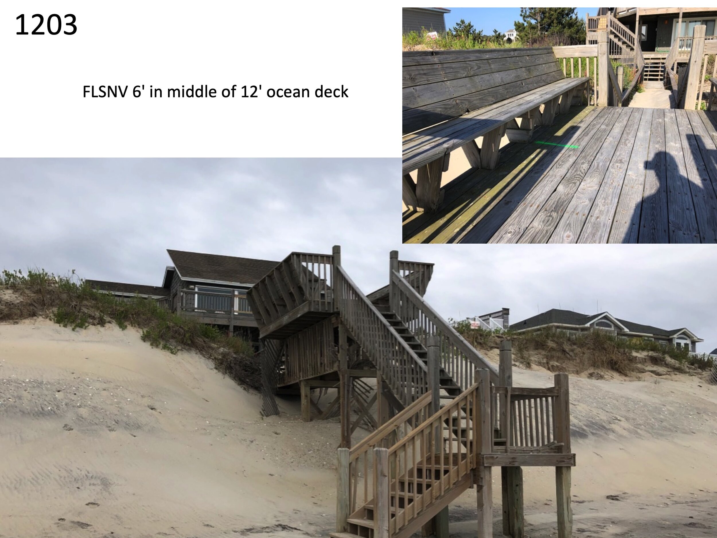
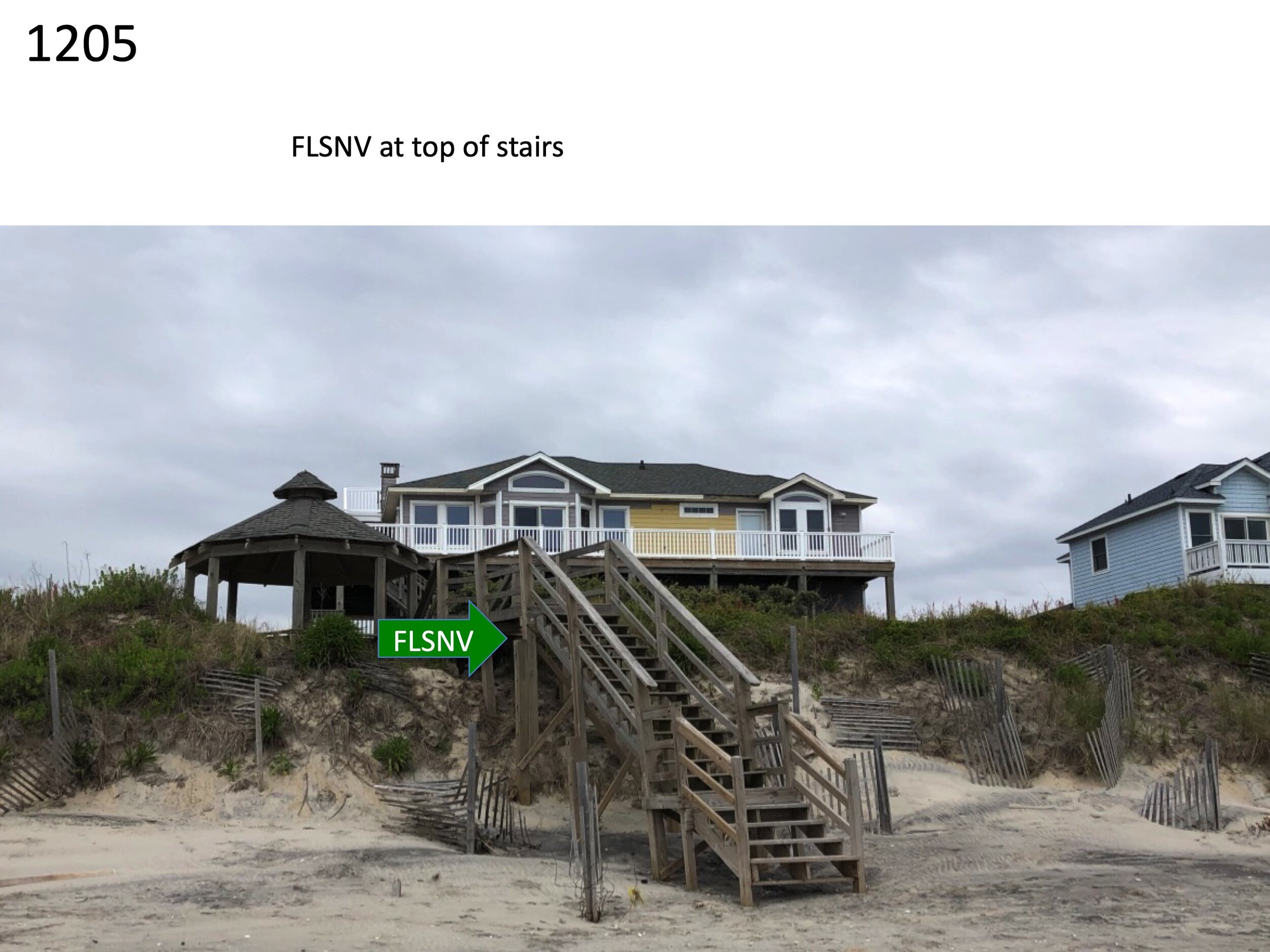
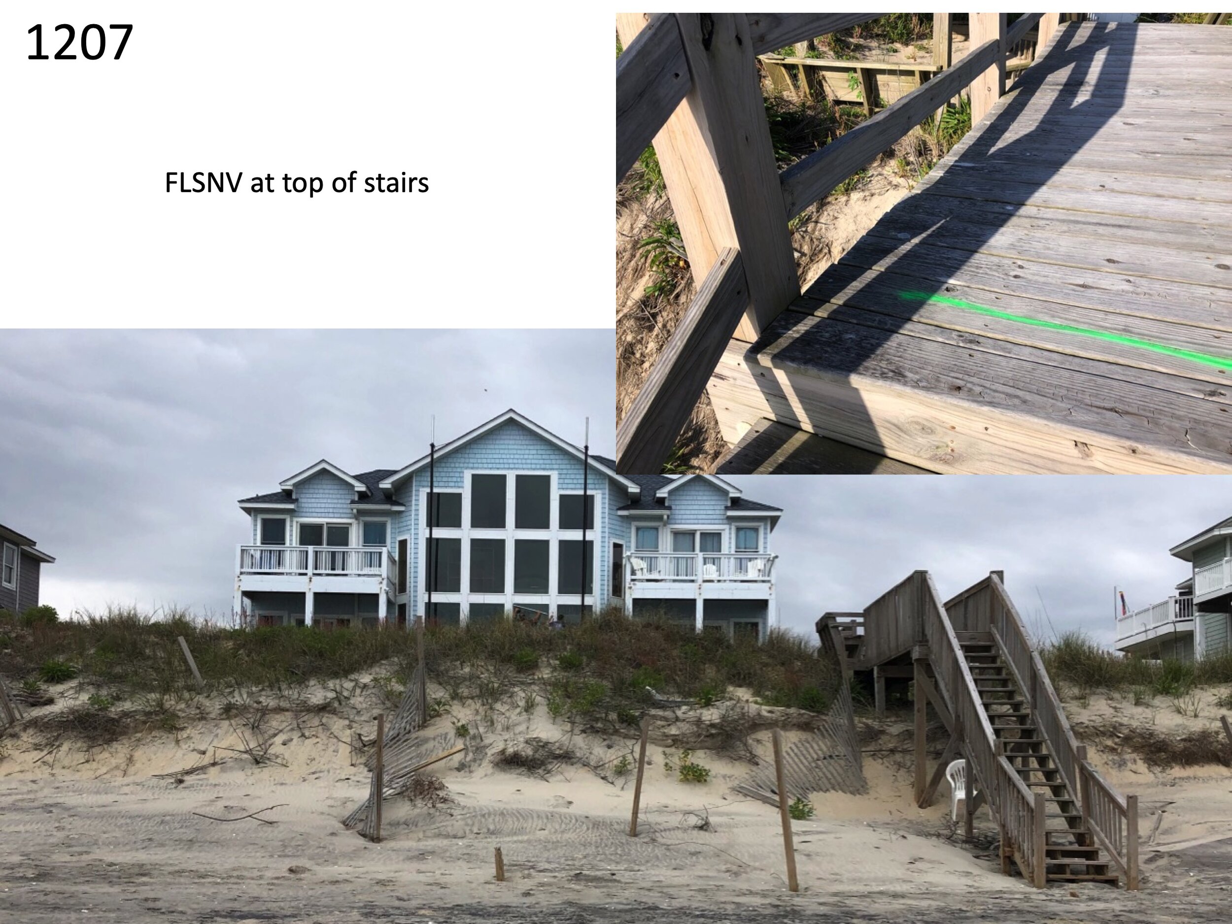
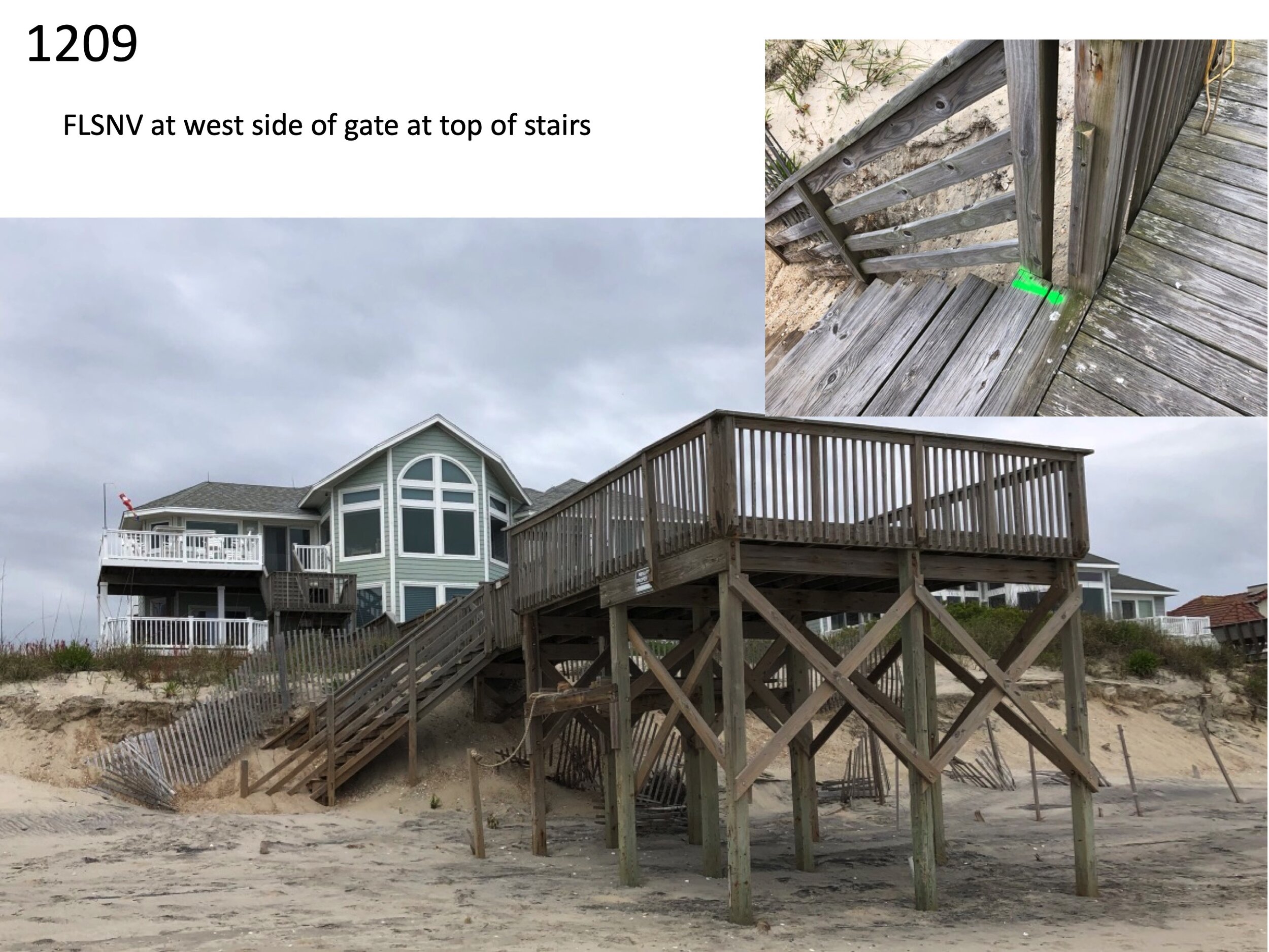
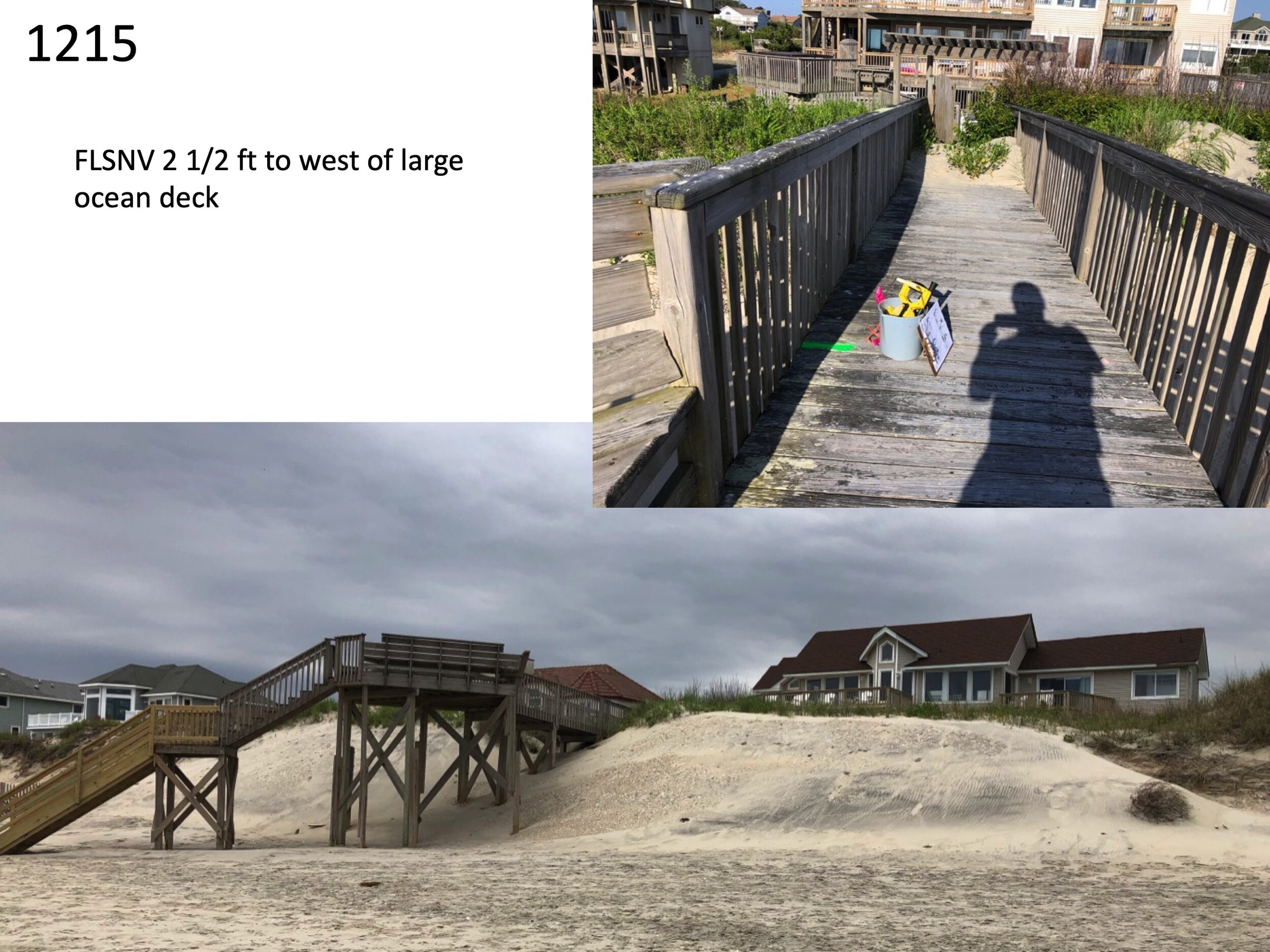
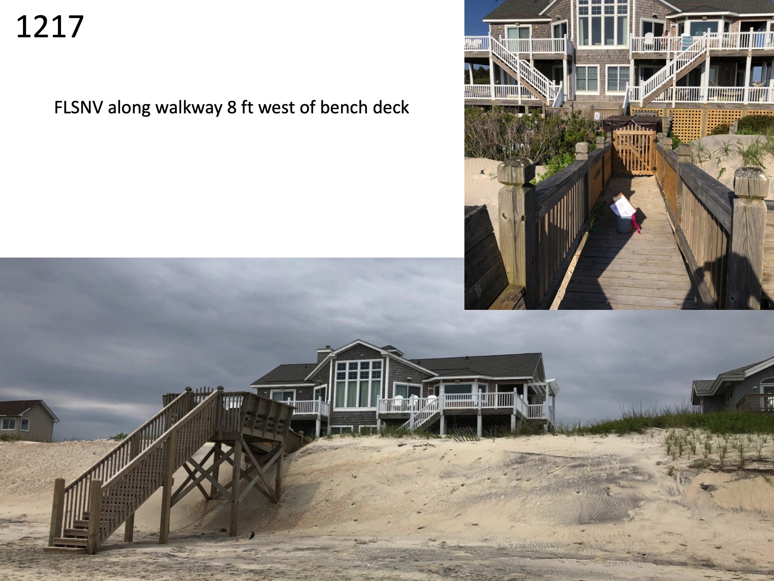
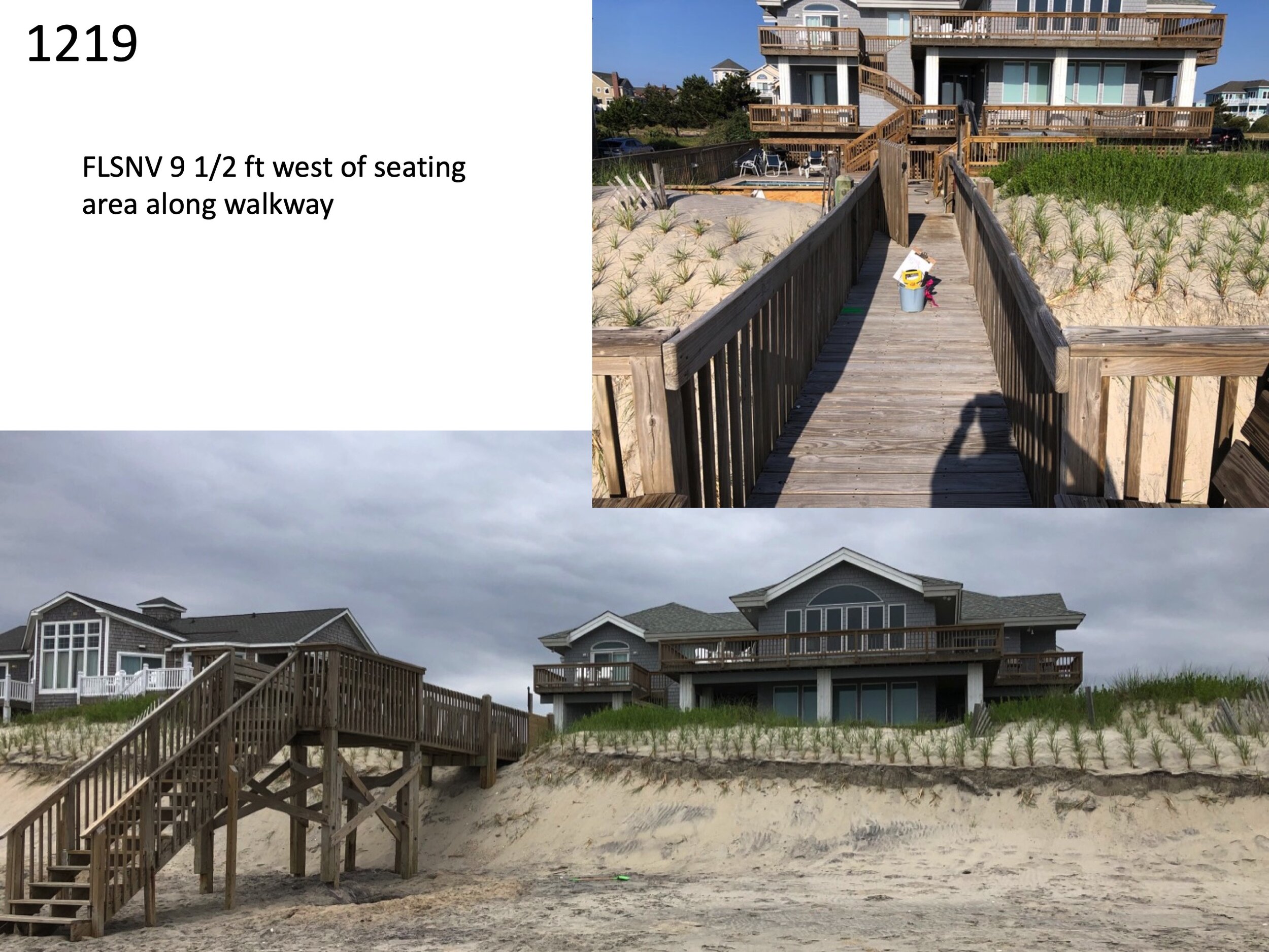
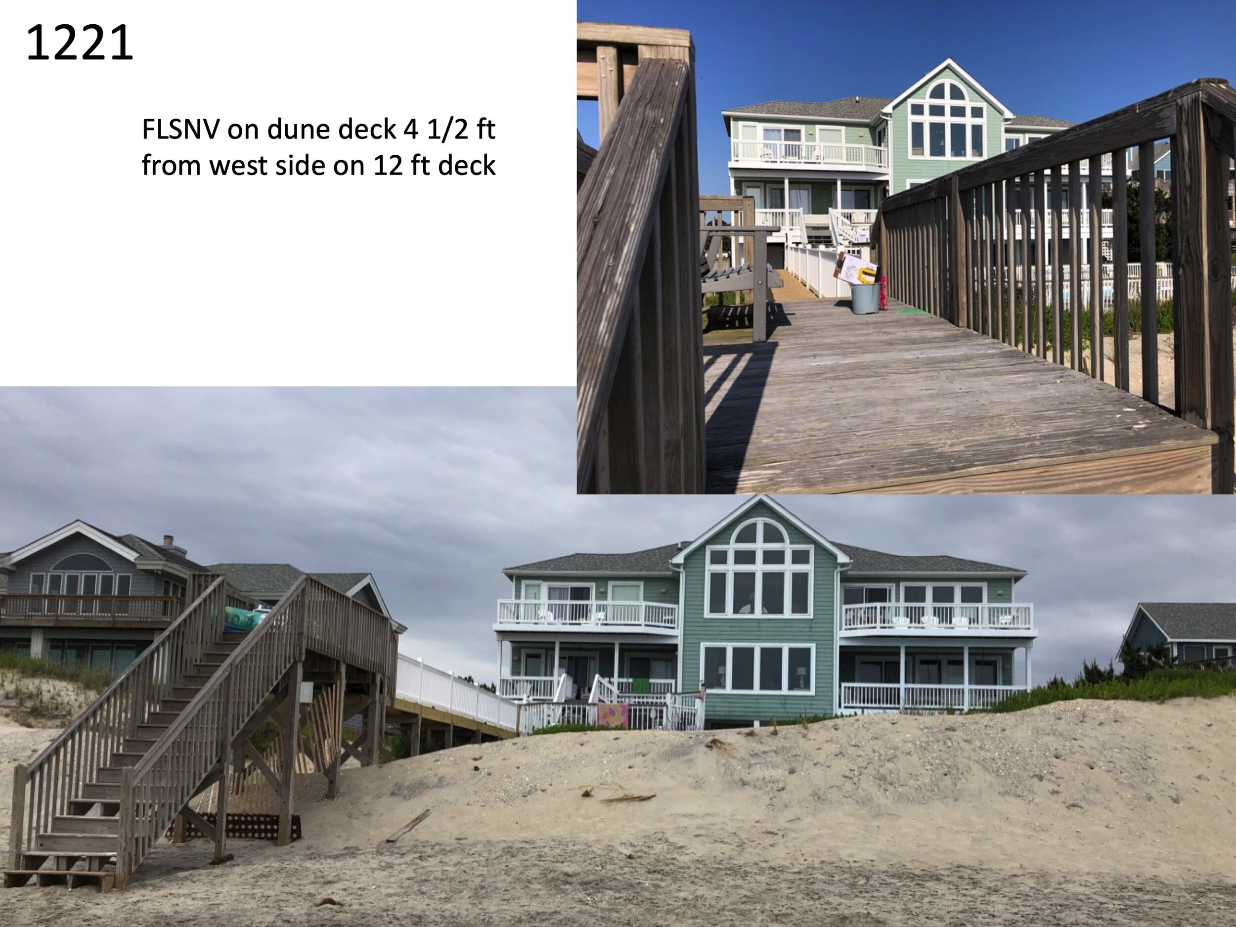
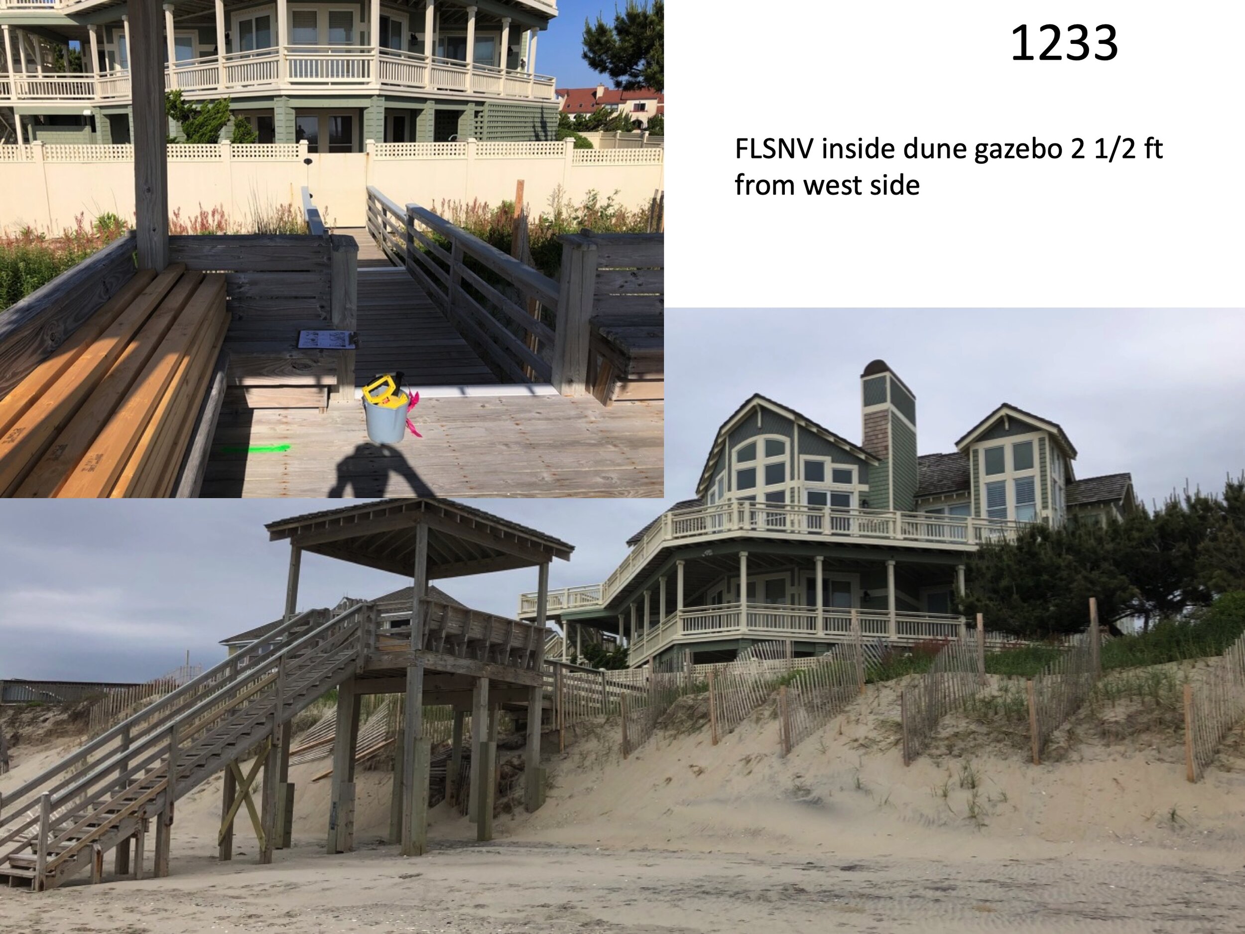
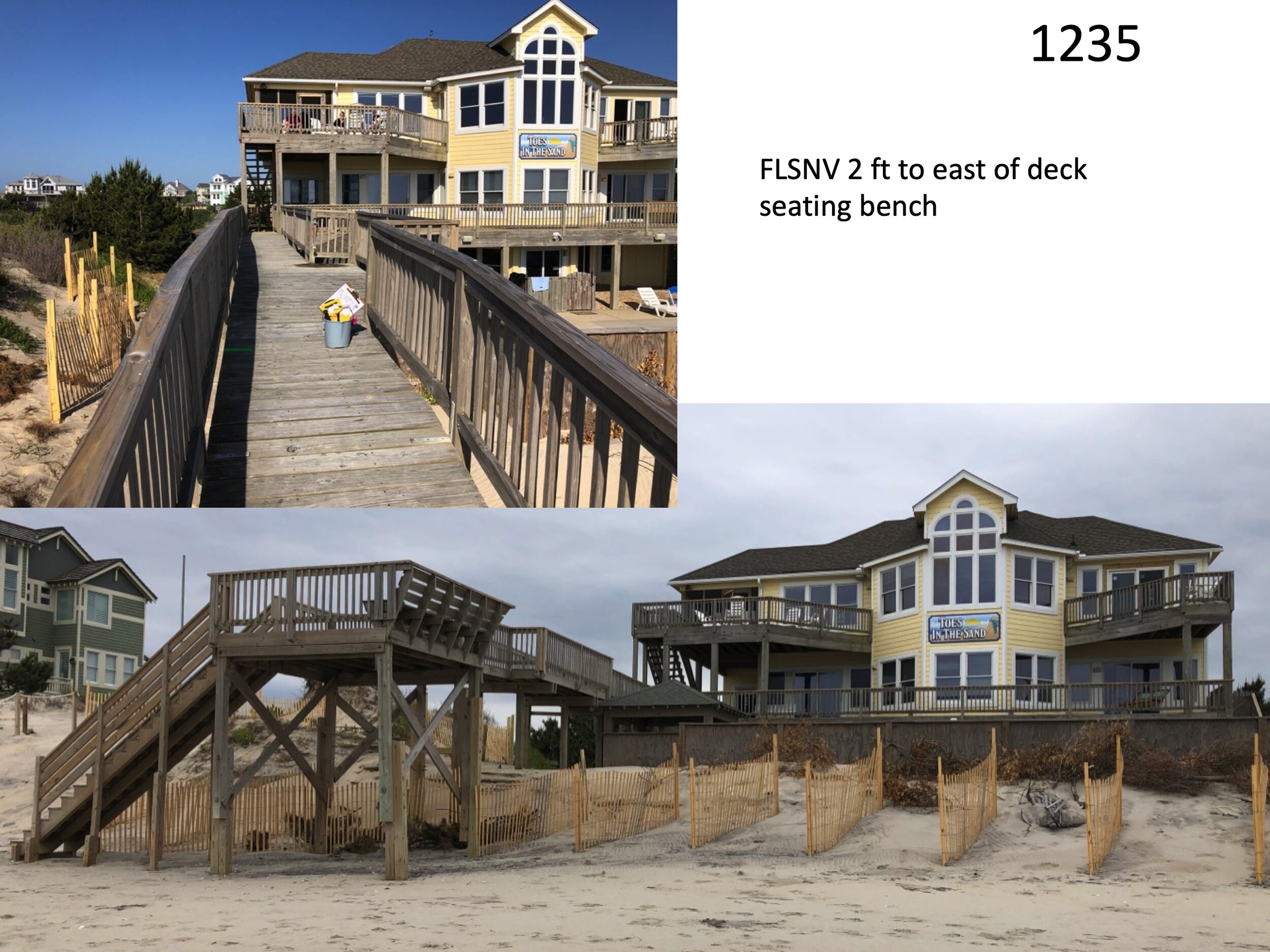
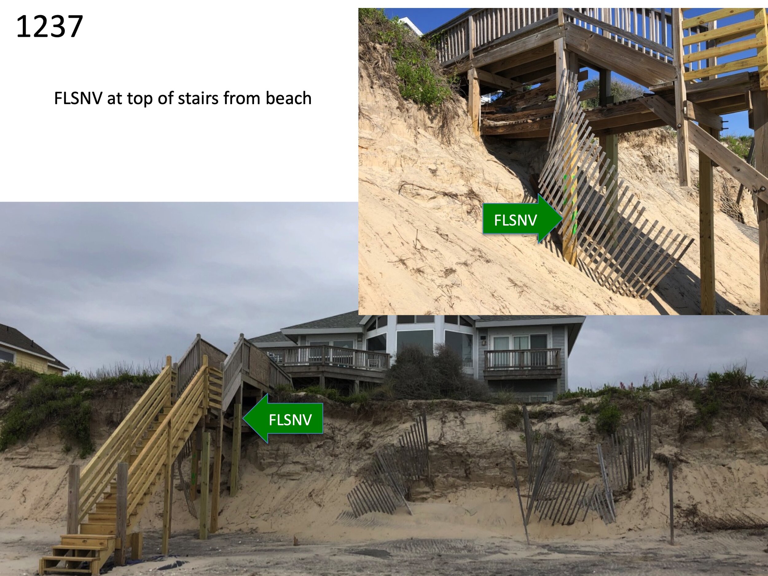
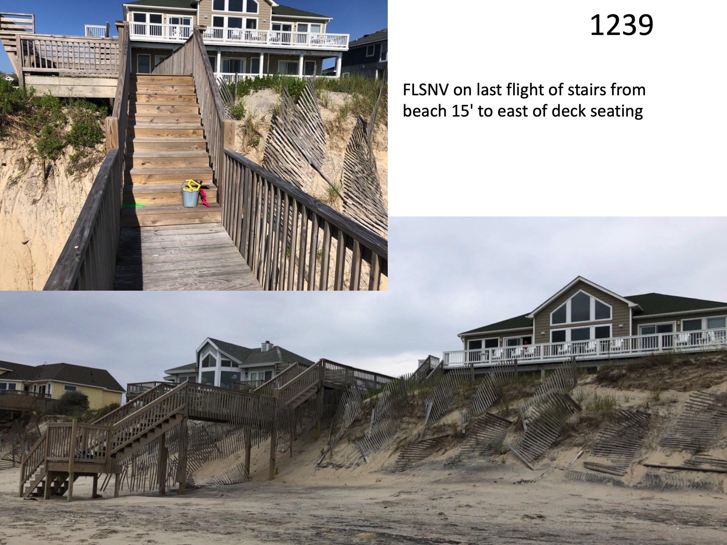
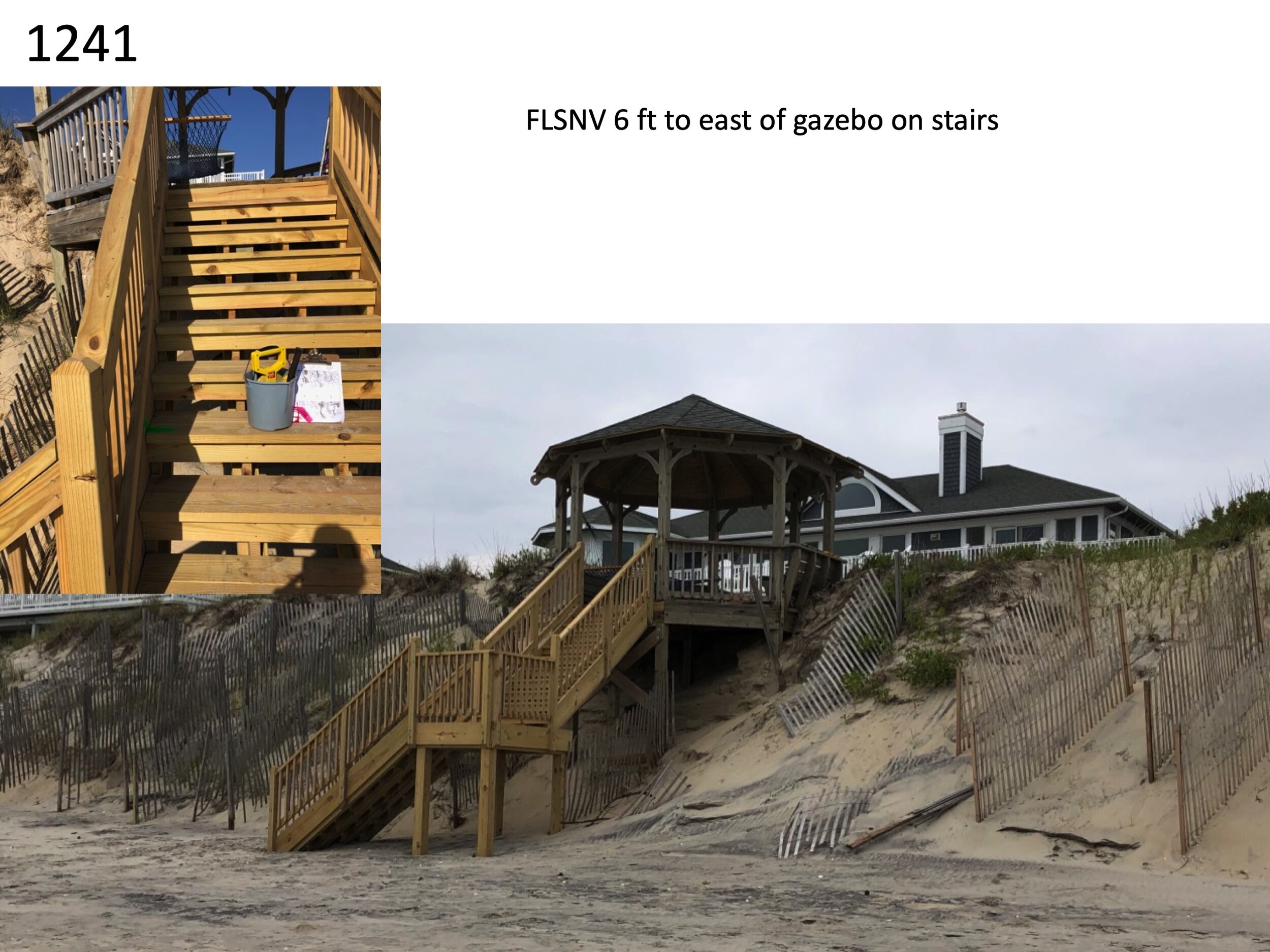
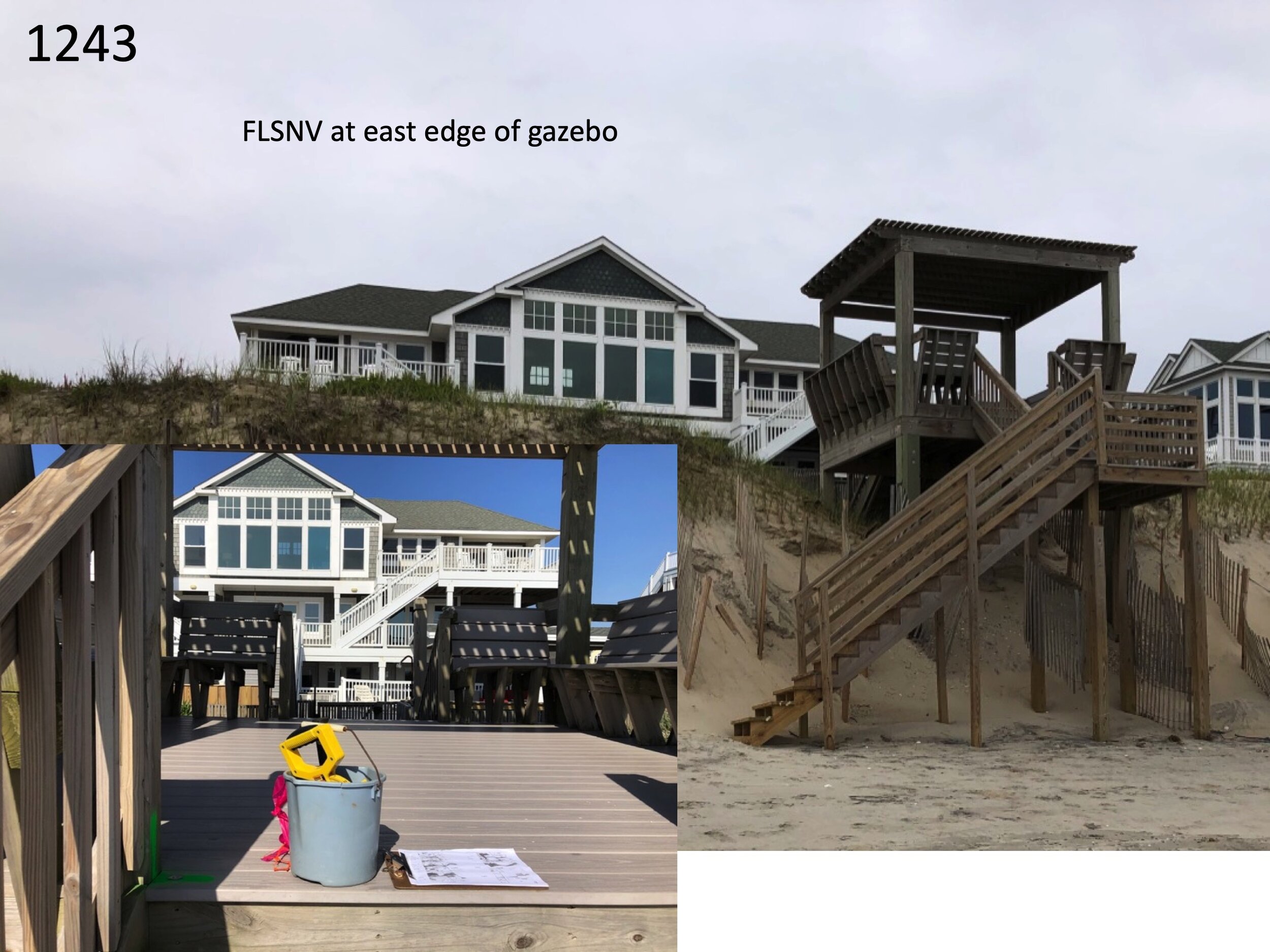
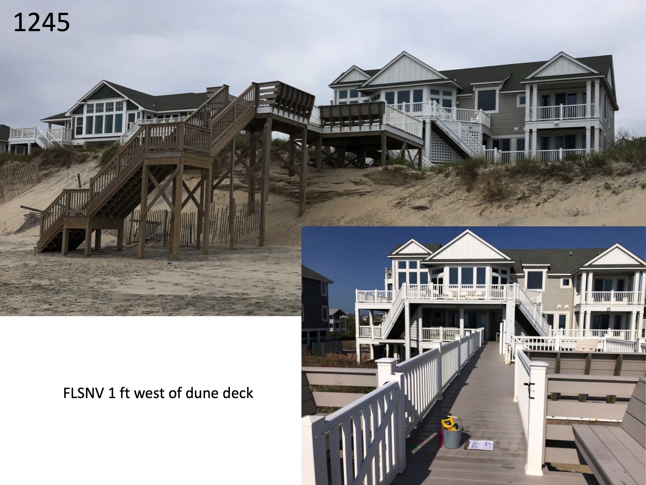
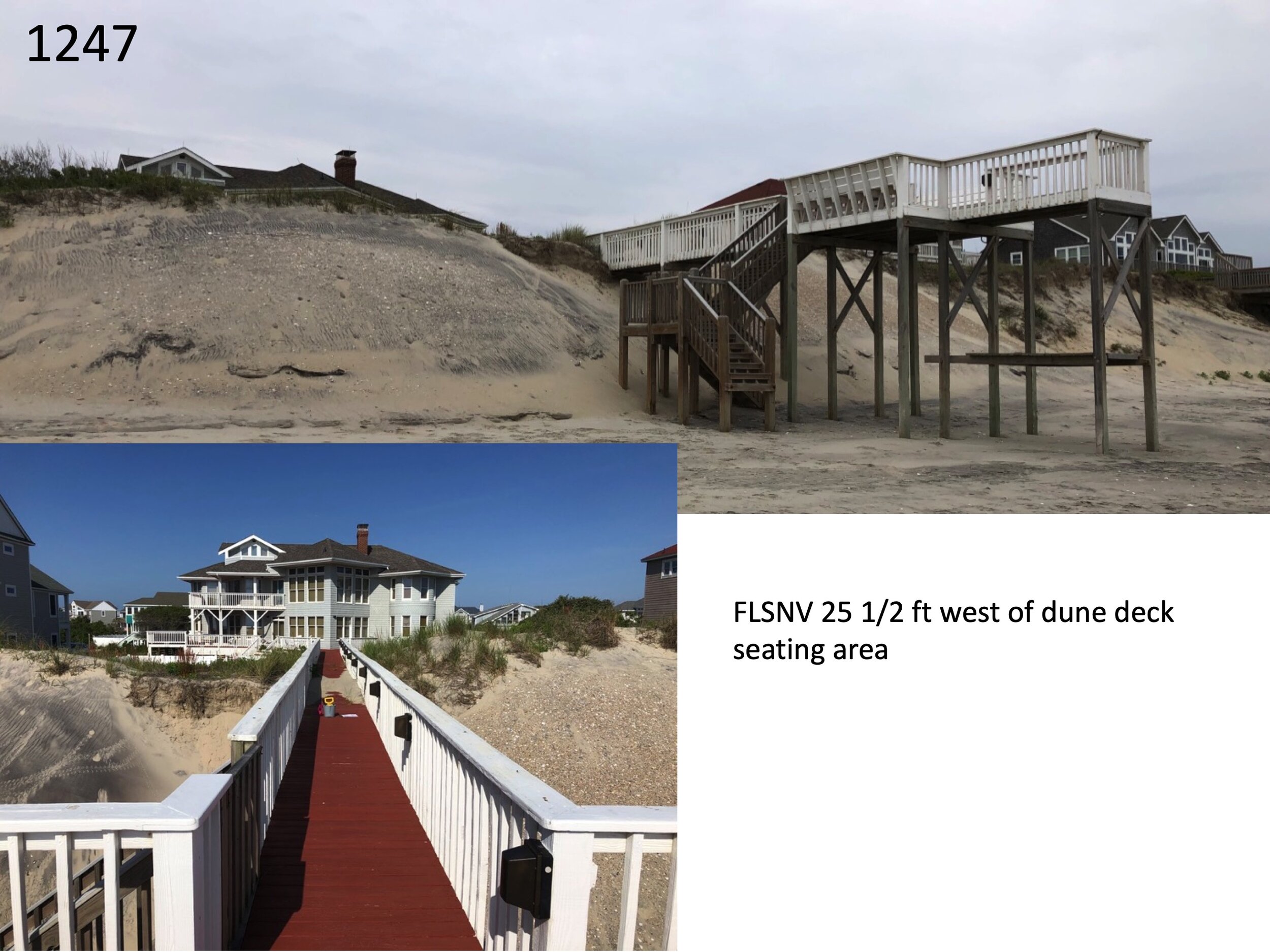
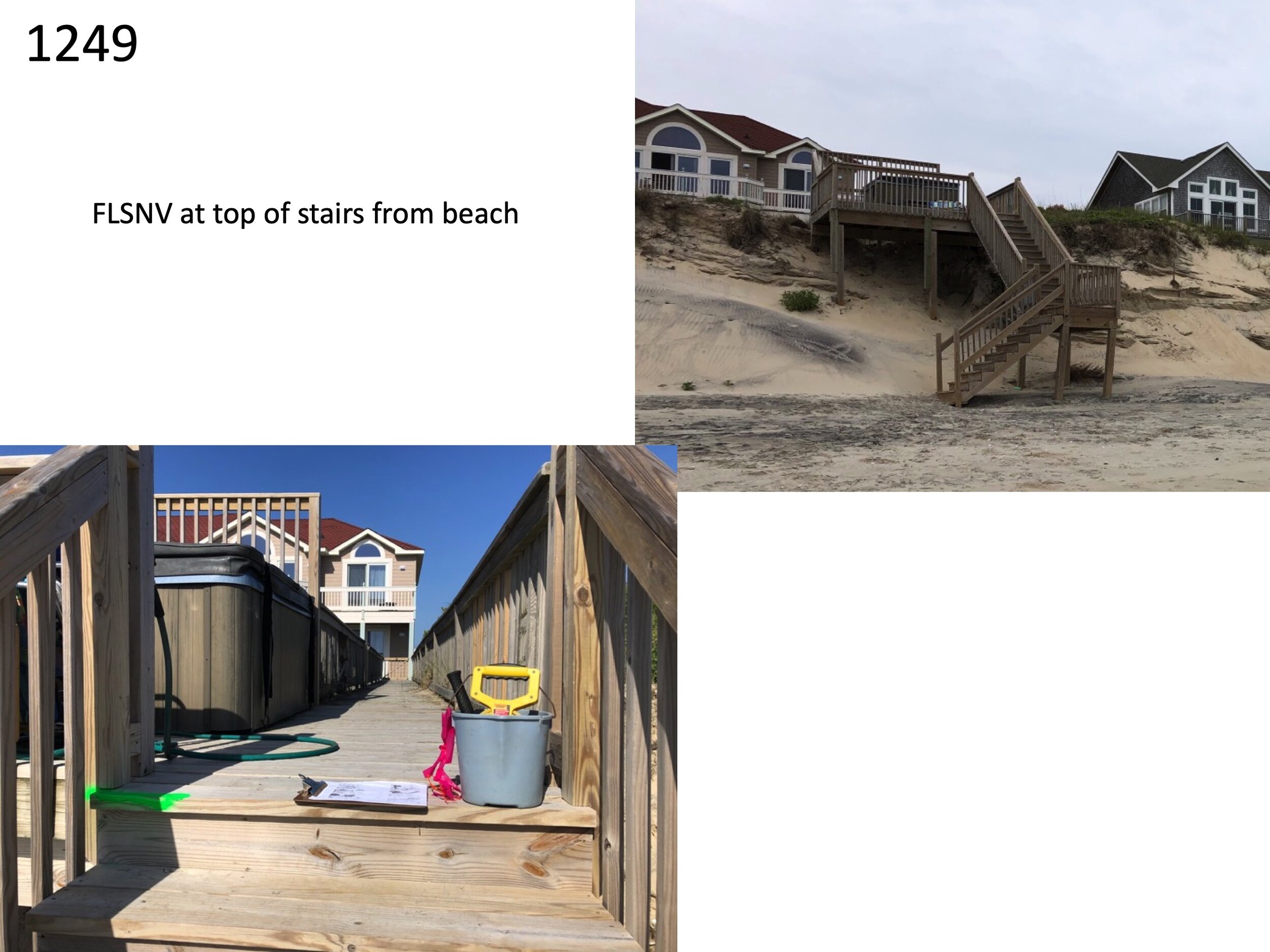
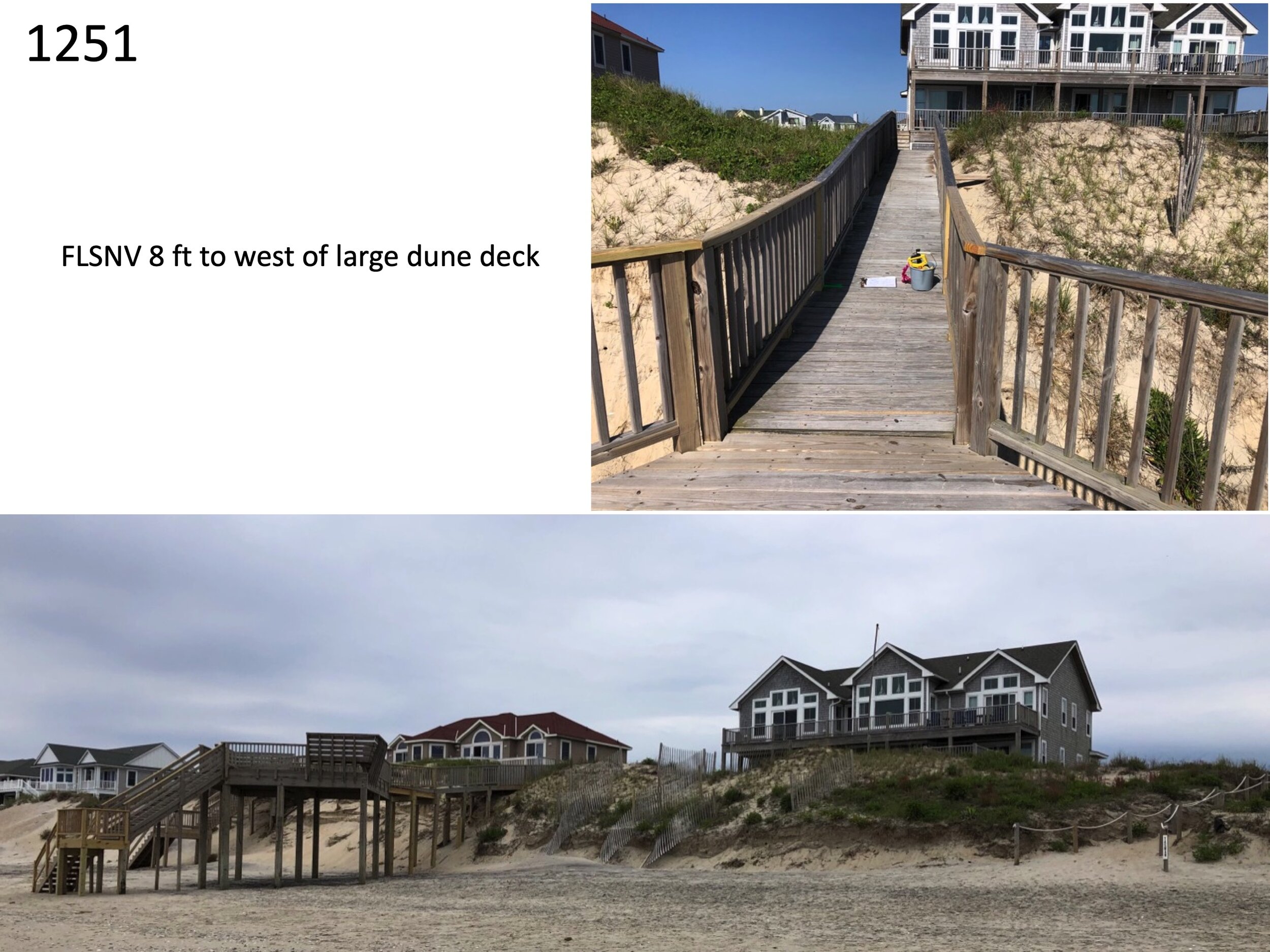
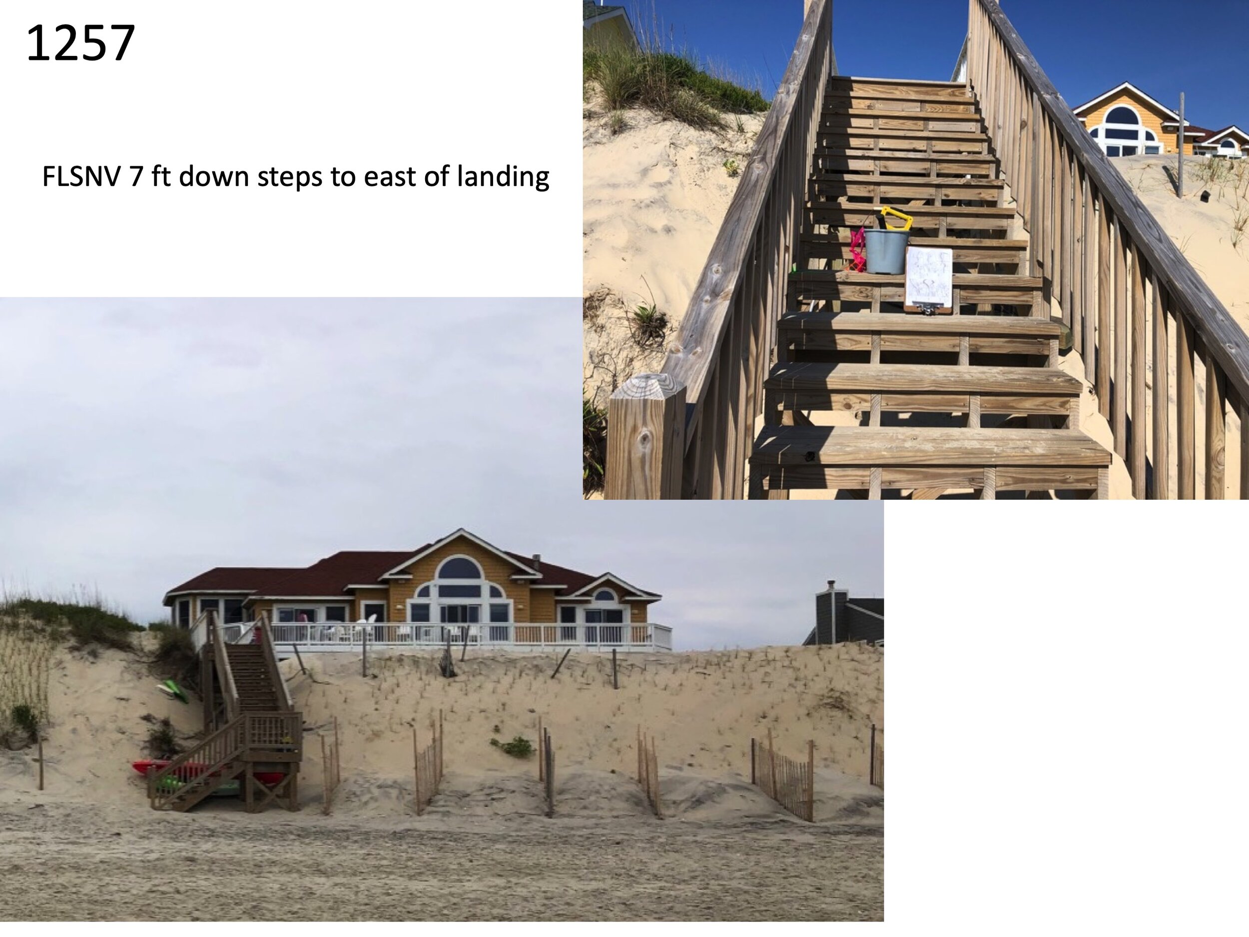
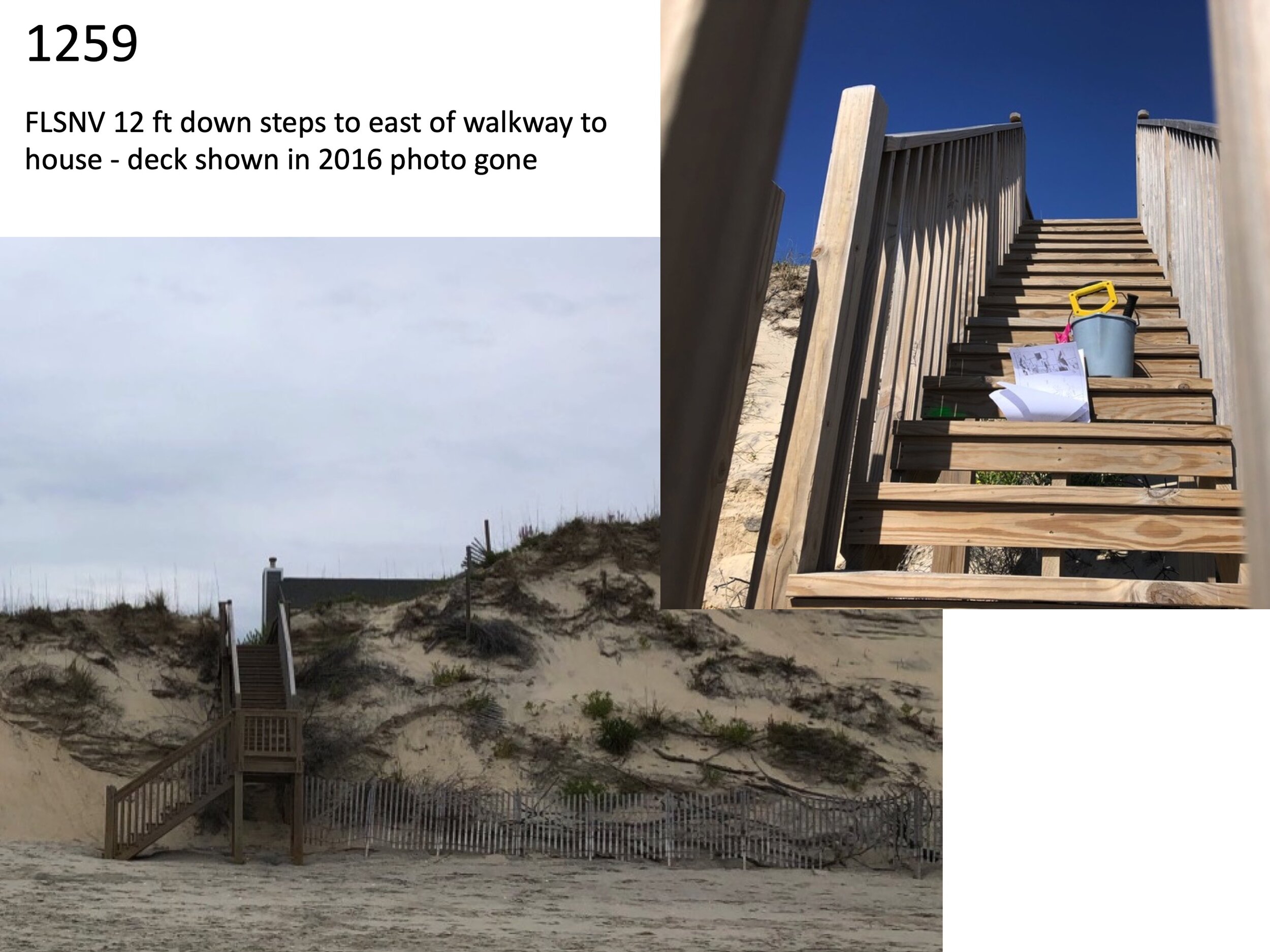
Ocean Hill owners first became concerned about beach erosion in 2003 when Hurricane Isabel washed under several oceanfront homes. Rebuilding walkways and beach decks, bringing in or pushing sand to rebuild the protective dune, adding sand fence and beach grass have become standard procedure for oceanfront owners every few years. However, as the beaches erode the dry sand beach keeps getting lower and narrower. This is the beach used by guests of all properties in the subdivision.

Calm day, but high tide “Not like it used to be. I hear Duck, Kitty Hawk and Nags Head beaches are better. Next year?”
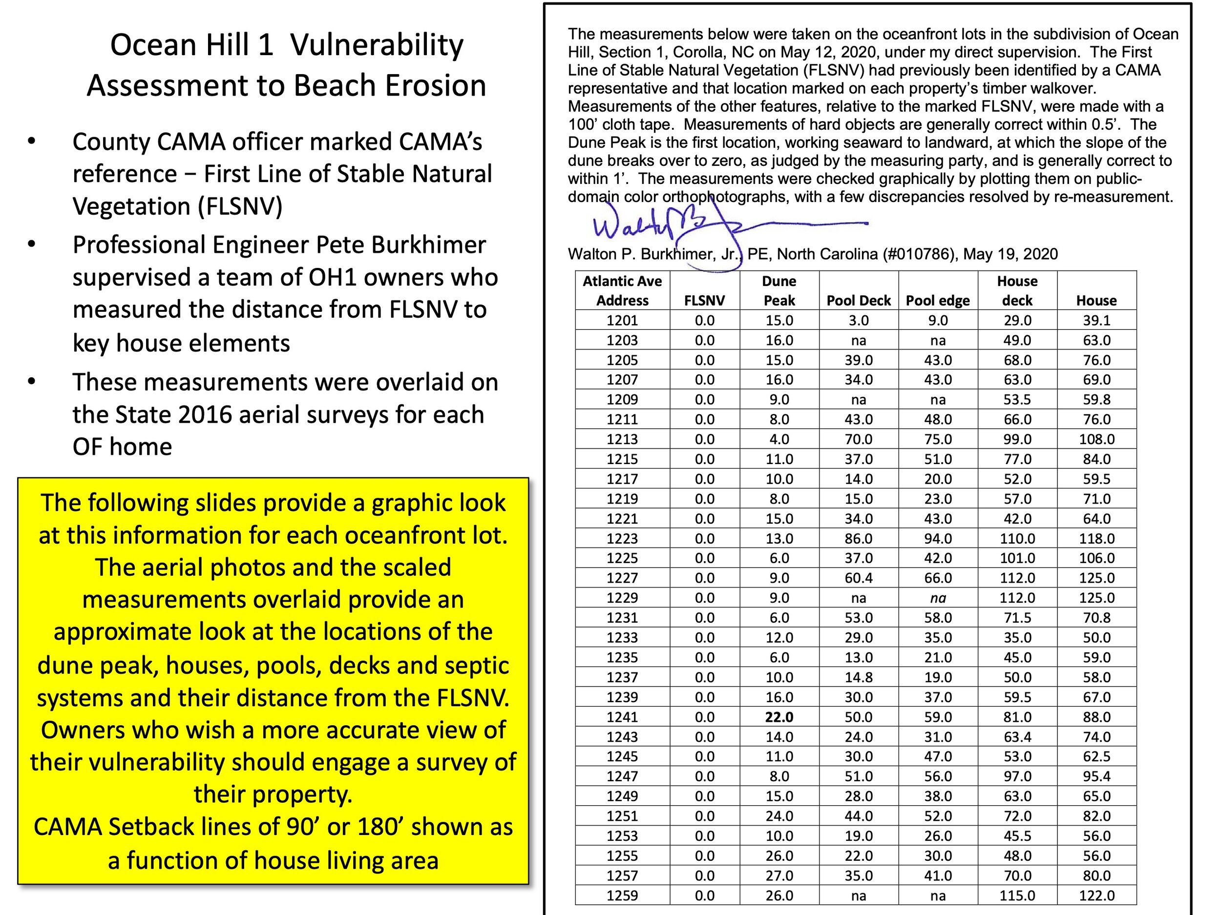
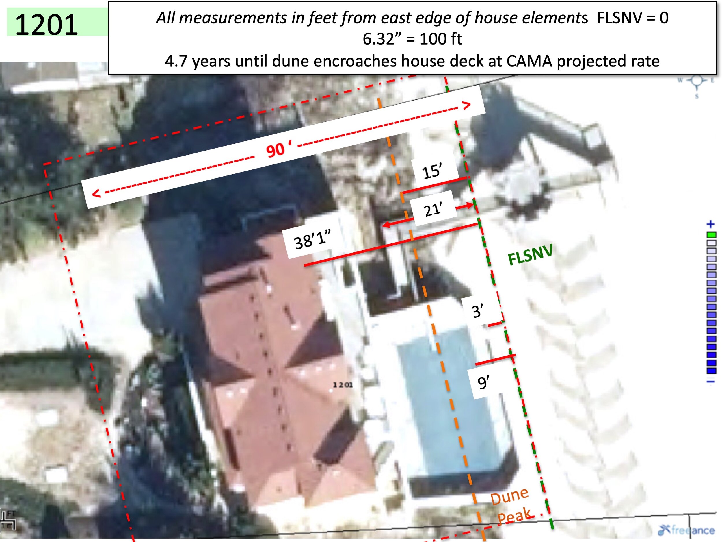
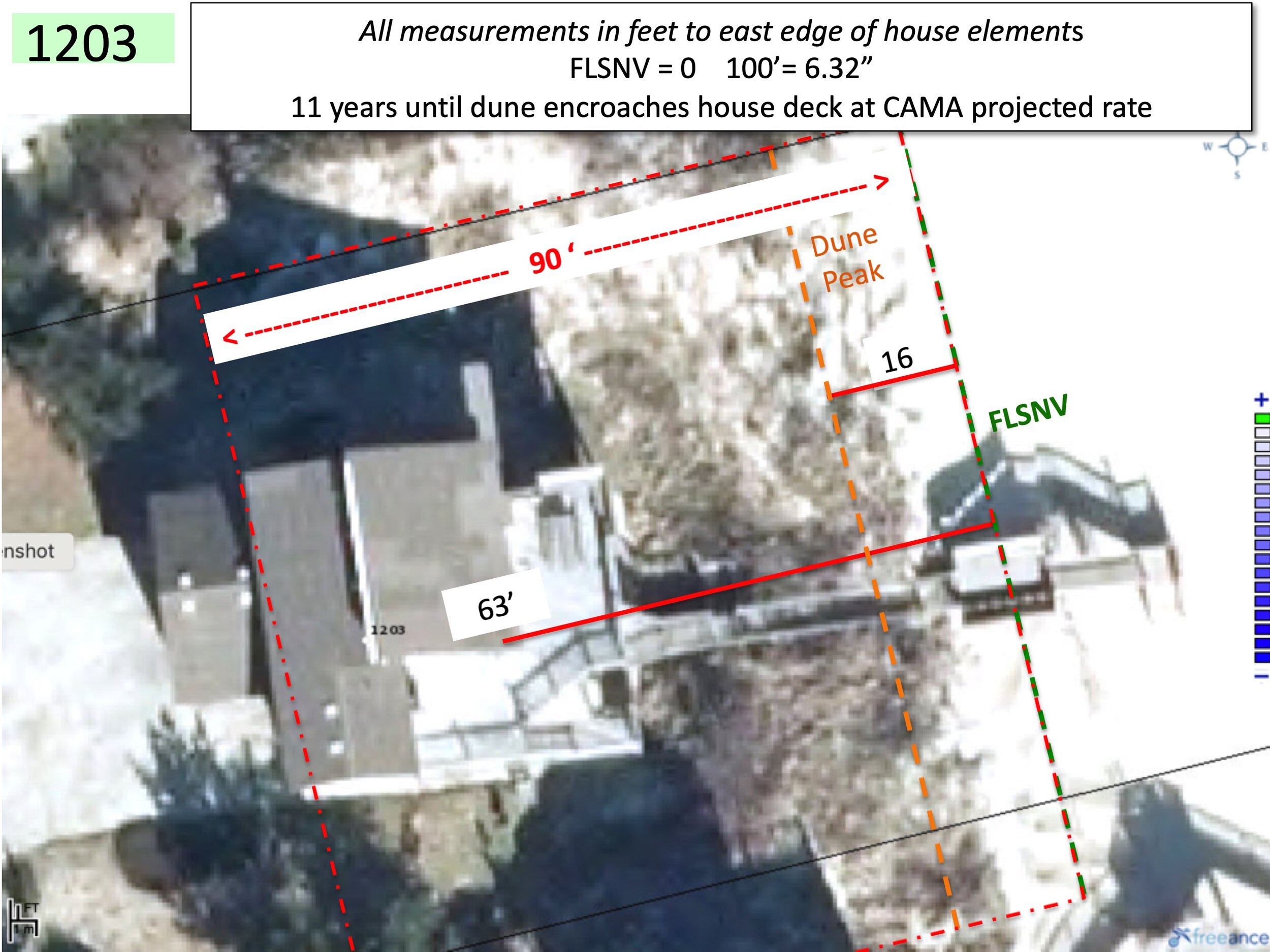
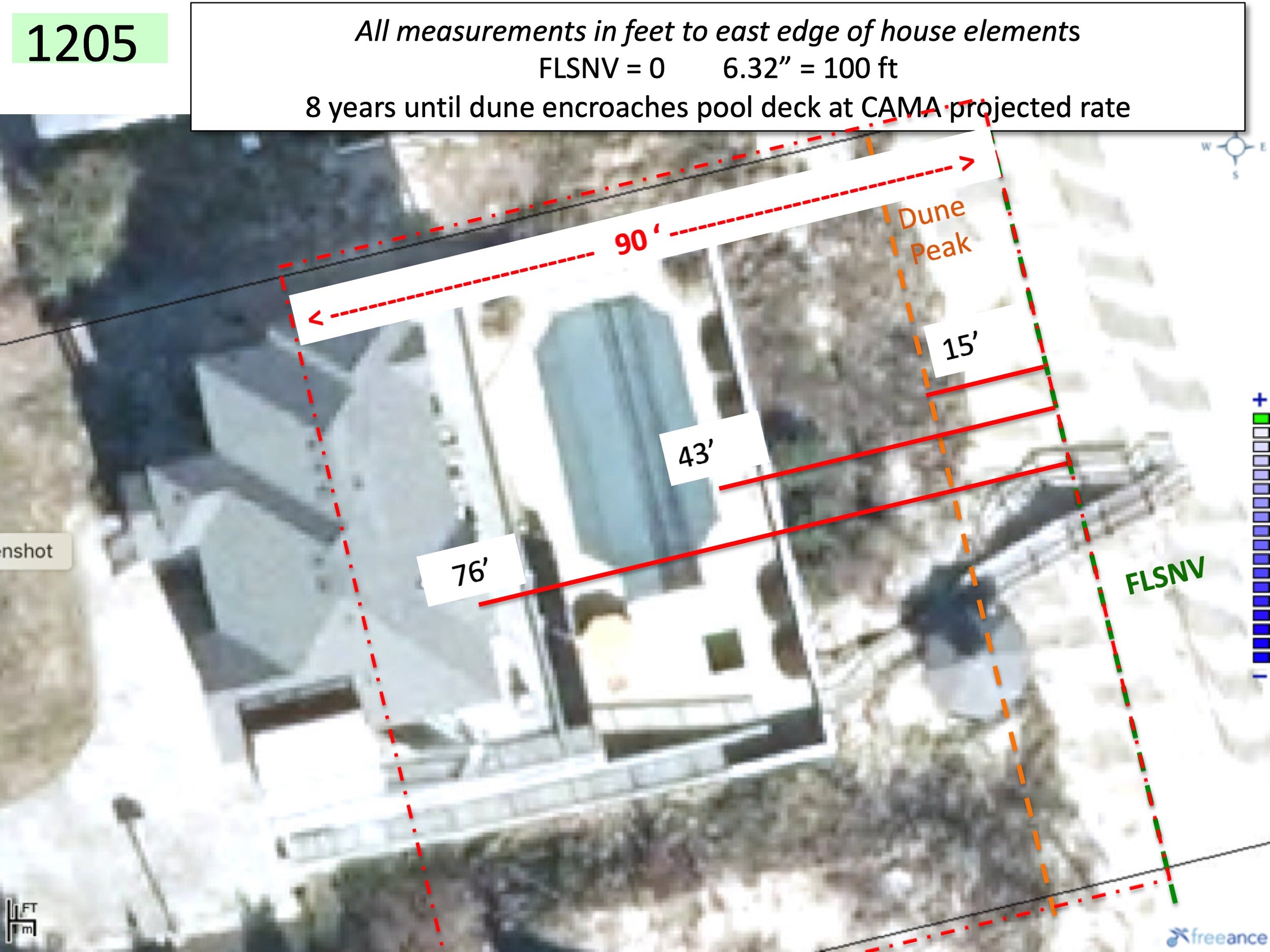
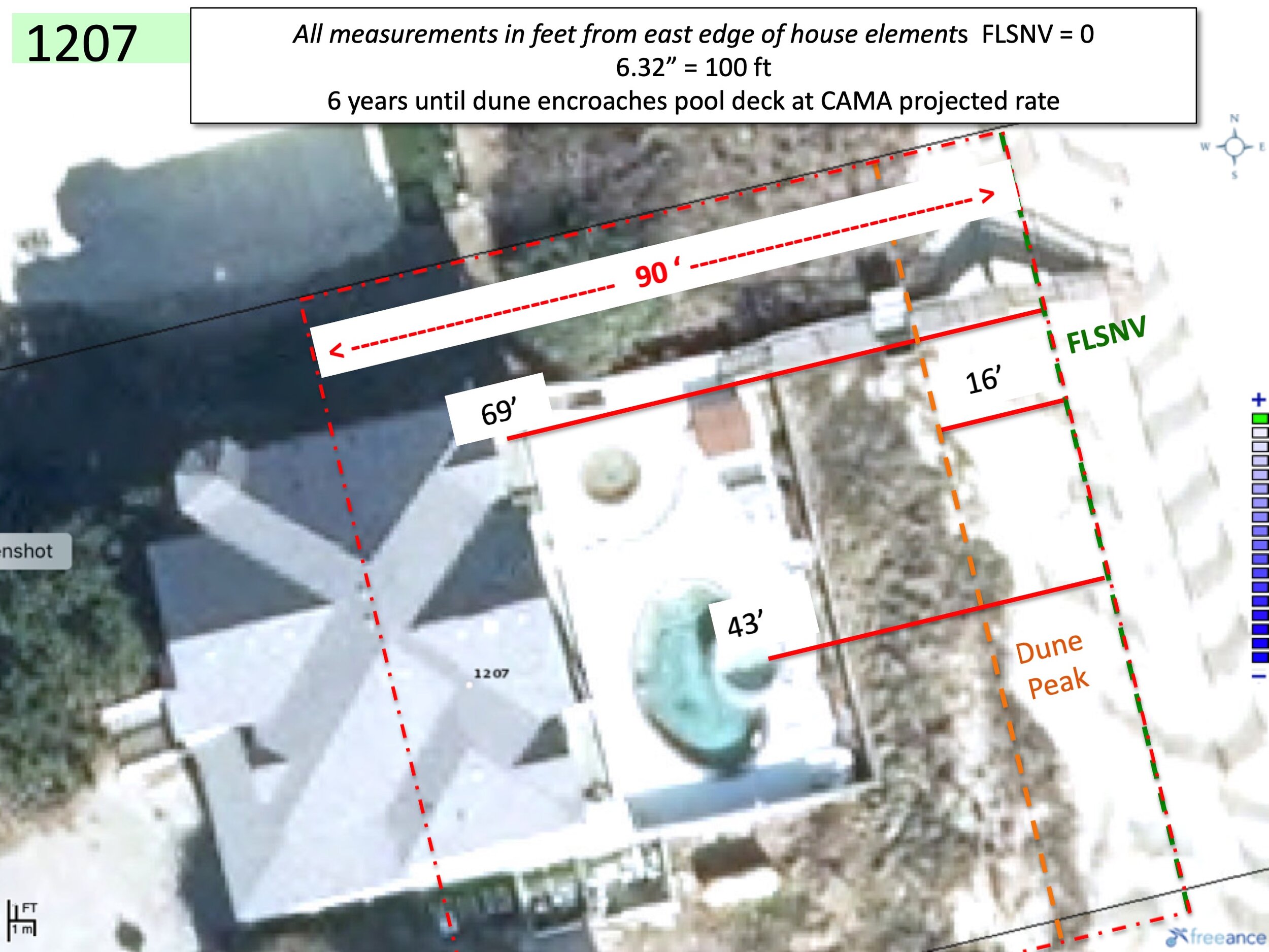
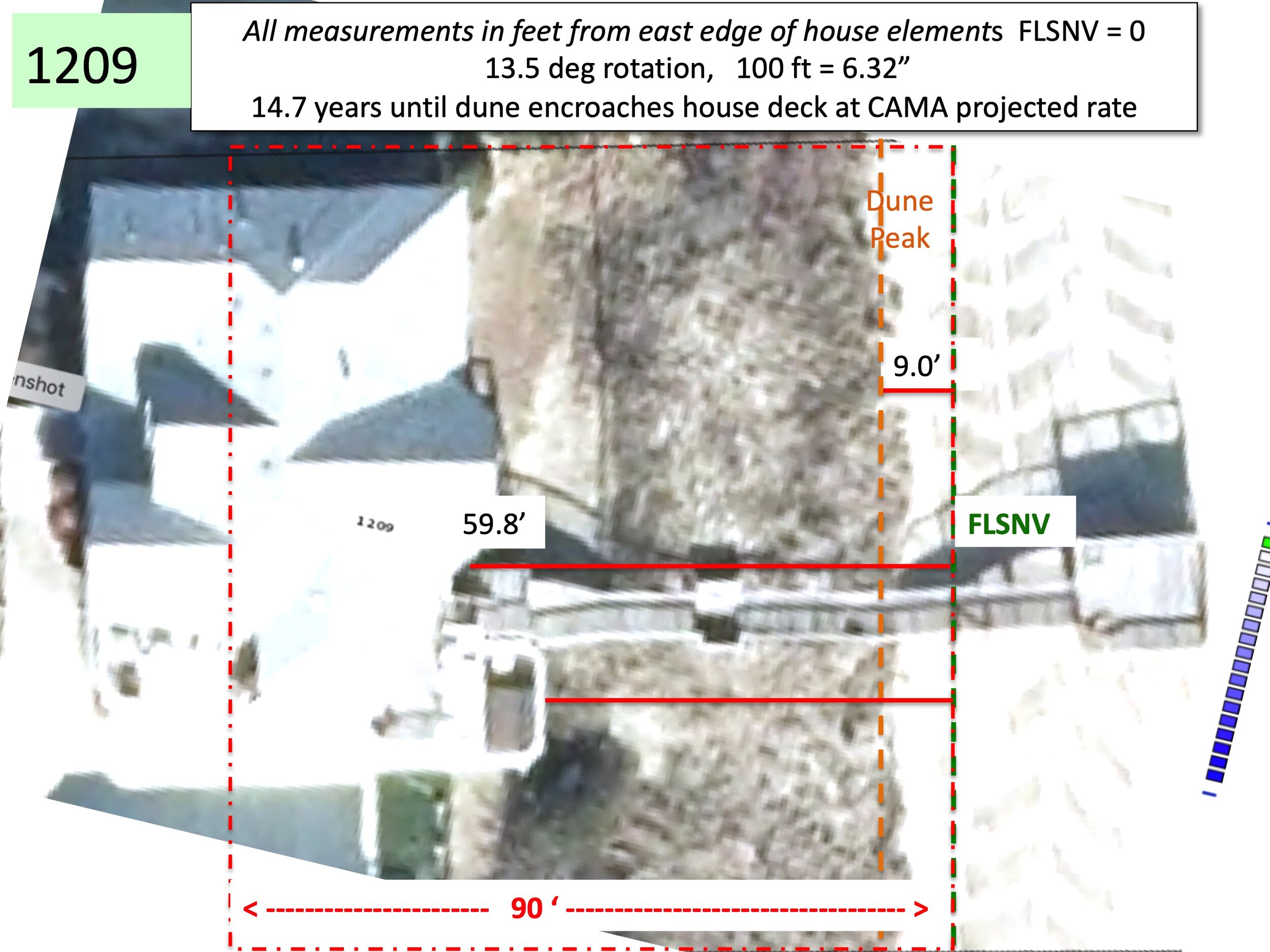
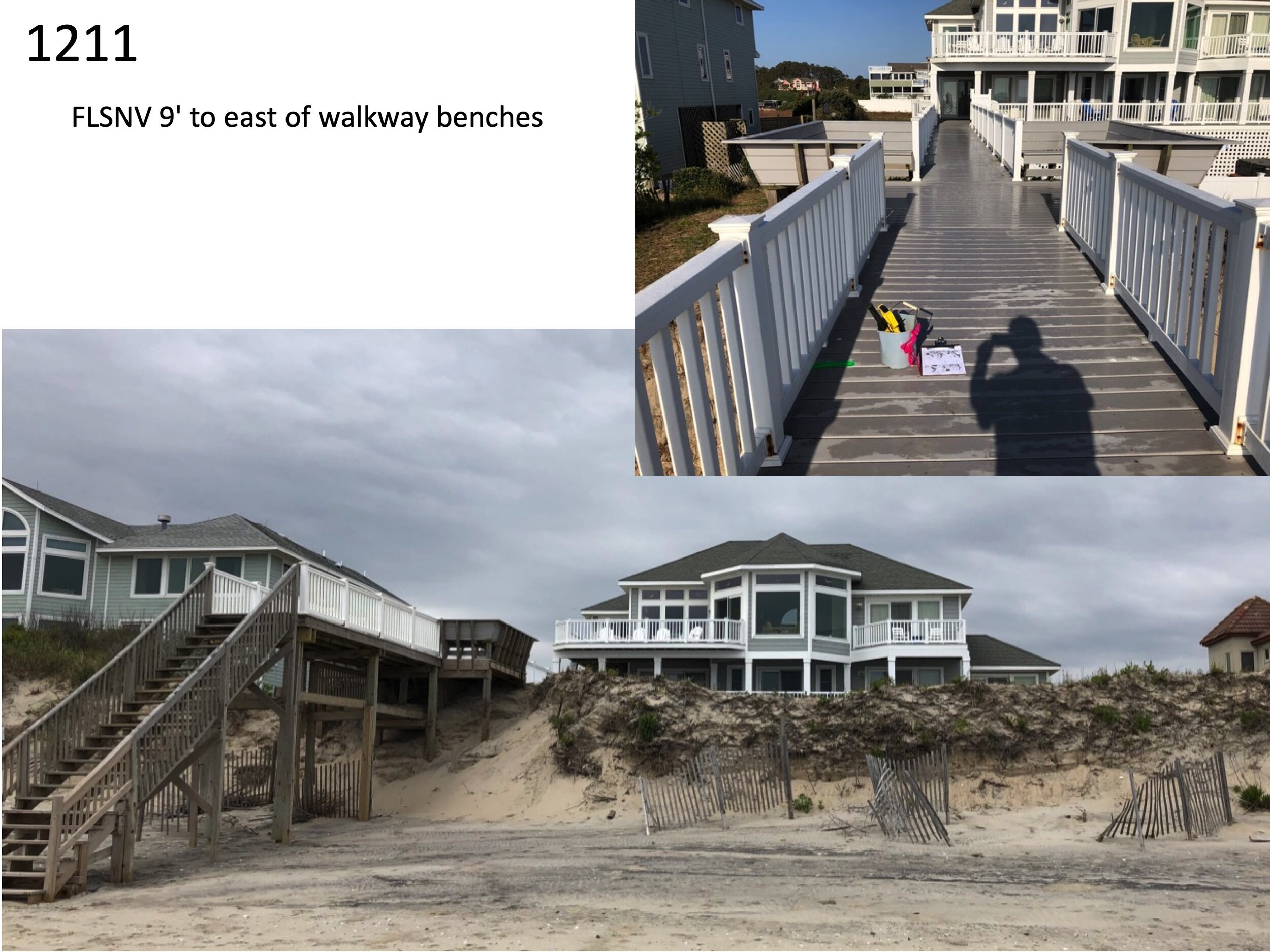
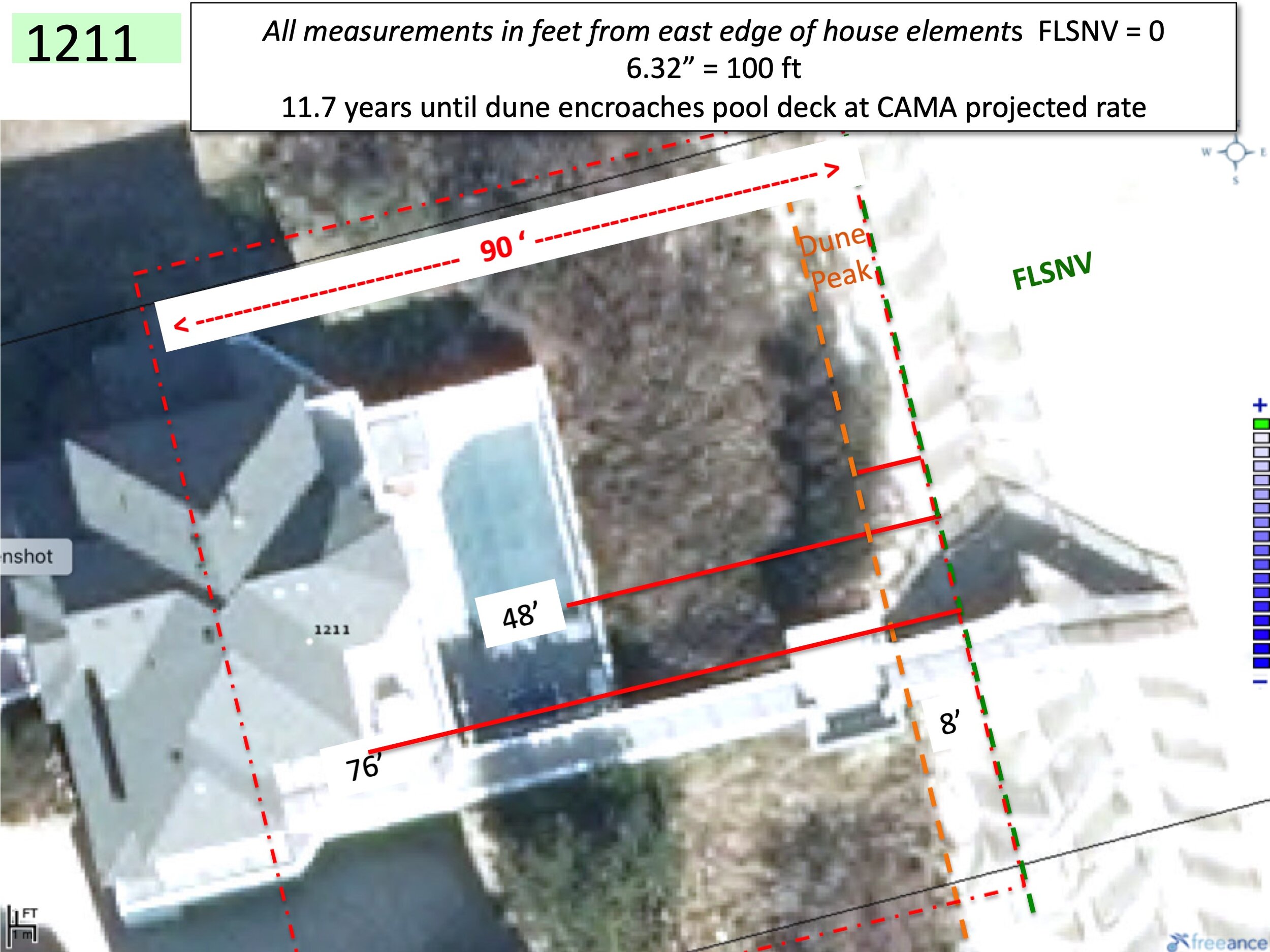
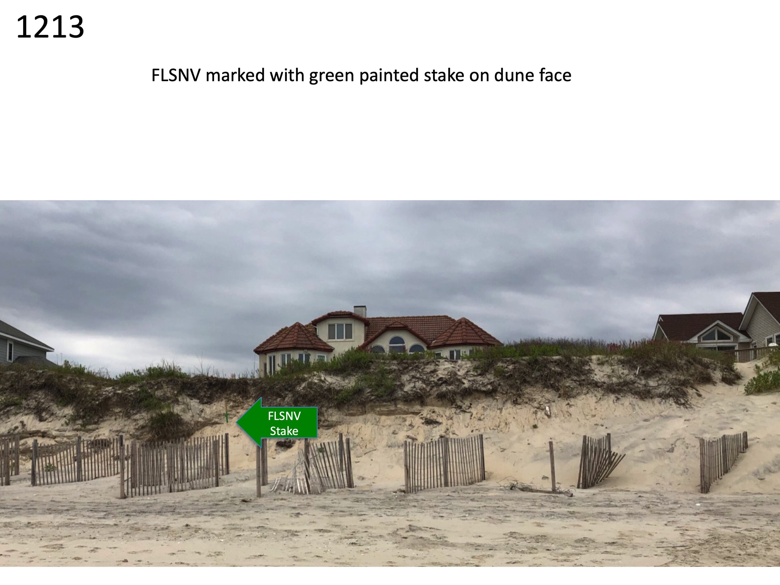
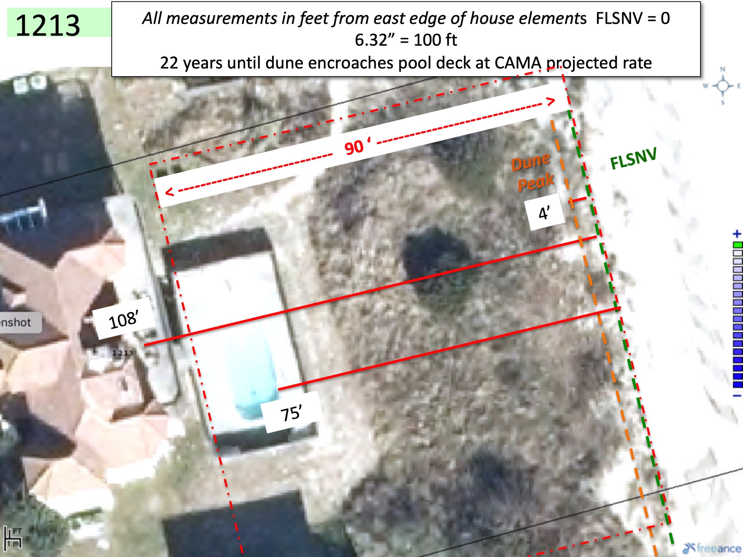
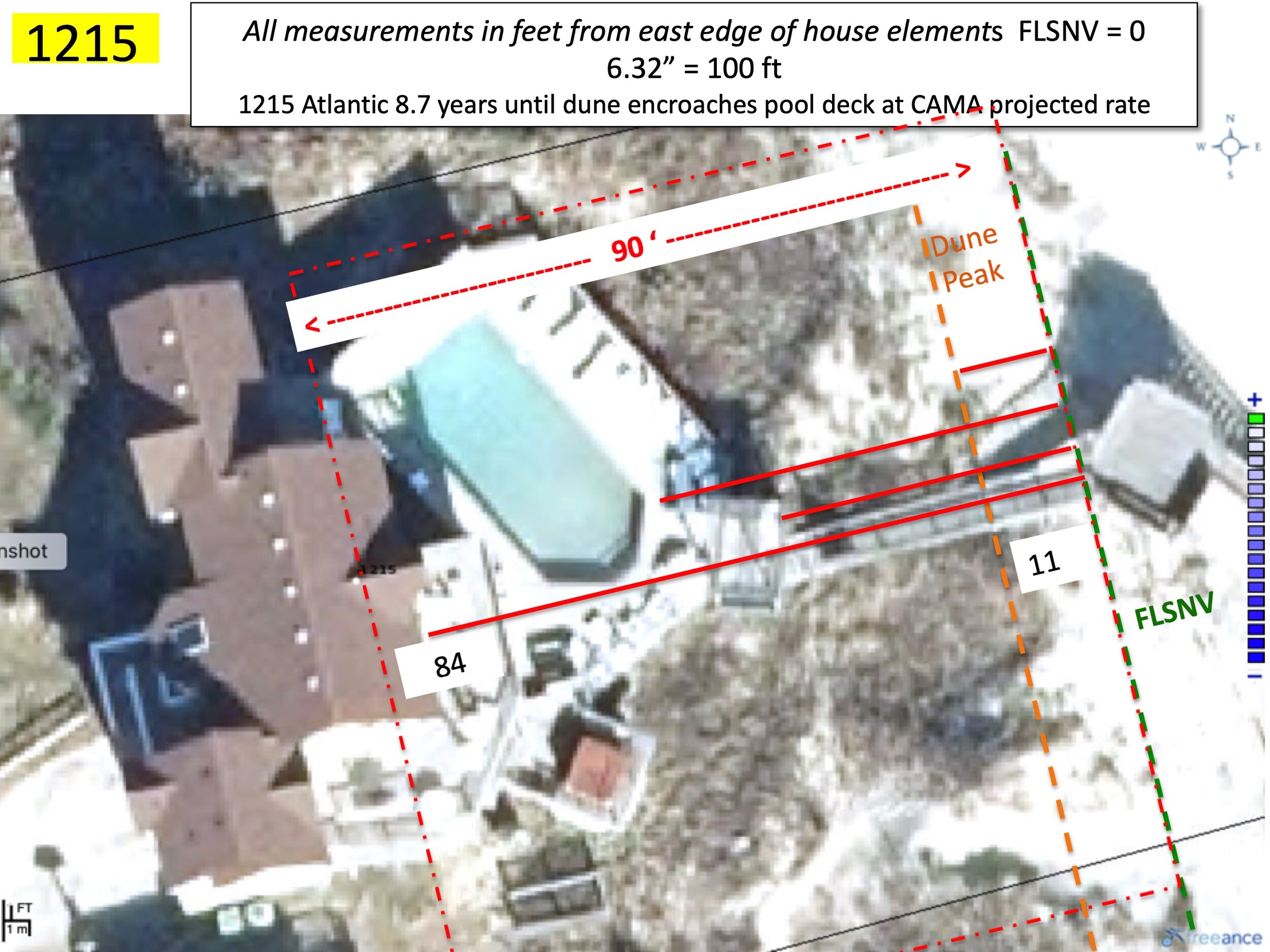
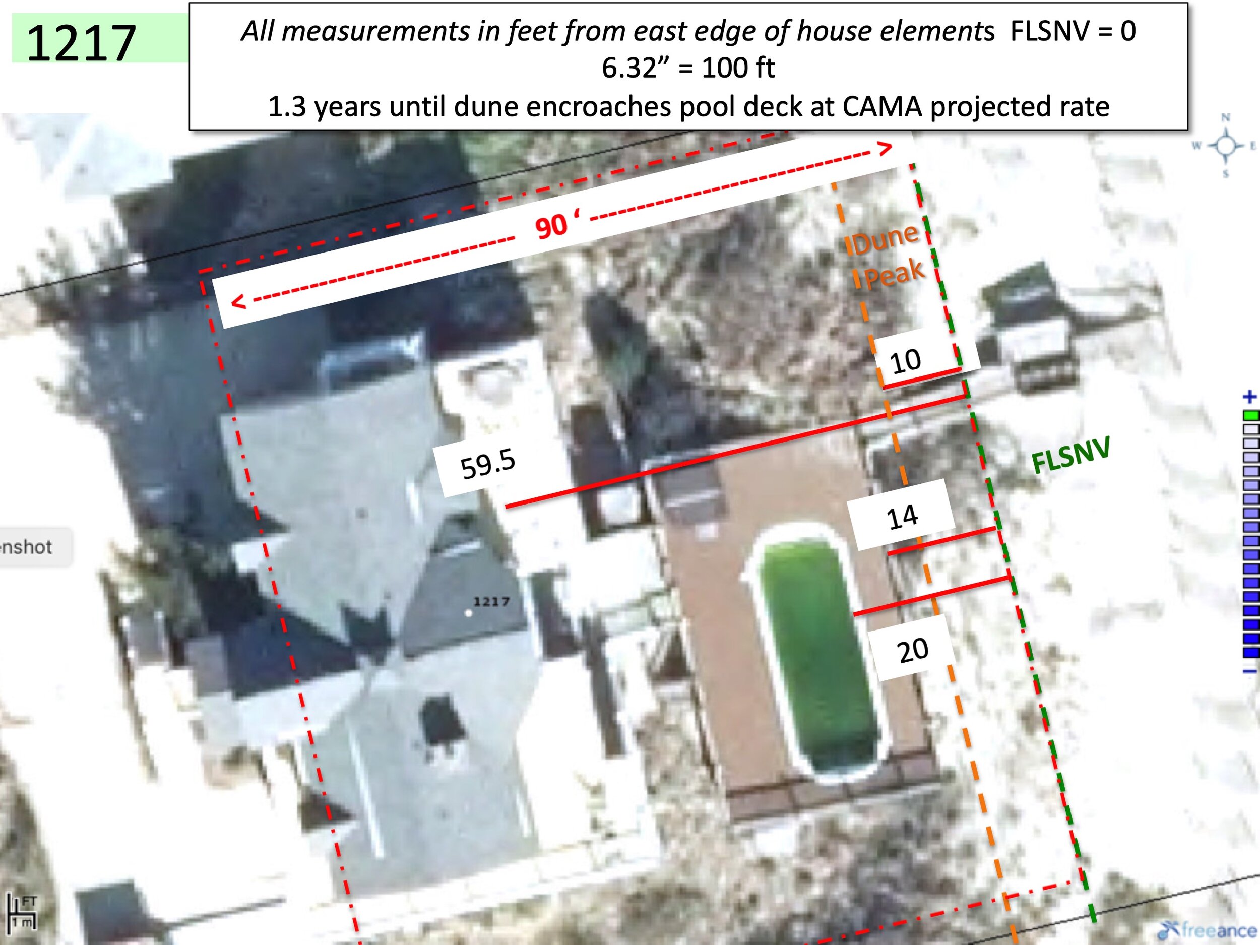
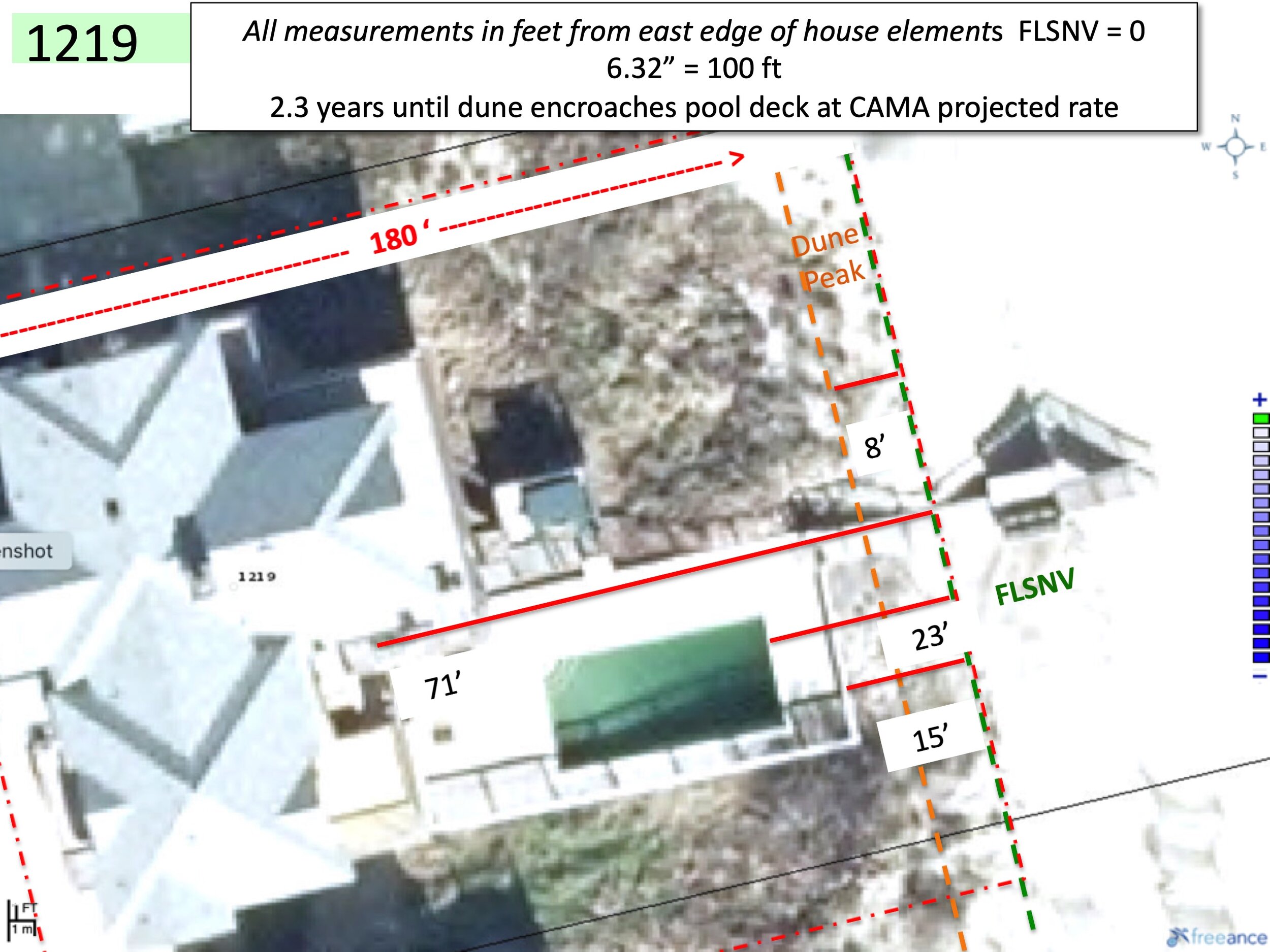
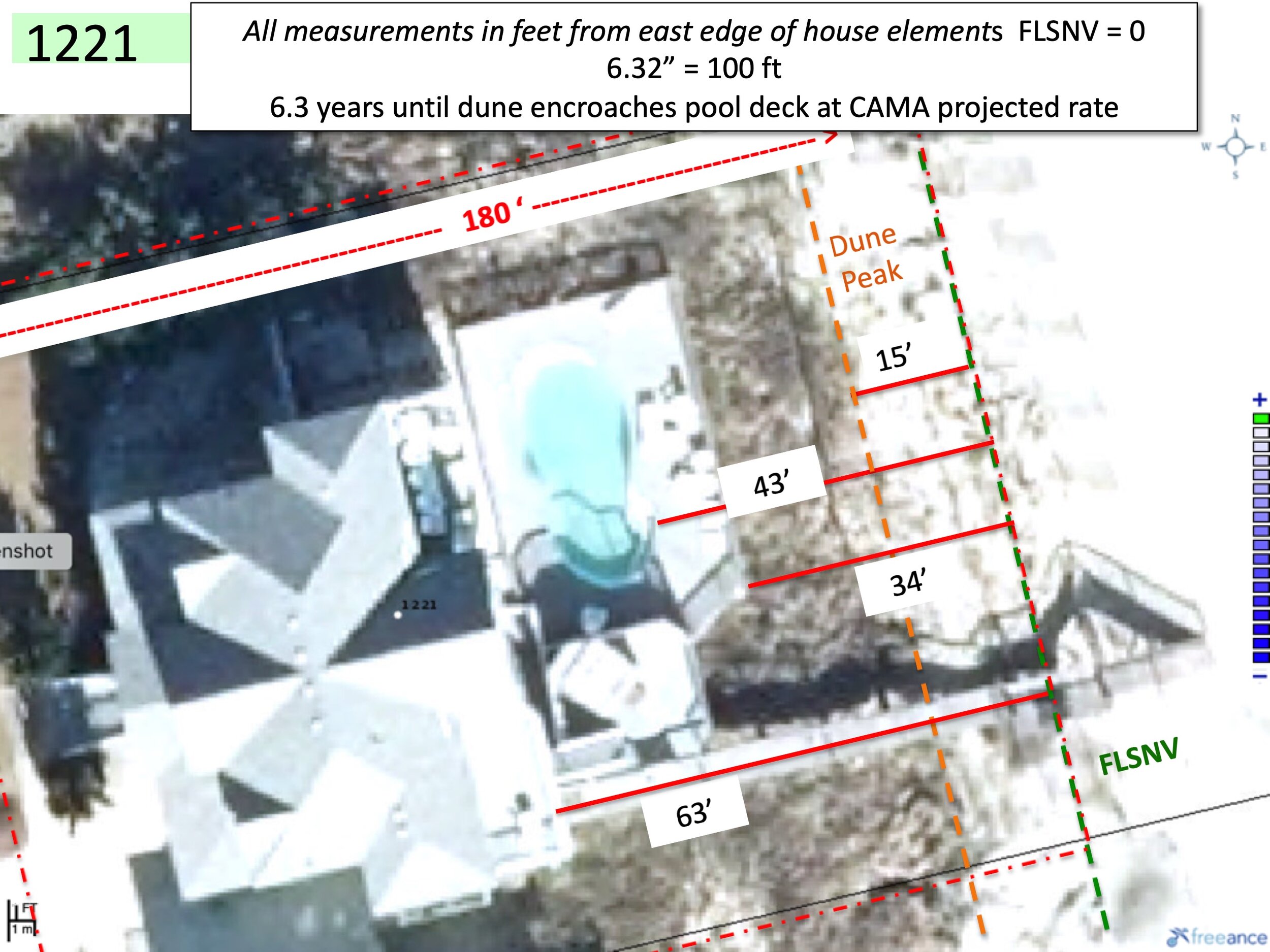
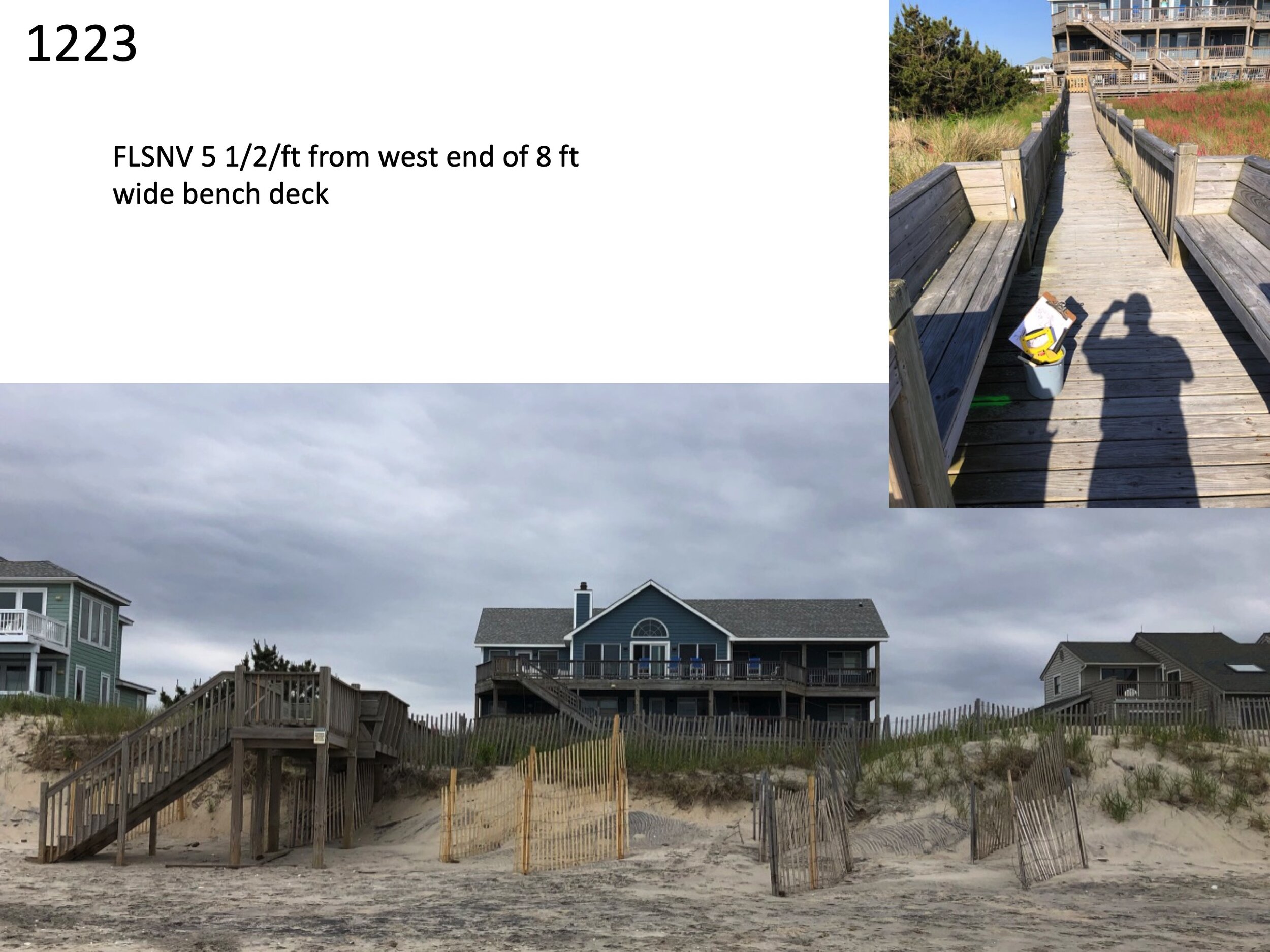
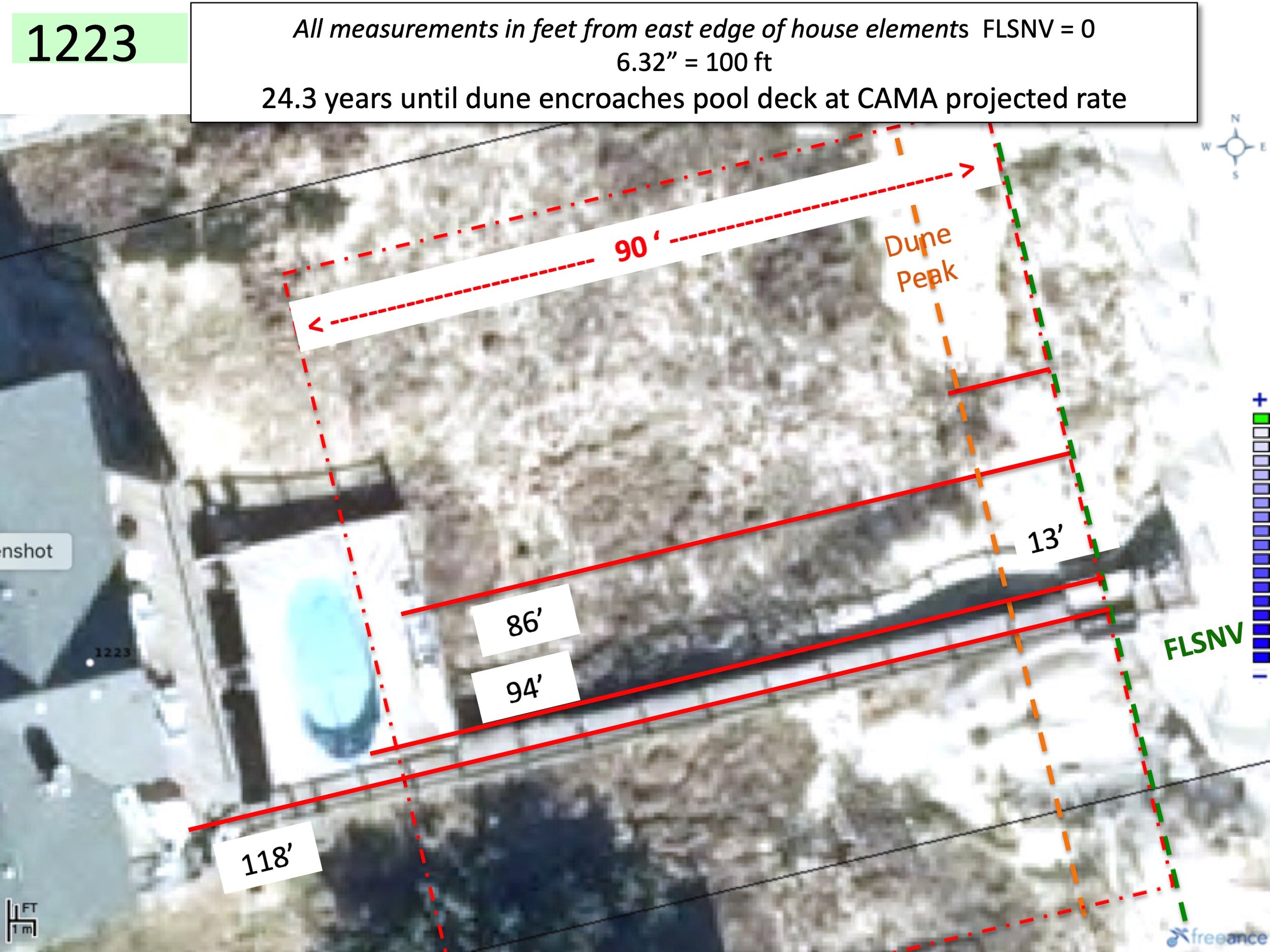
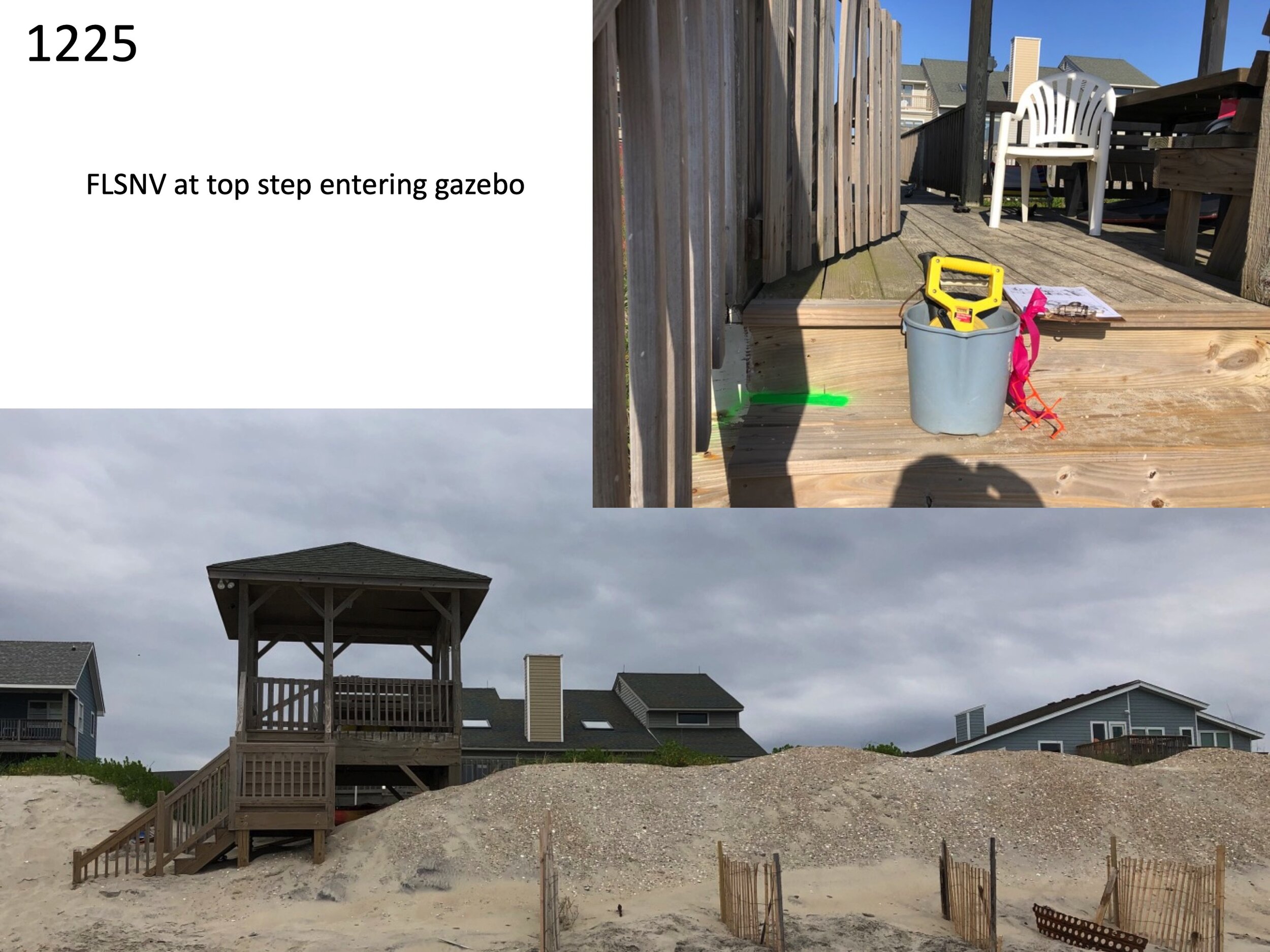
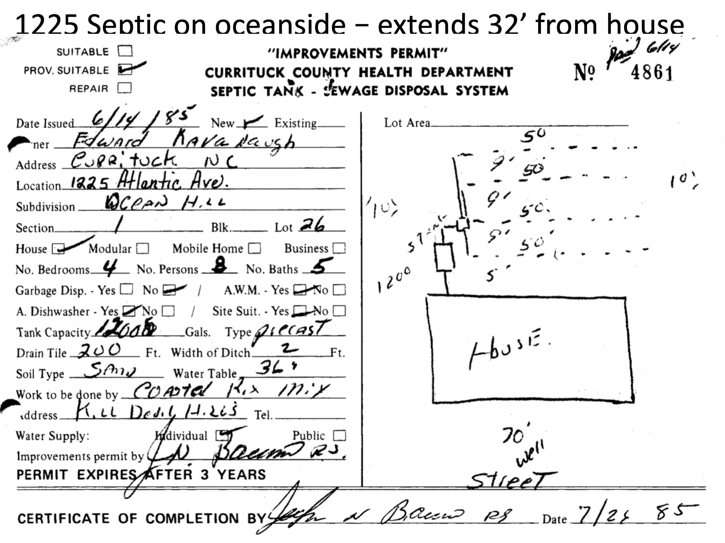
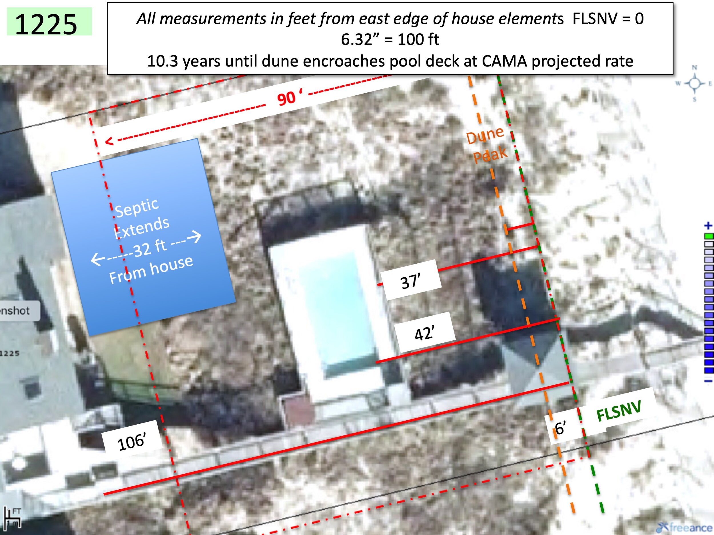
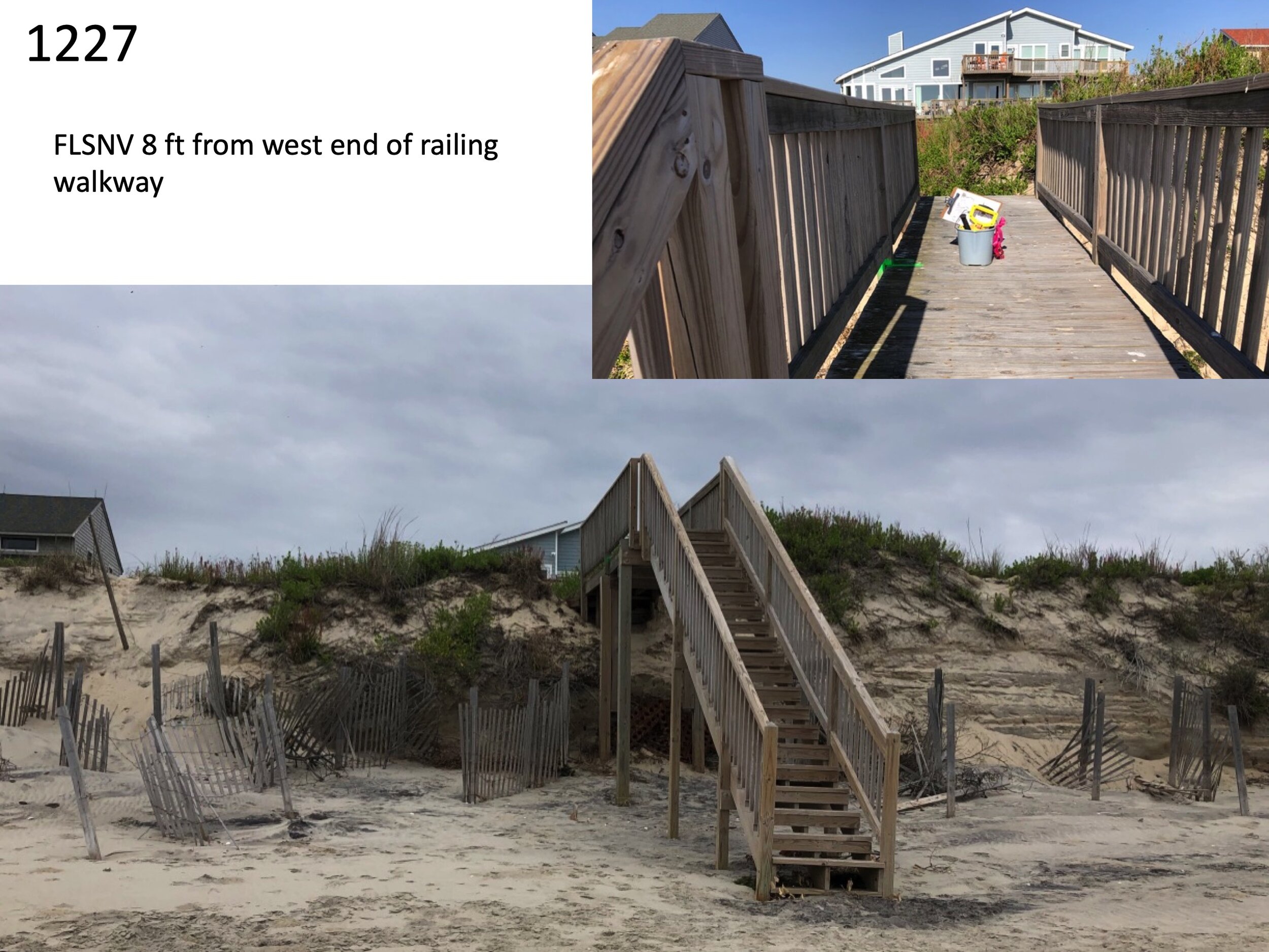
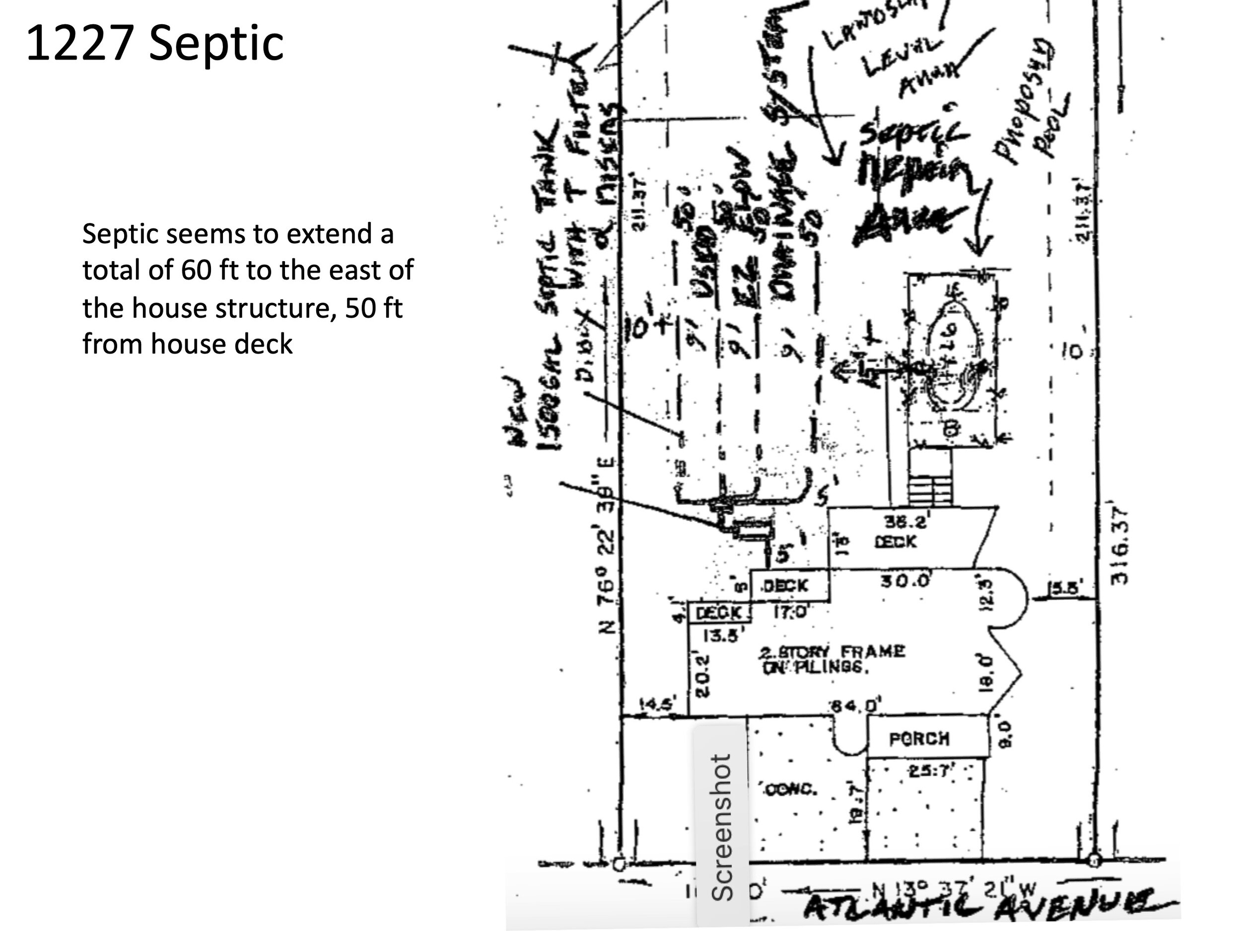
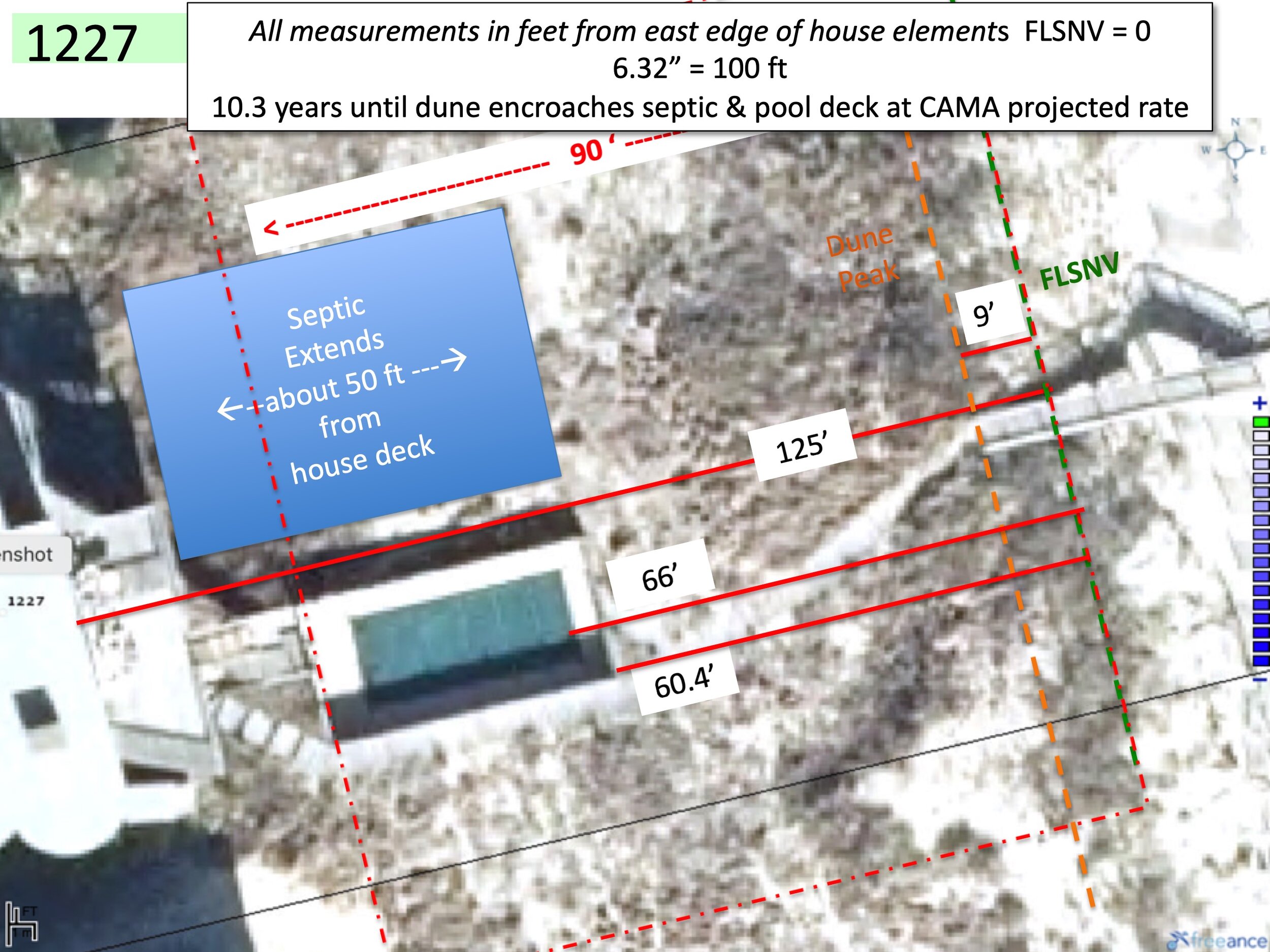
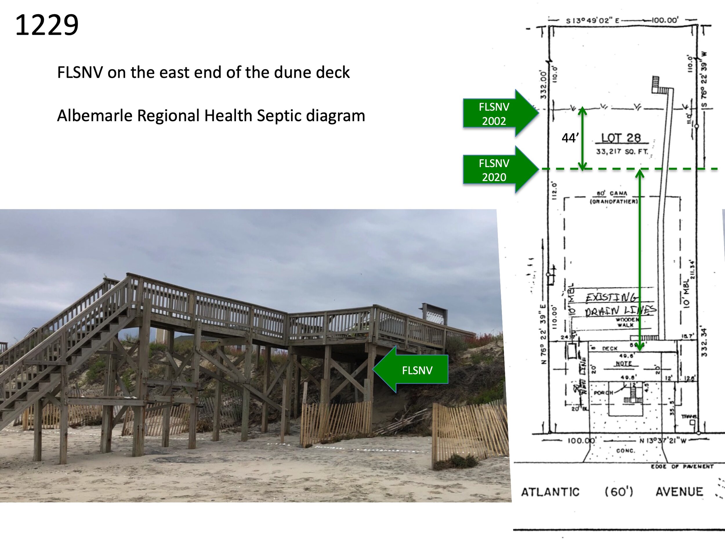
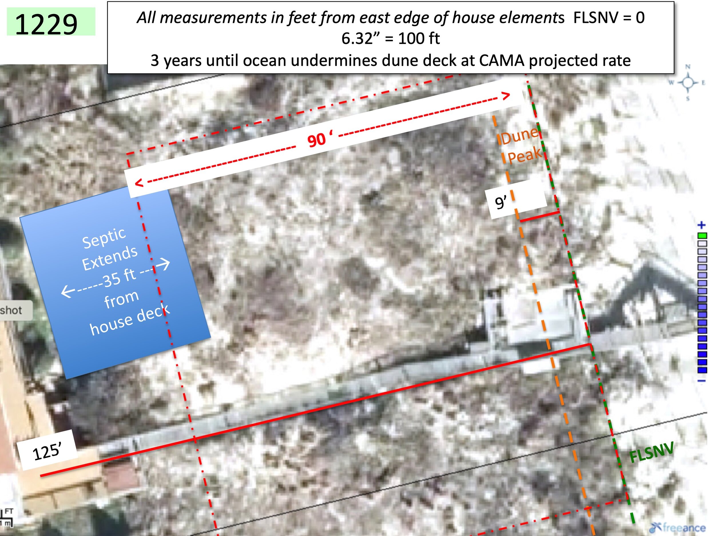
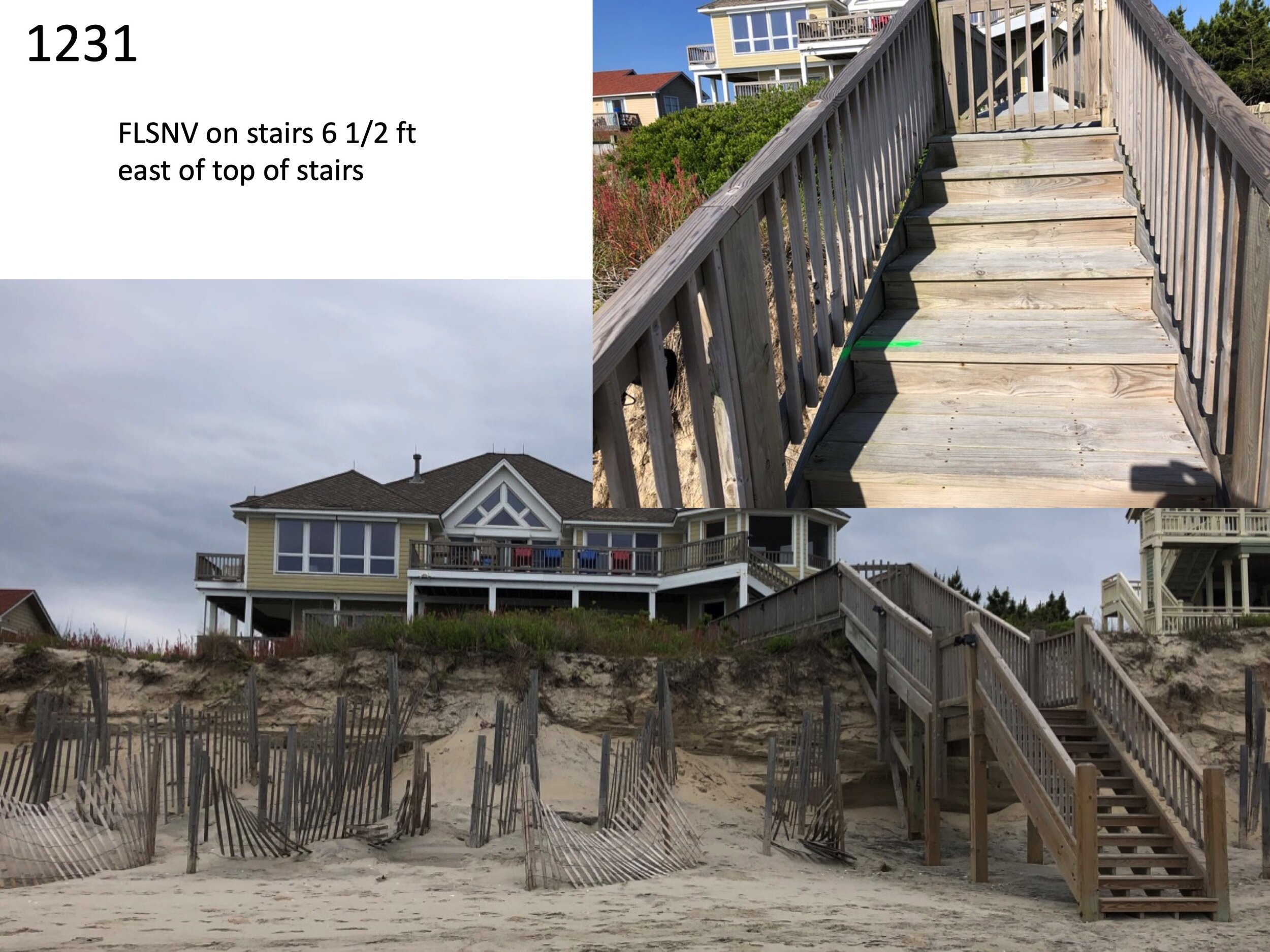
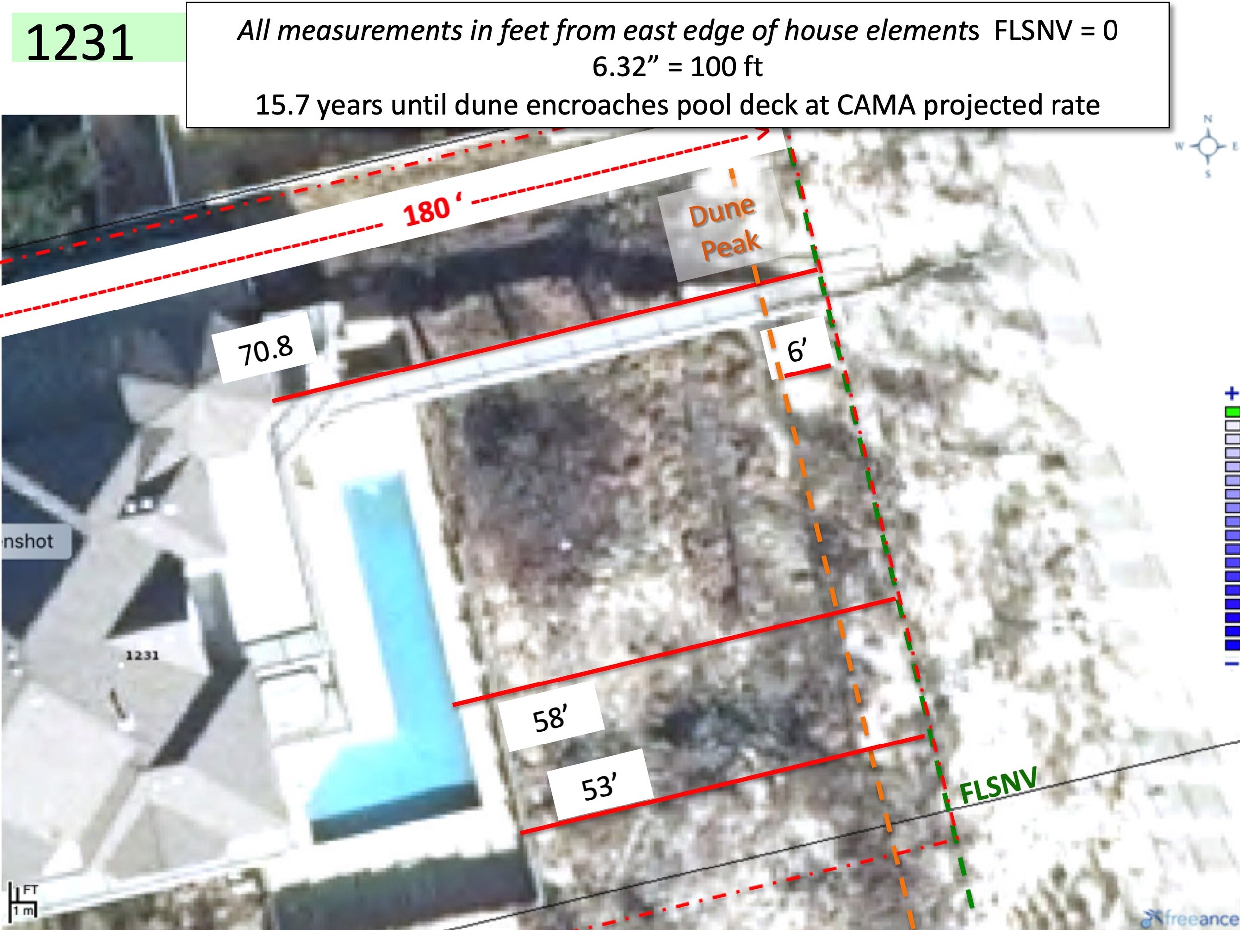
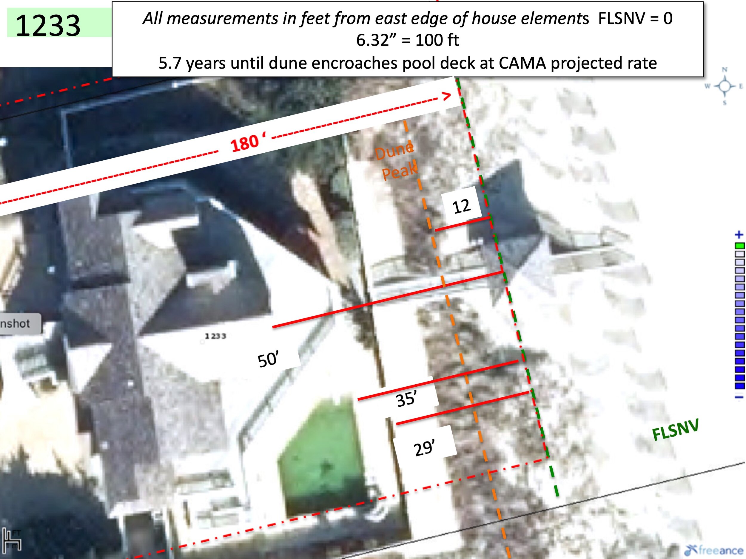
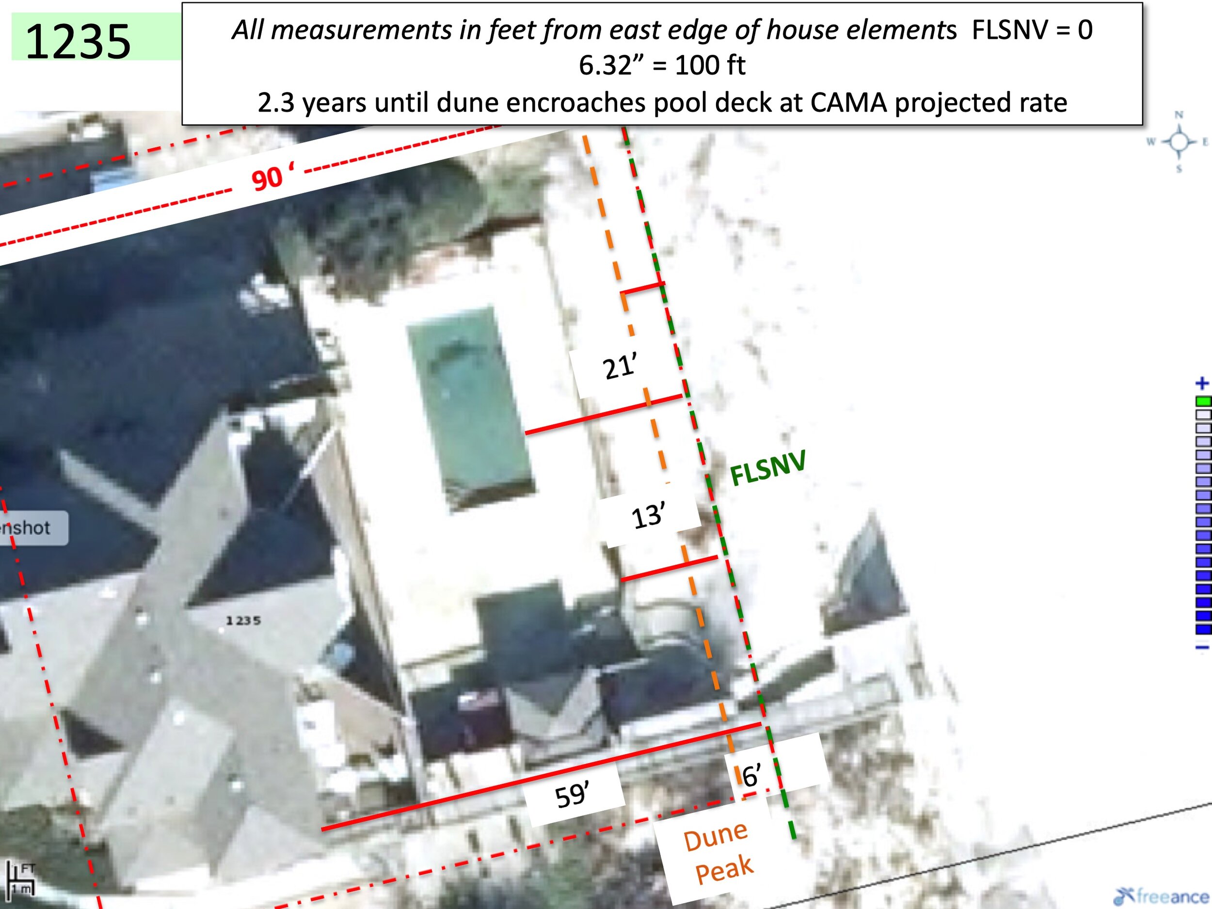
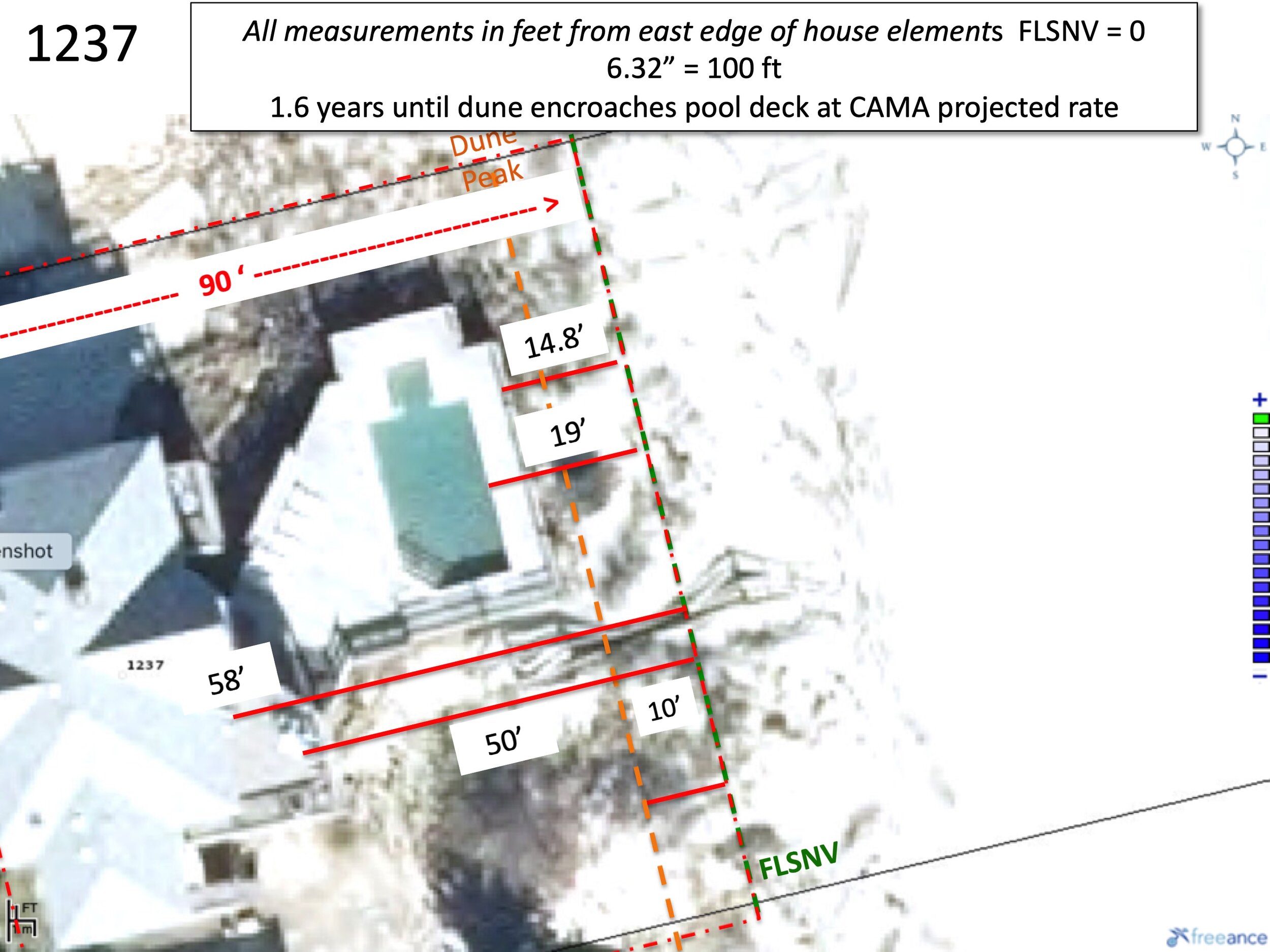
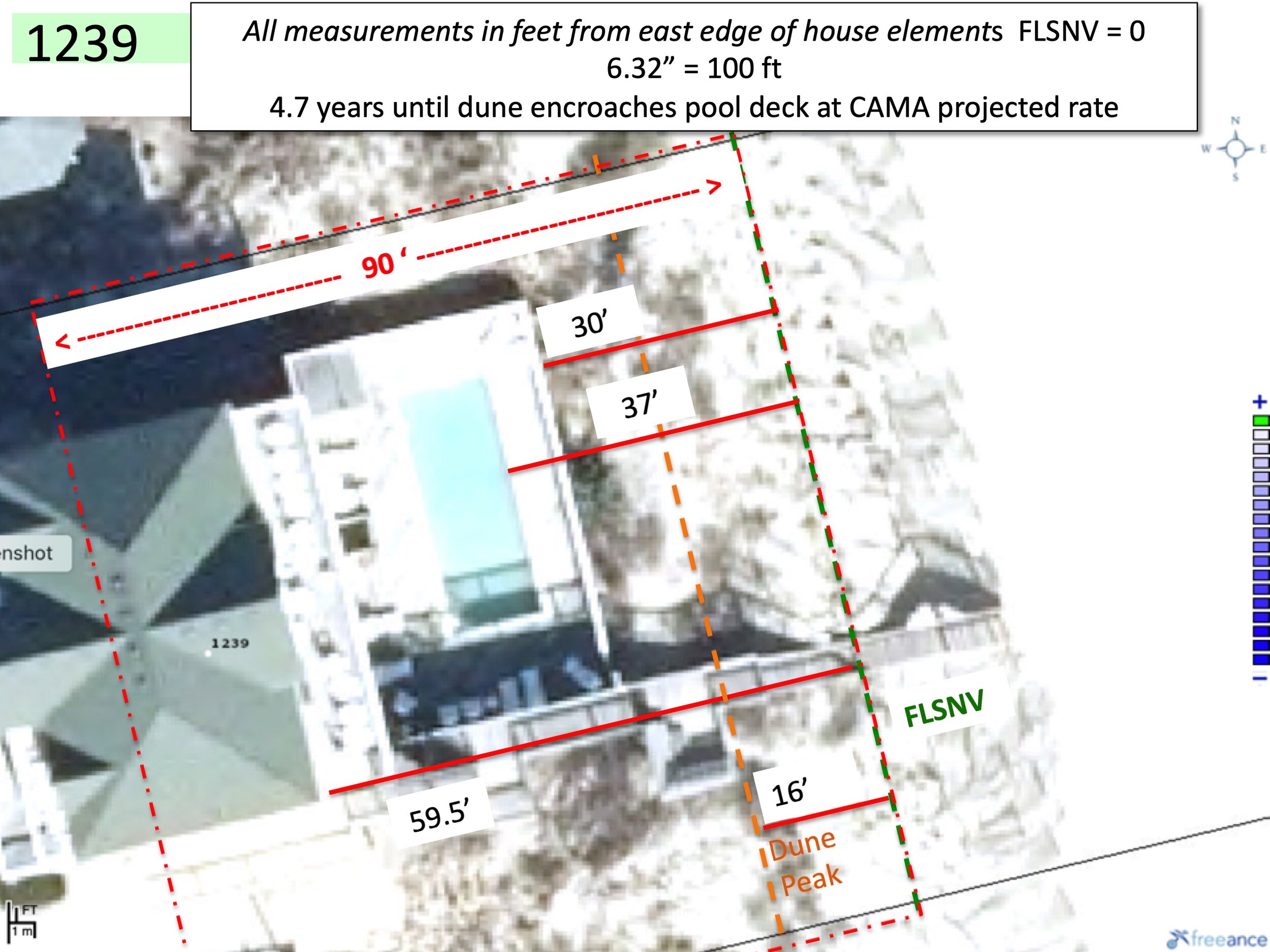
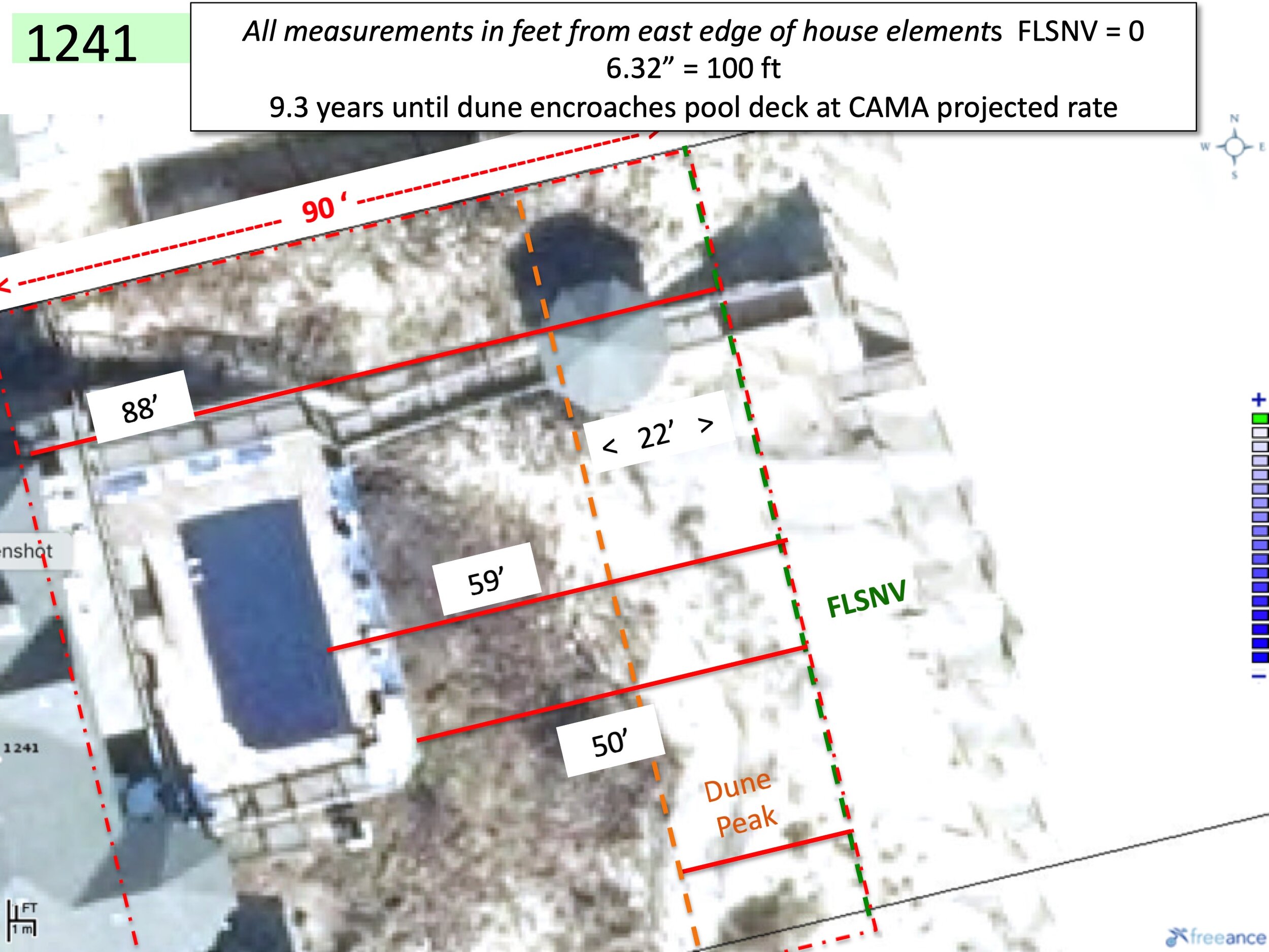
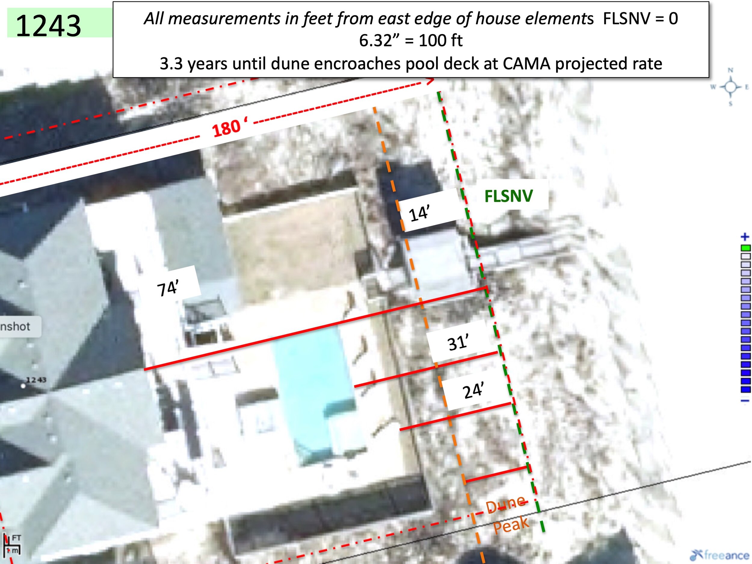
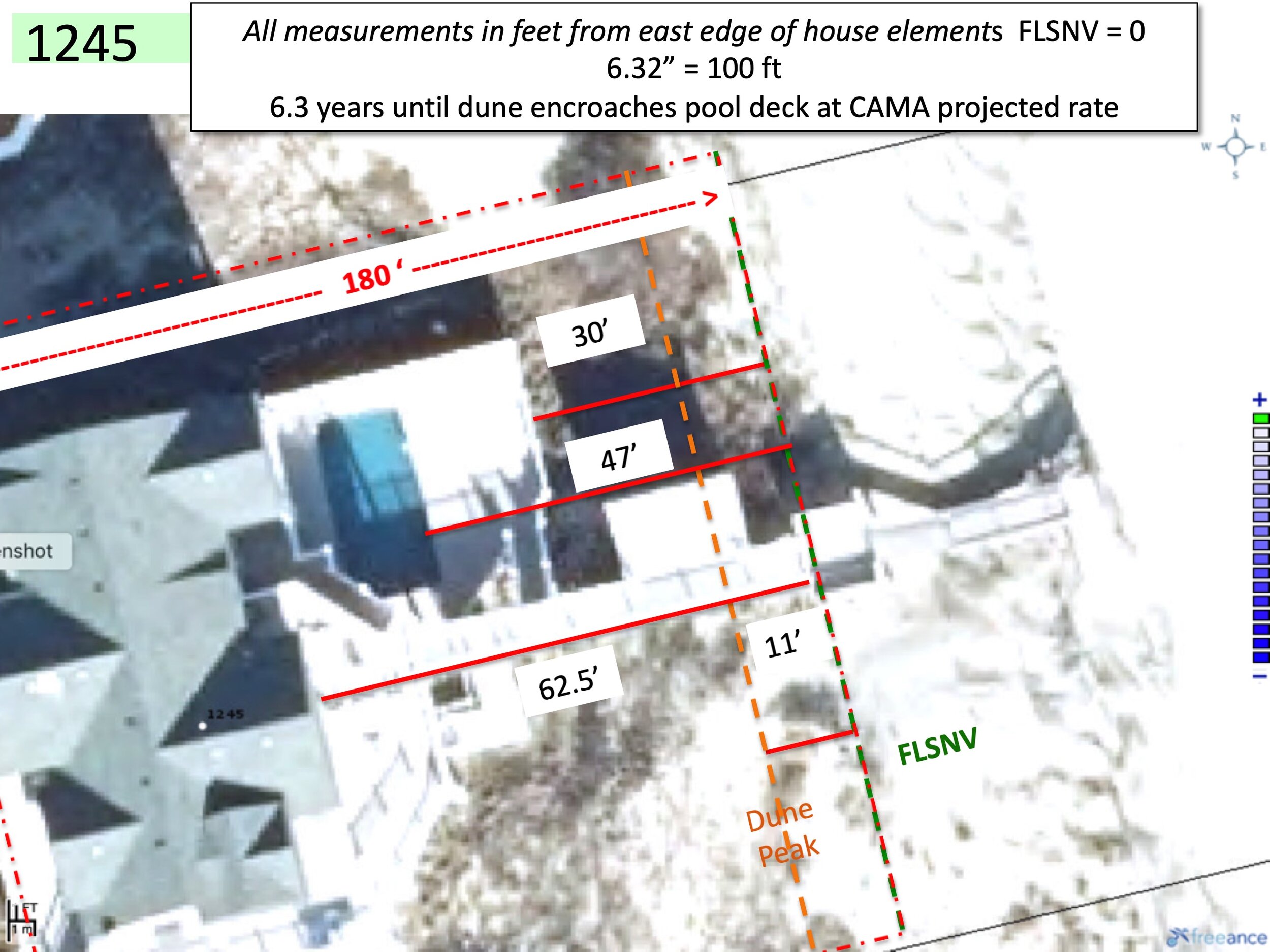
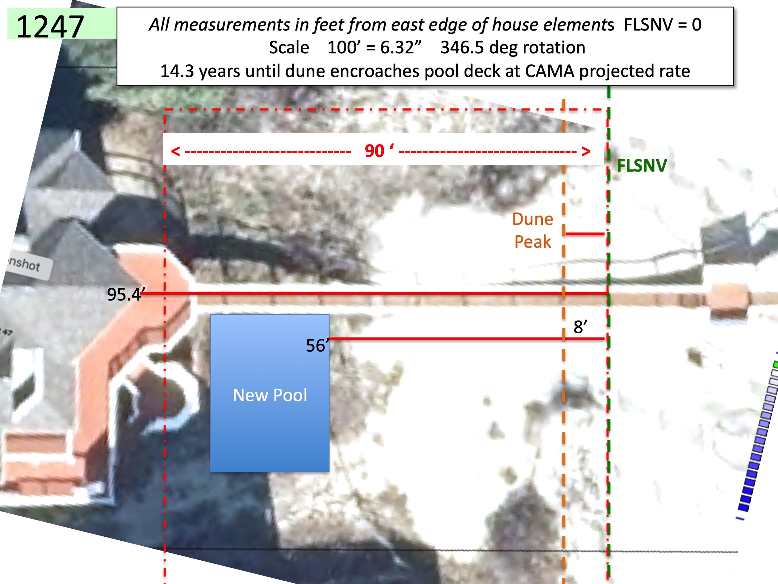
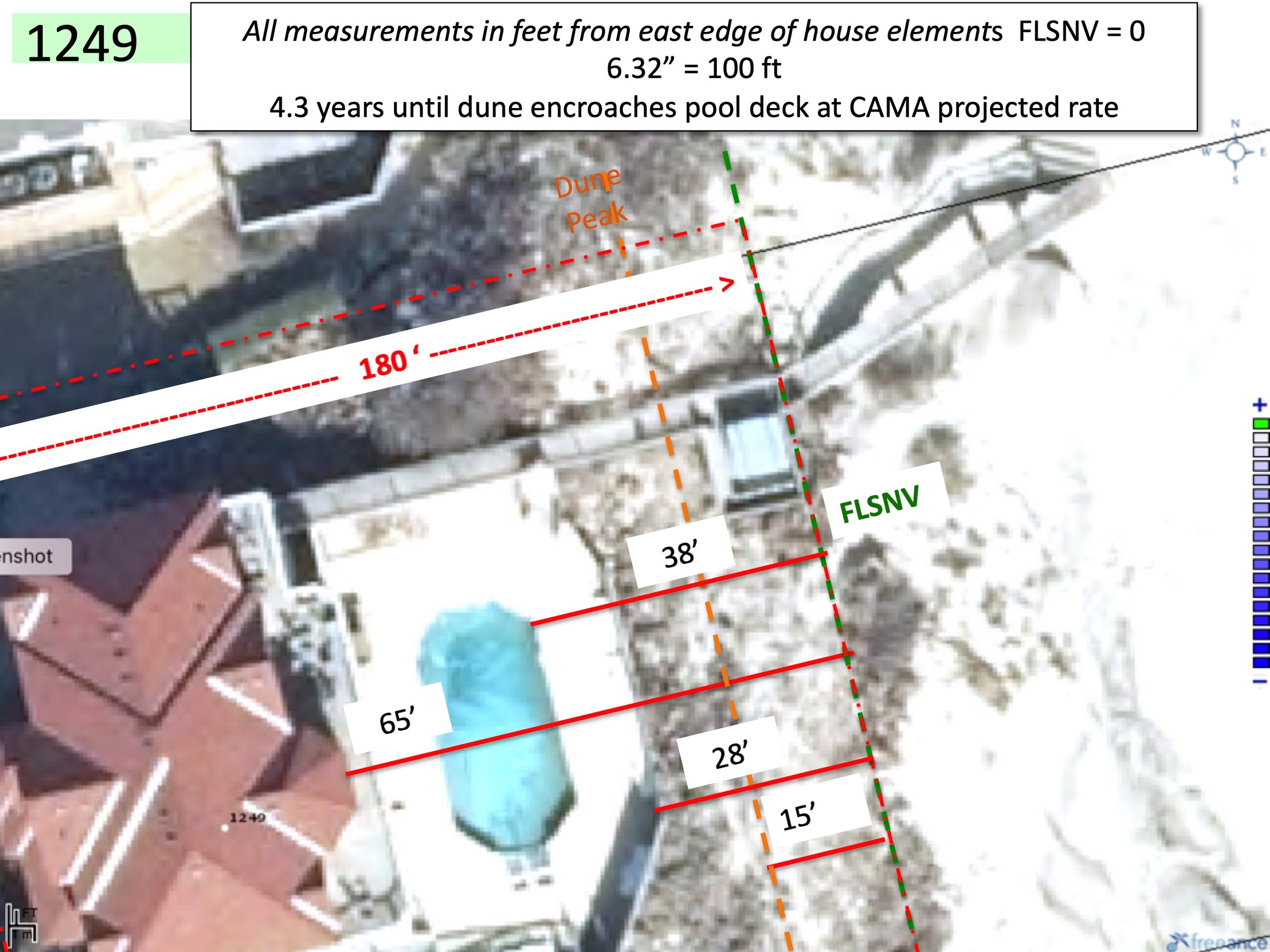
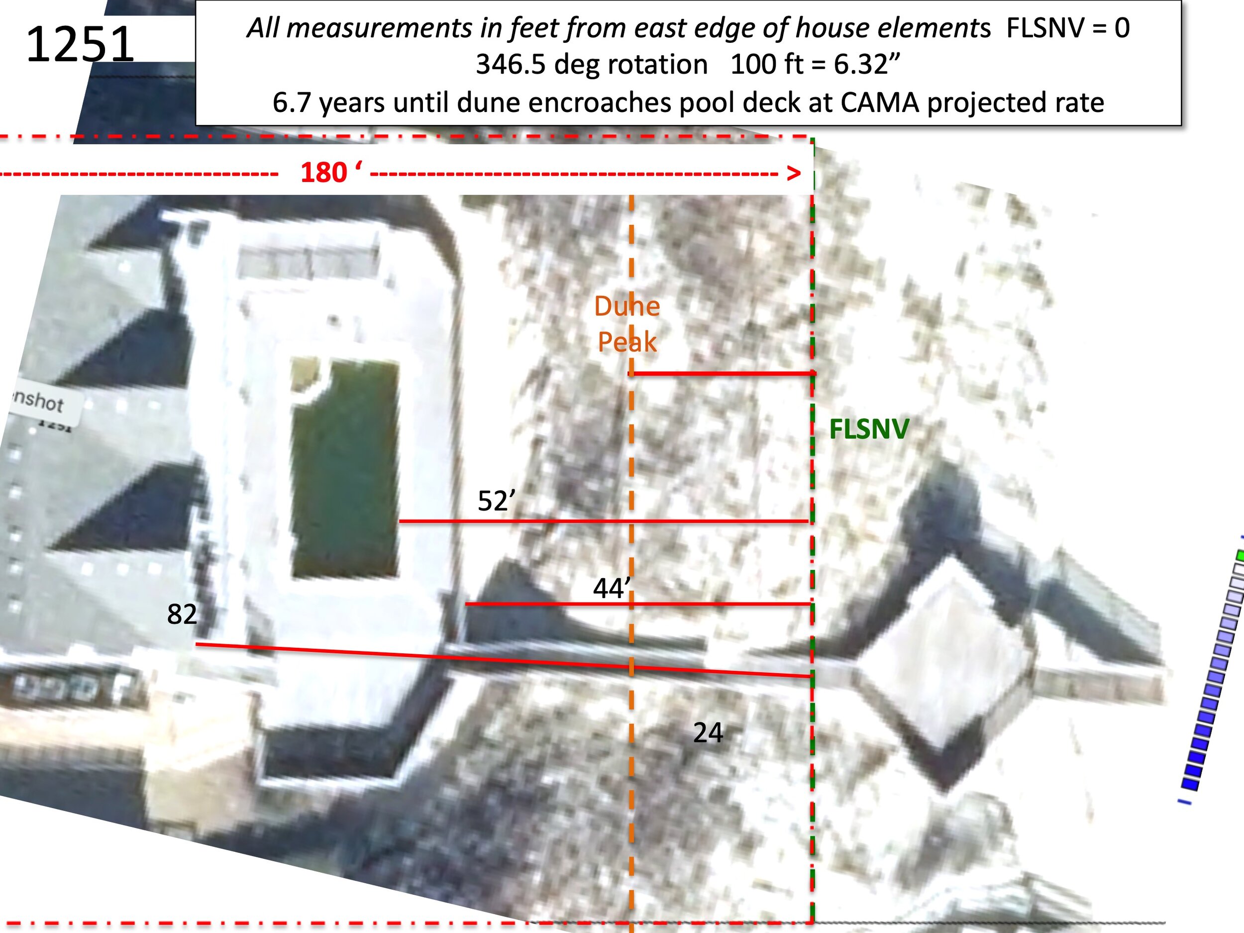
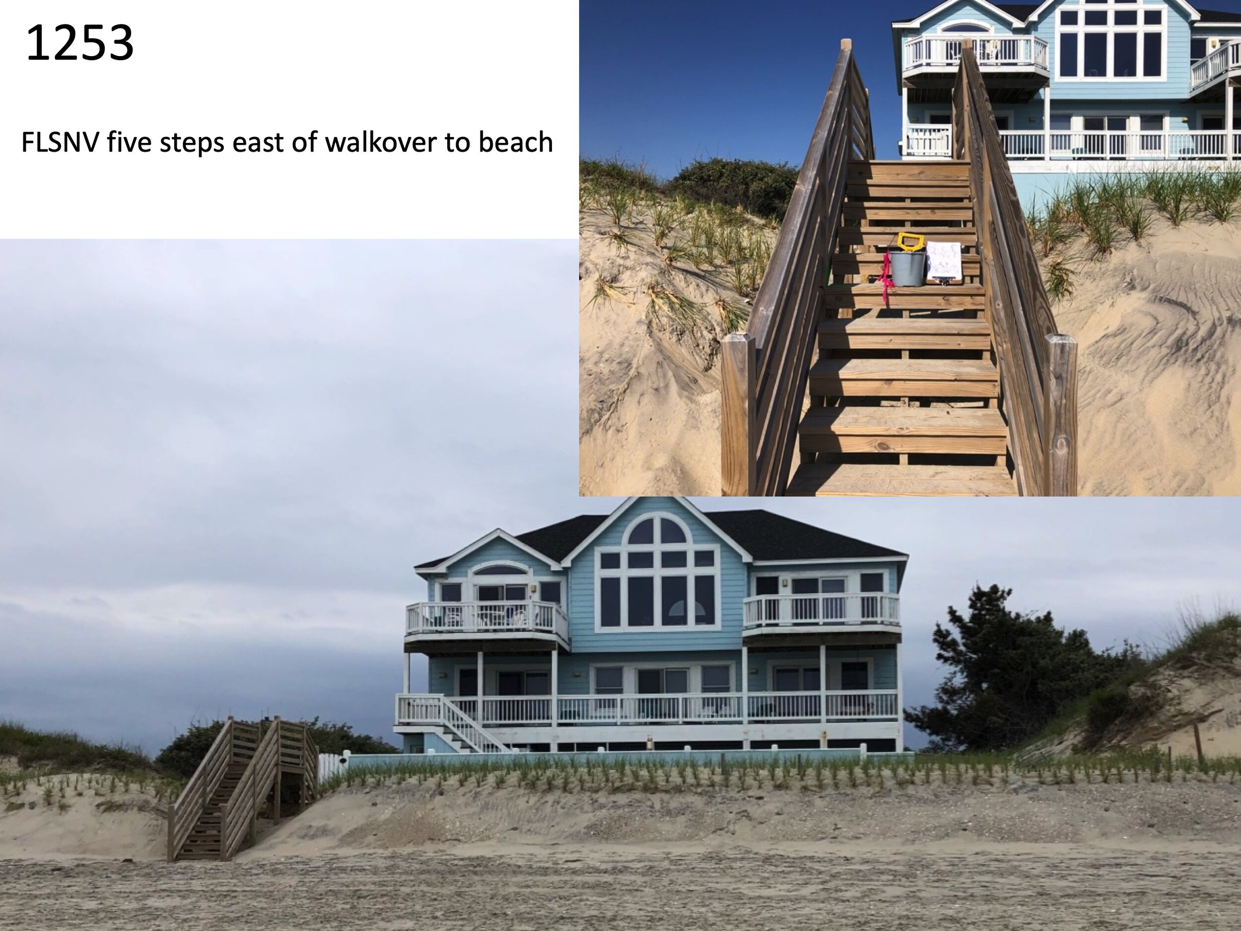
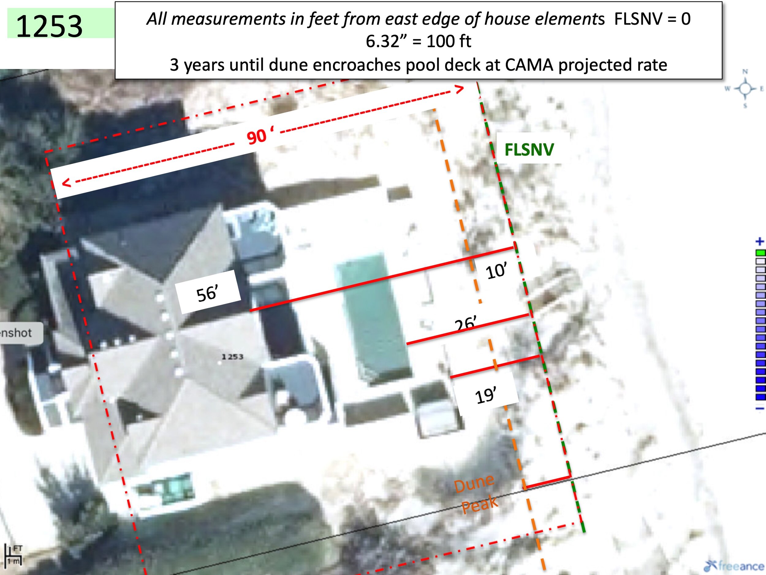
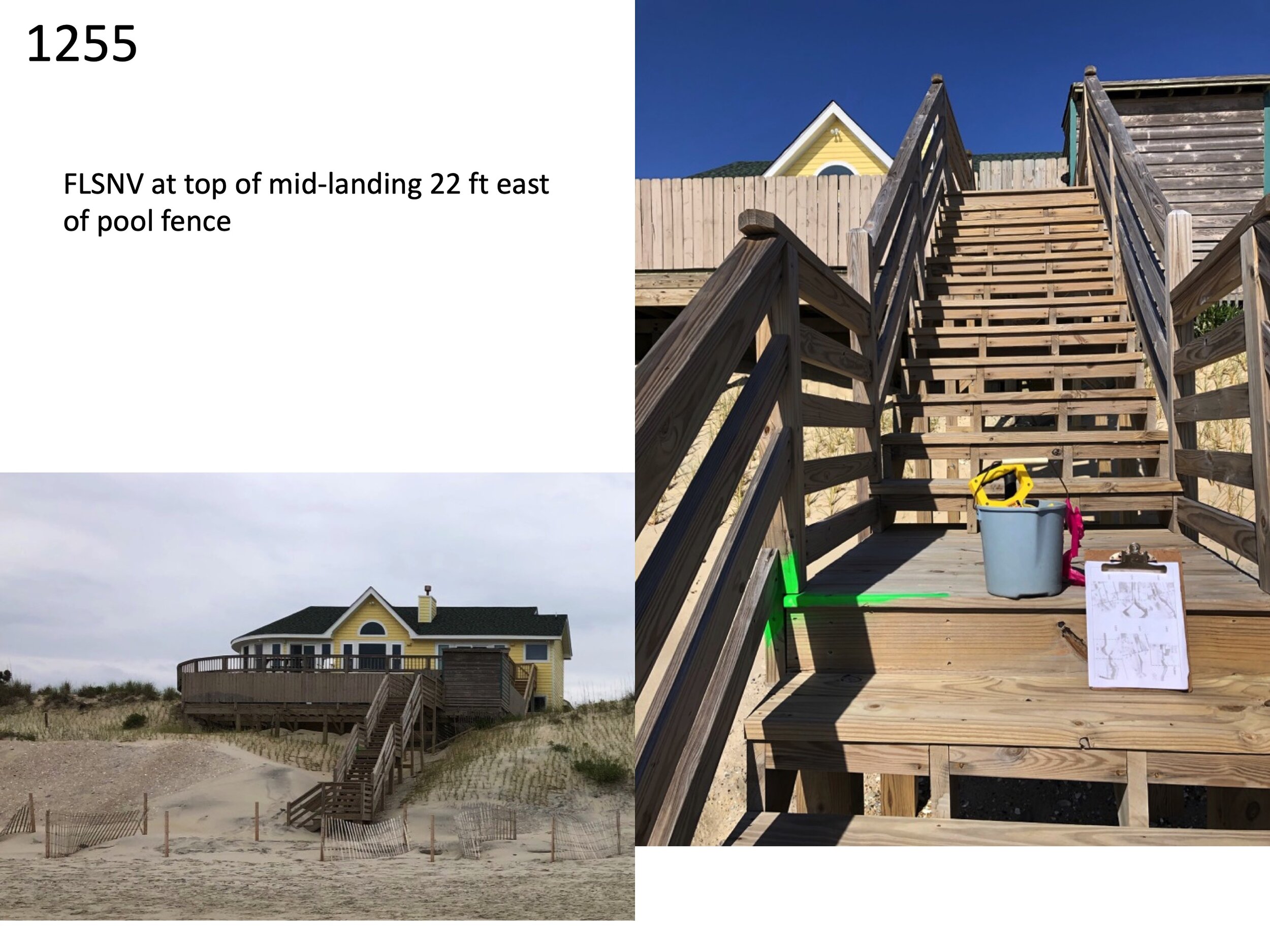
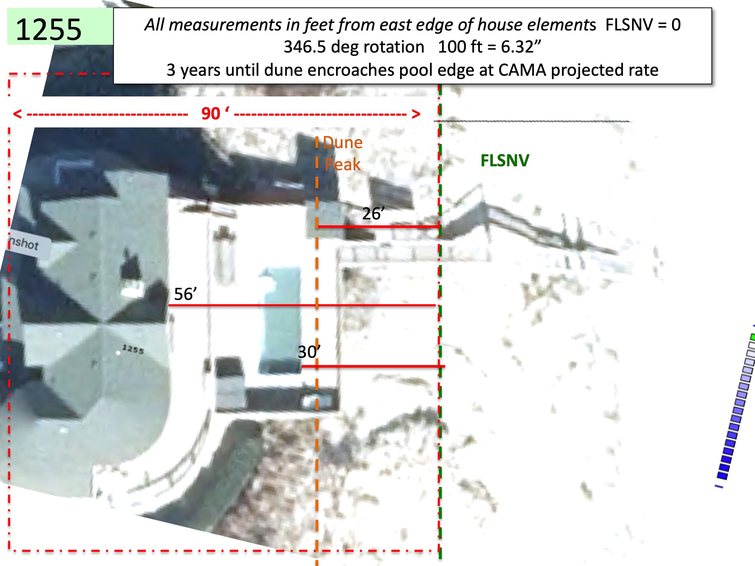
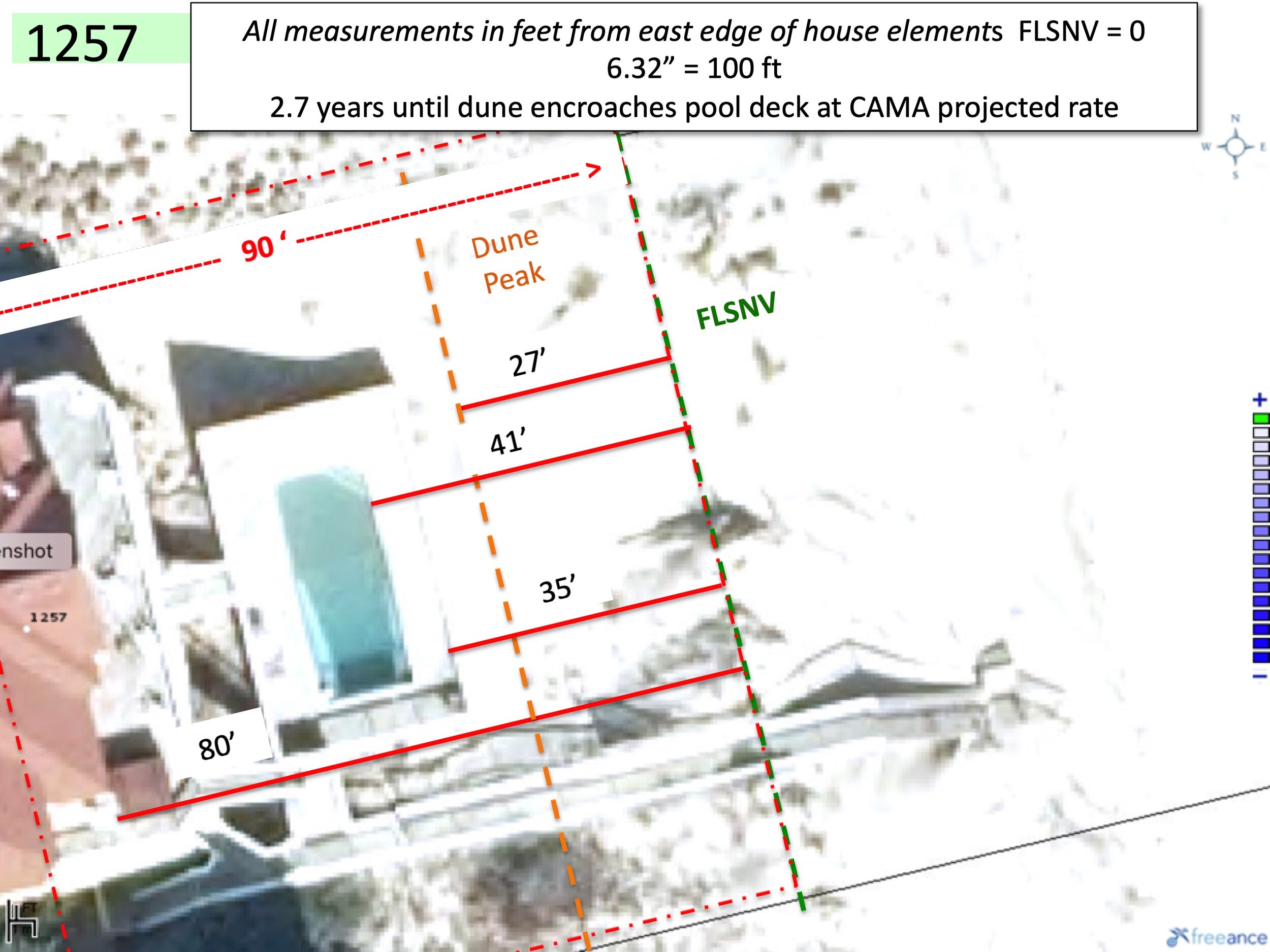
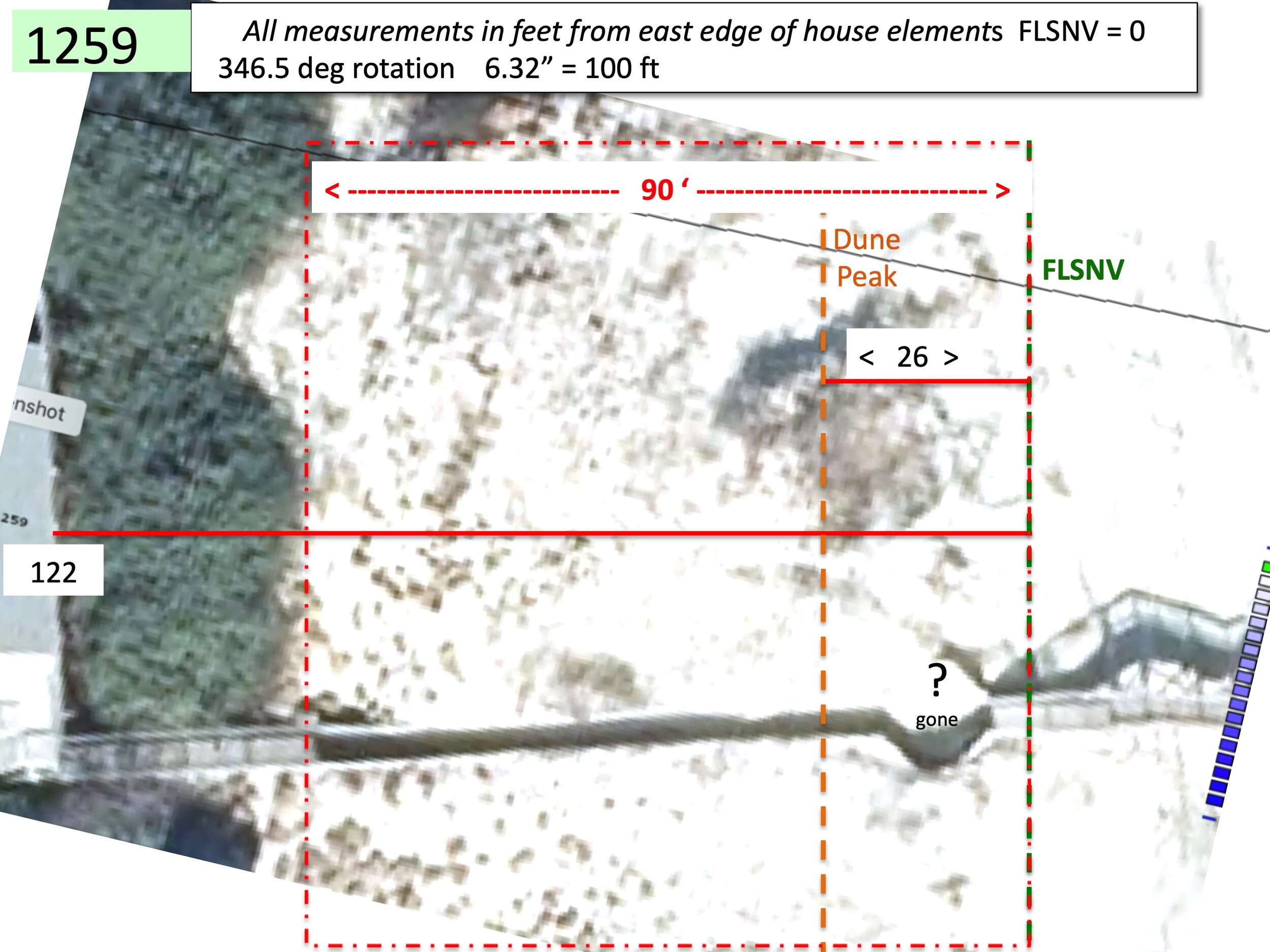
In 2020 Ocean Hill POA sponsored a study of the vulnerability of oceanfront homes and the dry sand beach. The team arranged for CAMA to mark the First Line of Natural Stable Vegetation (FLSNV) for each of our 30 oceanfront homes. Then a team led by Pete Burkhimer, Professional Engineer, measured the distance from the FLSNV to the dune peak and the closest approach to the pool deck, the pool, the house deck and the house. CAMA regulations place severe restraints on repair and replacement of any oceanfront structures that are within 90 feet of the FLSNV. For homes with living space 5,000 SF or larger must respect 180 ft restrictions.
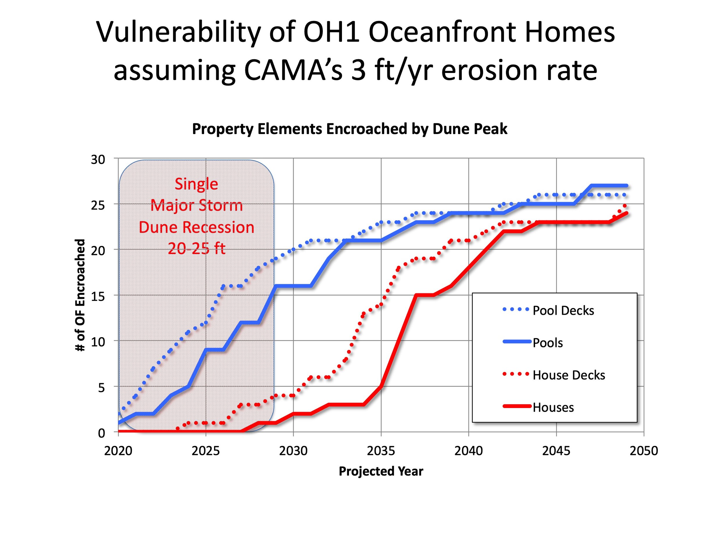
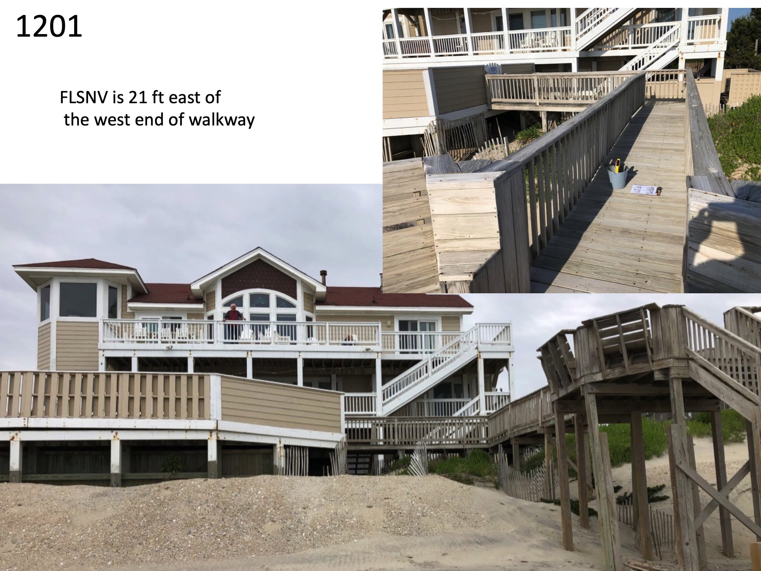
Below is a graphical representation of the results of this work. The aerial photos are from the County’s Graphic Information System (GIS). On top of each lot’s photo is a scaled dimension of the setbacks from the FLSNV and the 90’ or 180’ setback indicator of how far back the rebuilt house would have to be placed if the current house were substantially damaged by a storm.