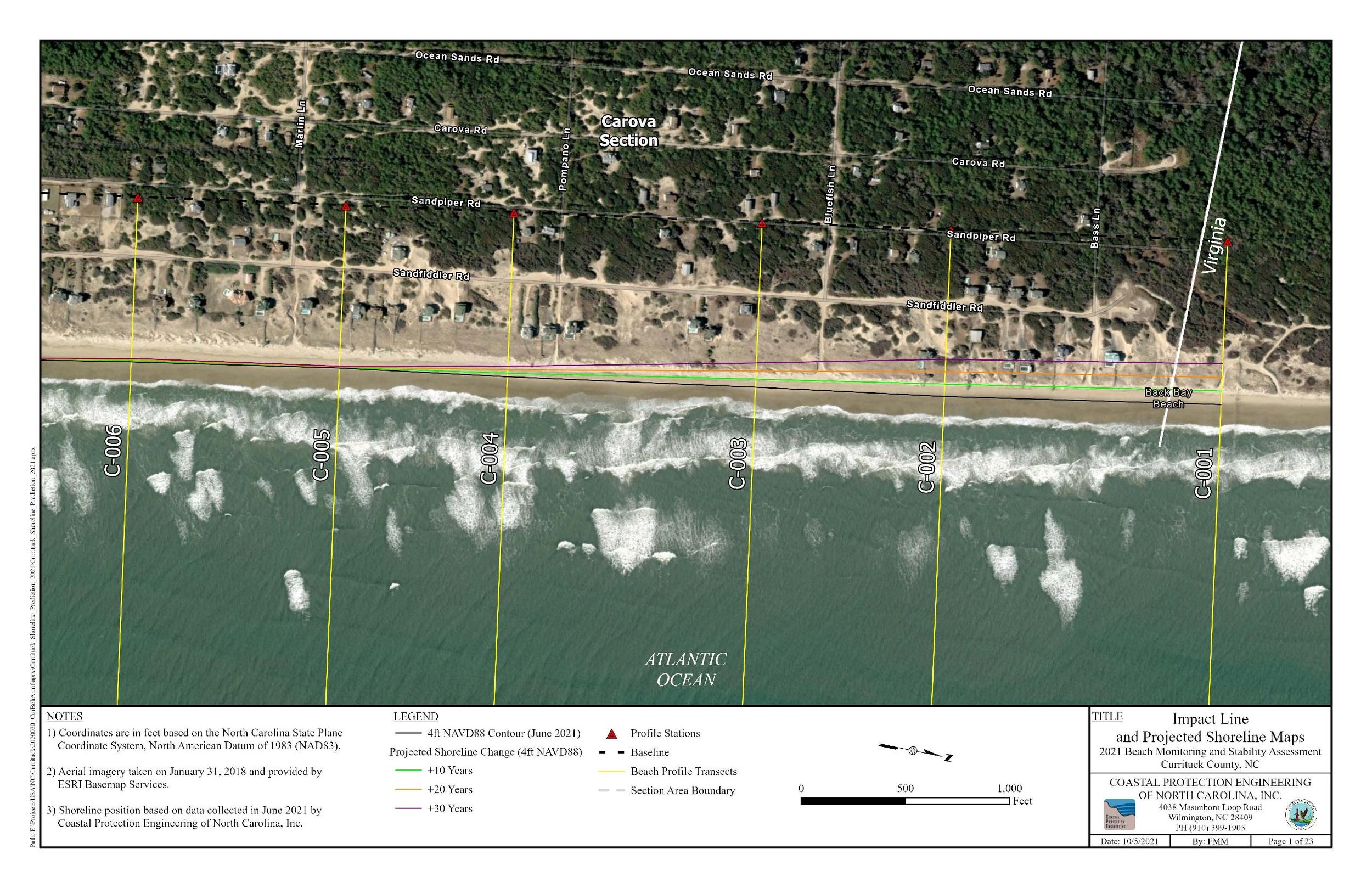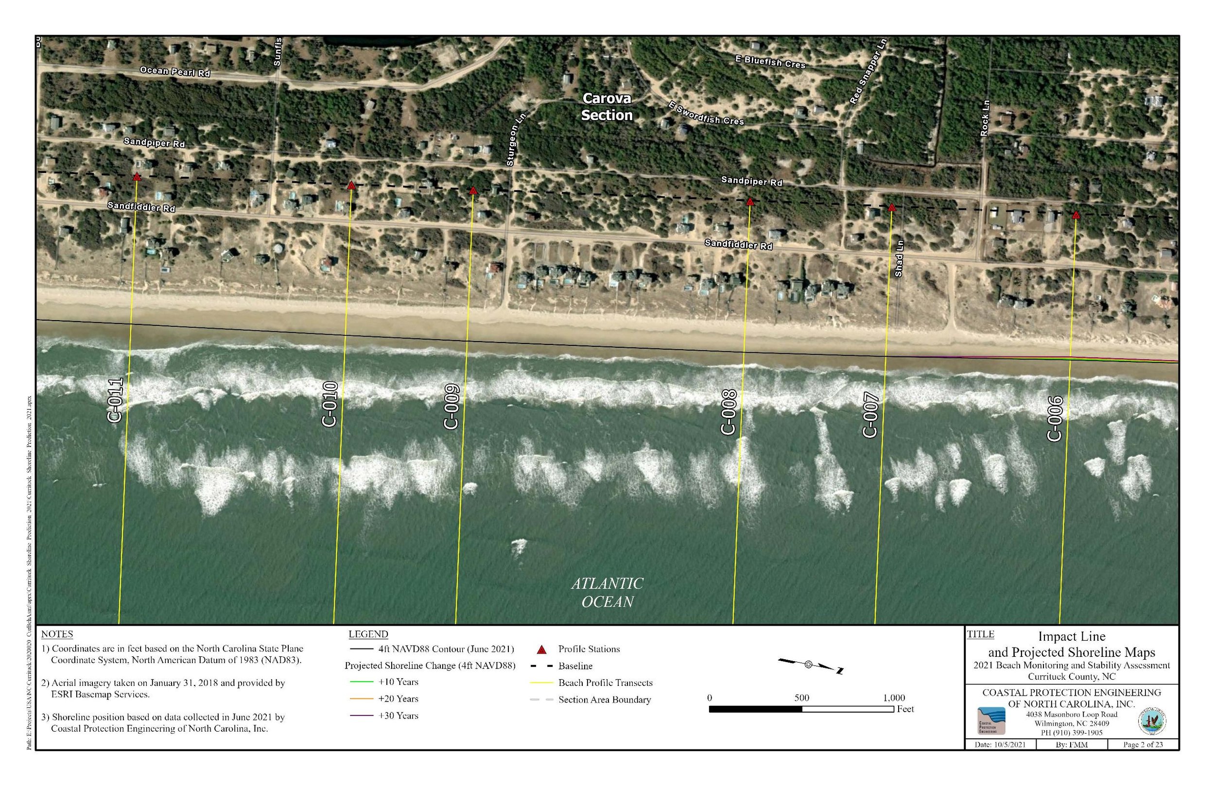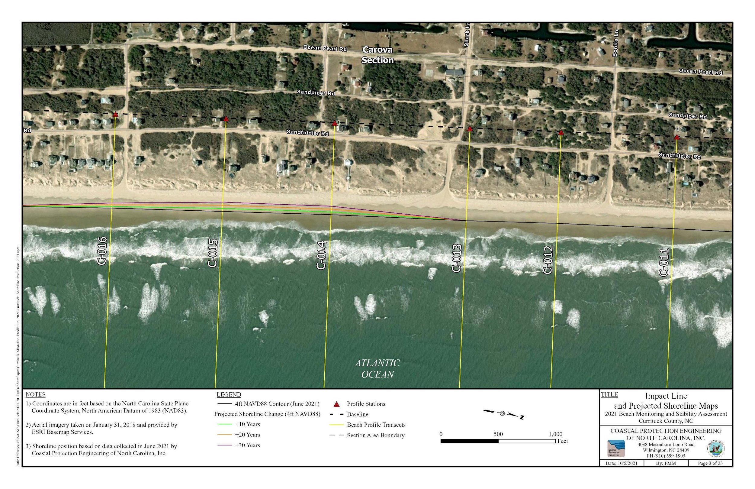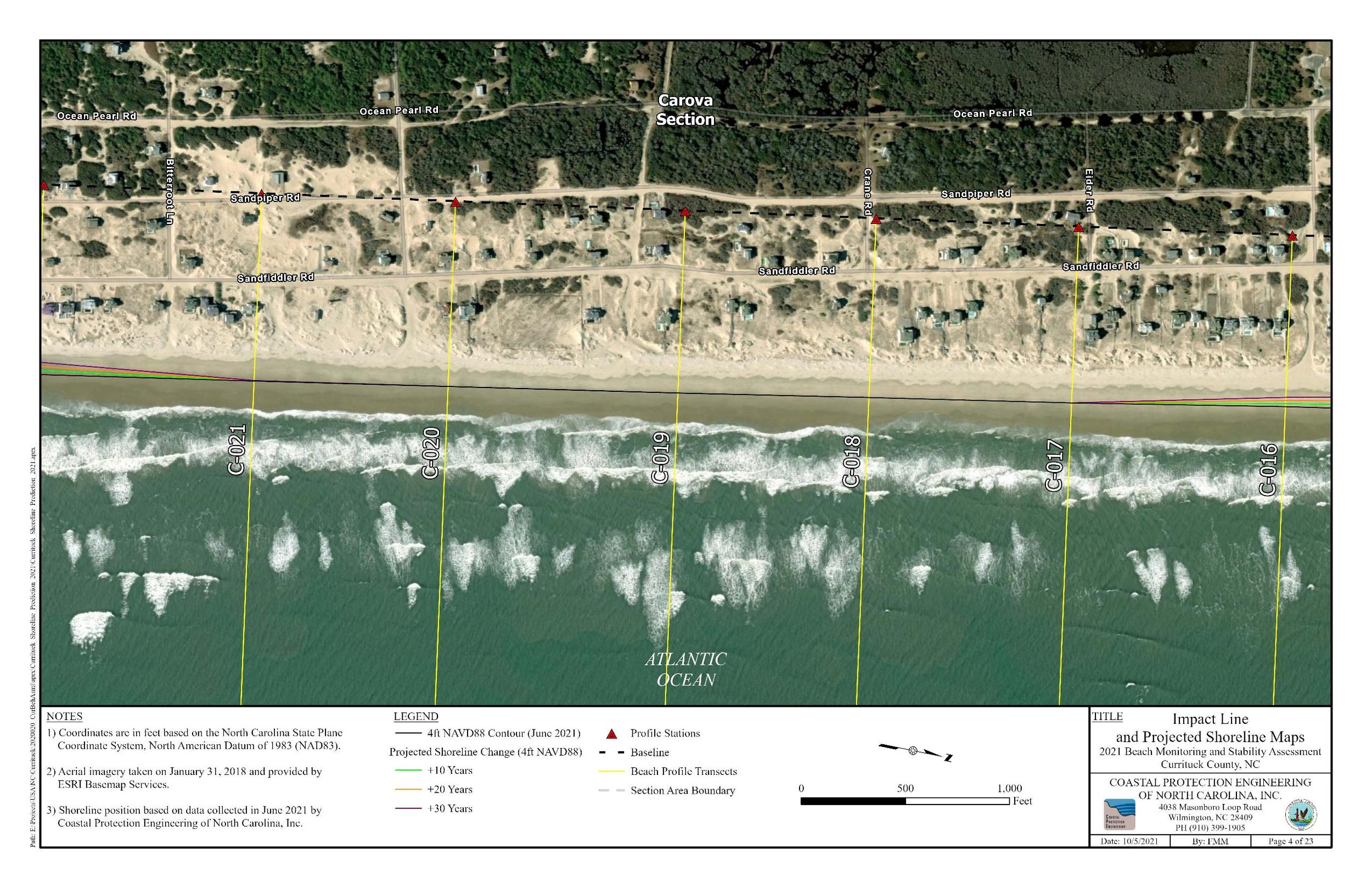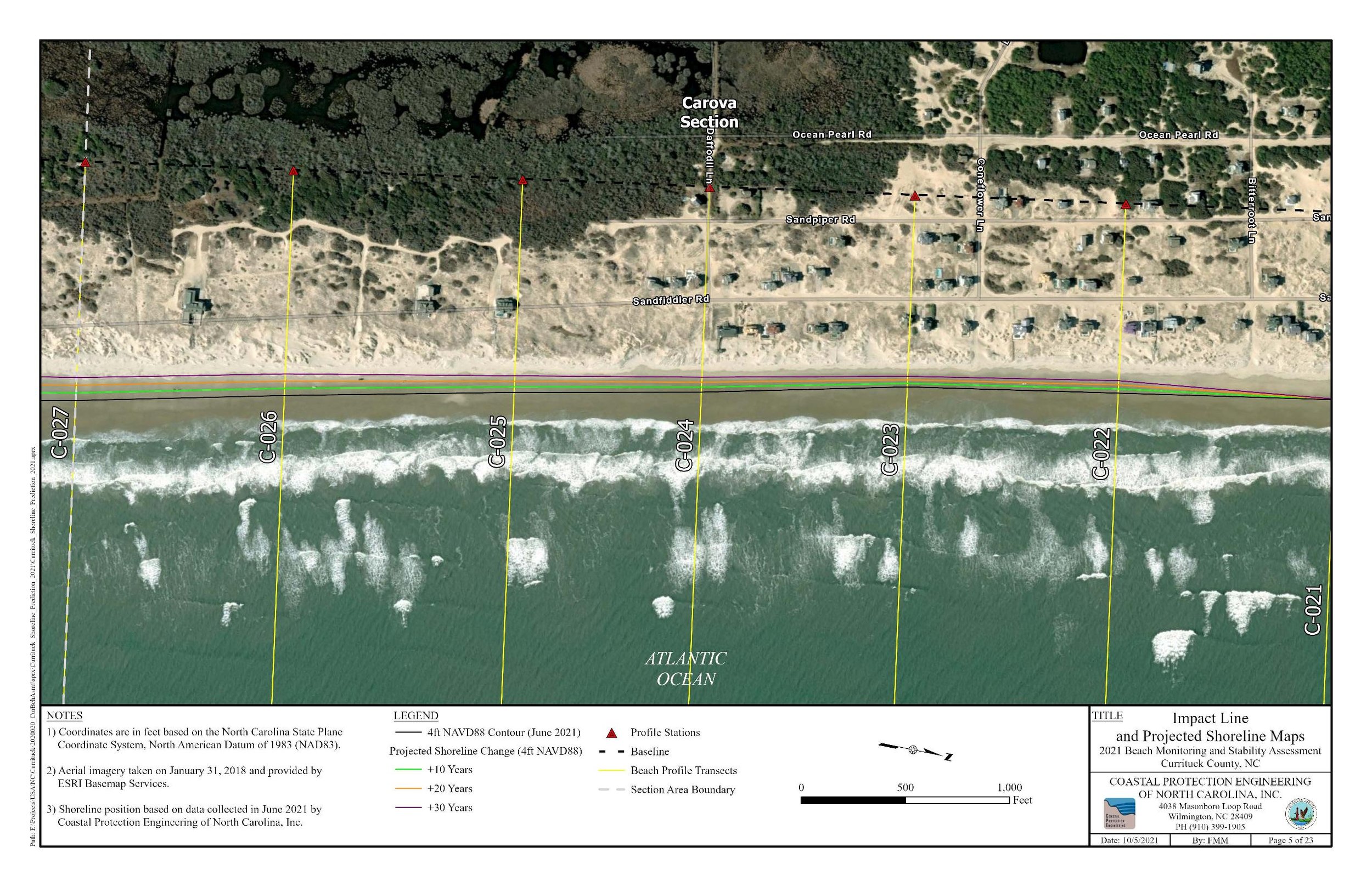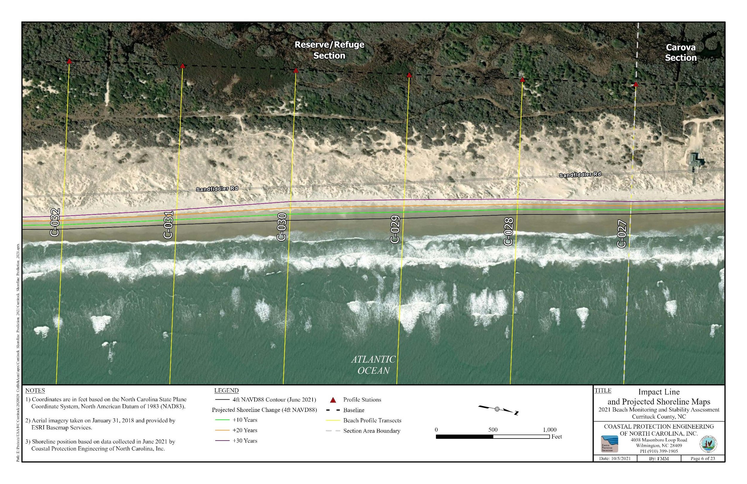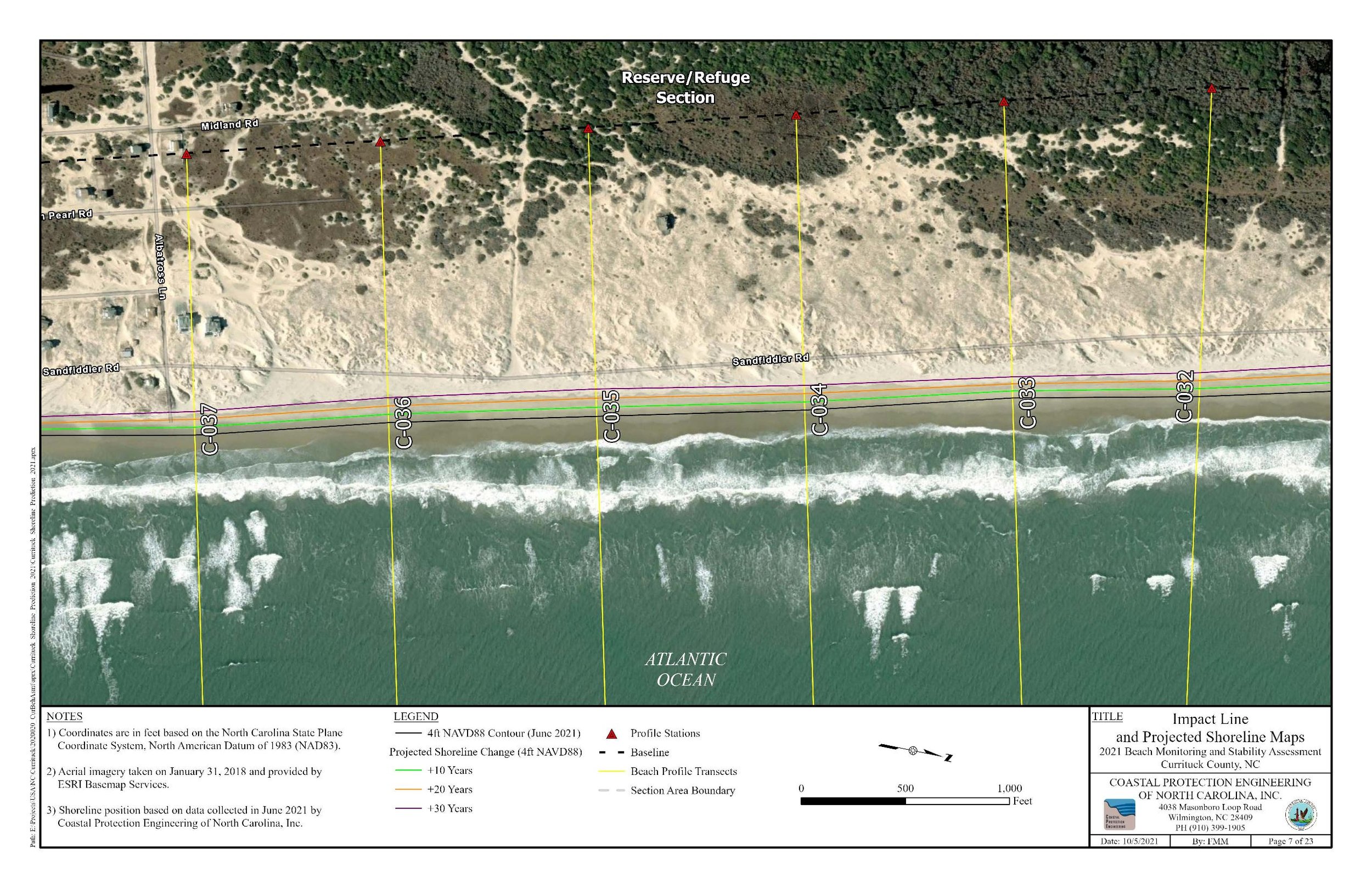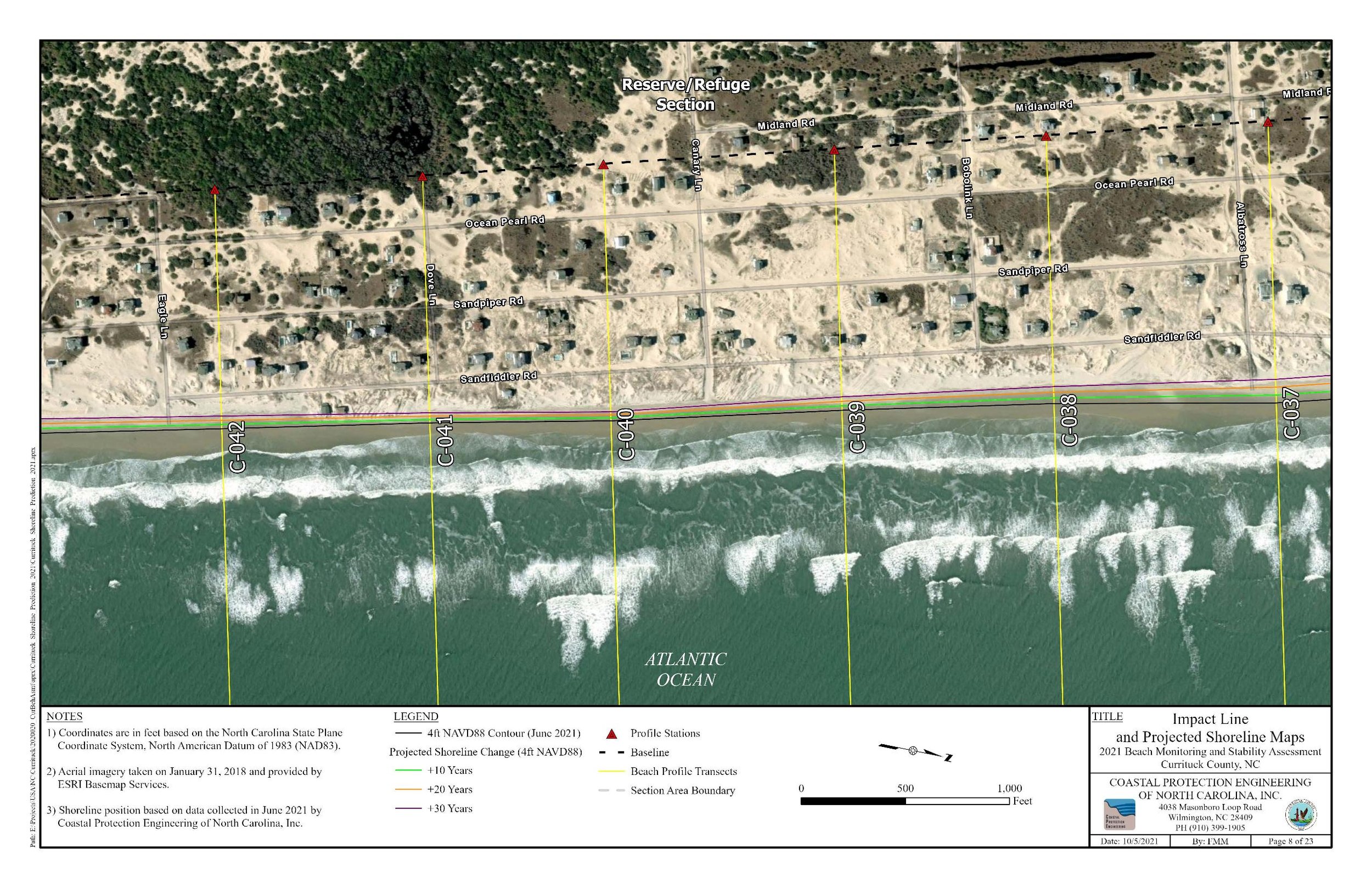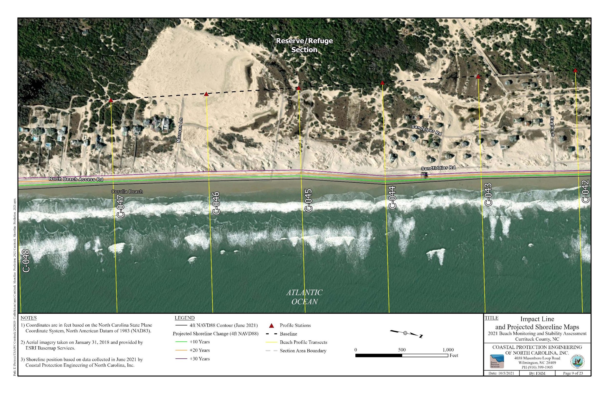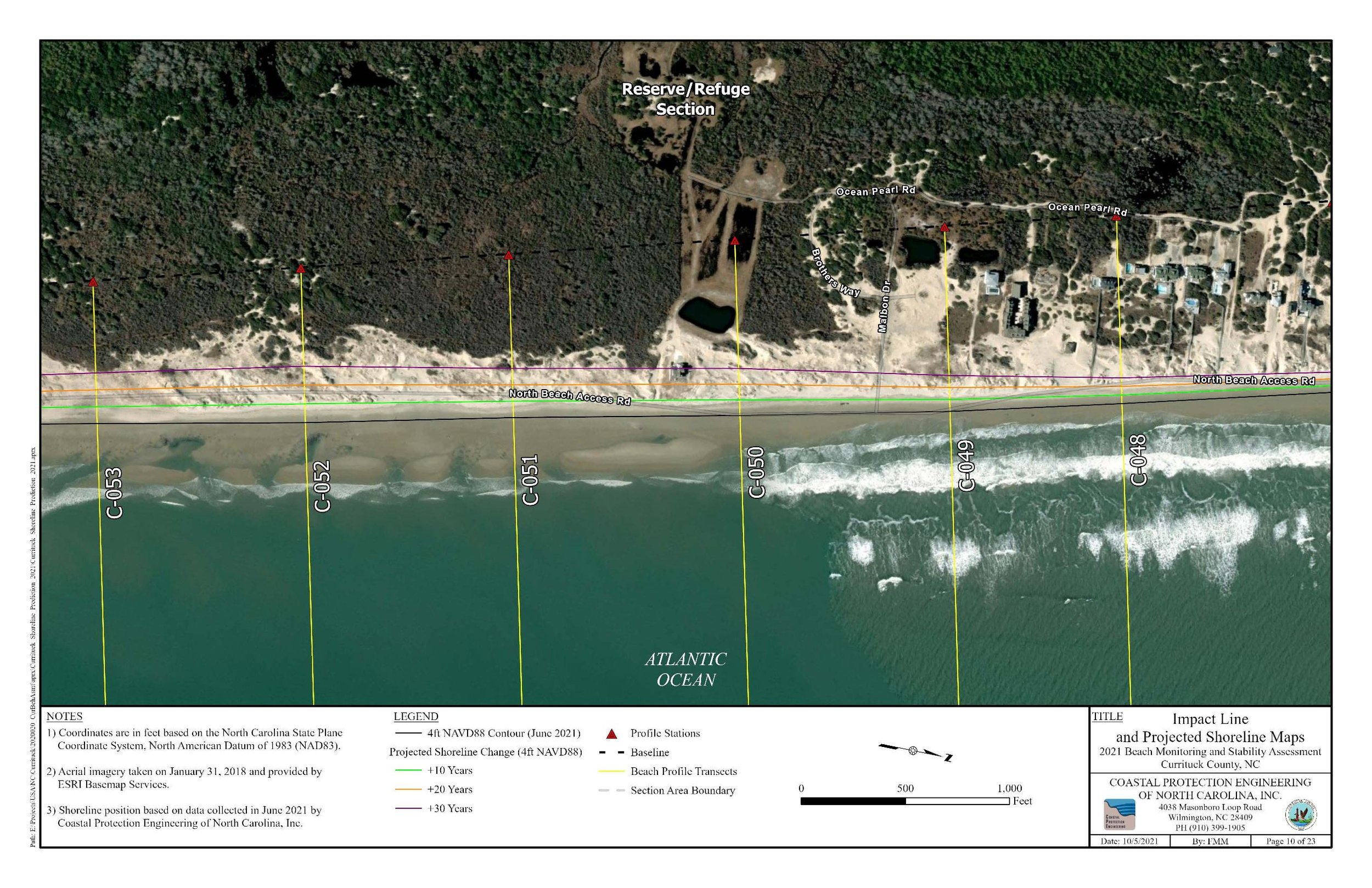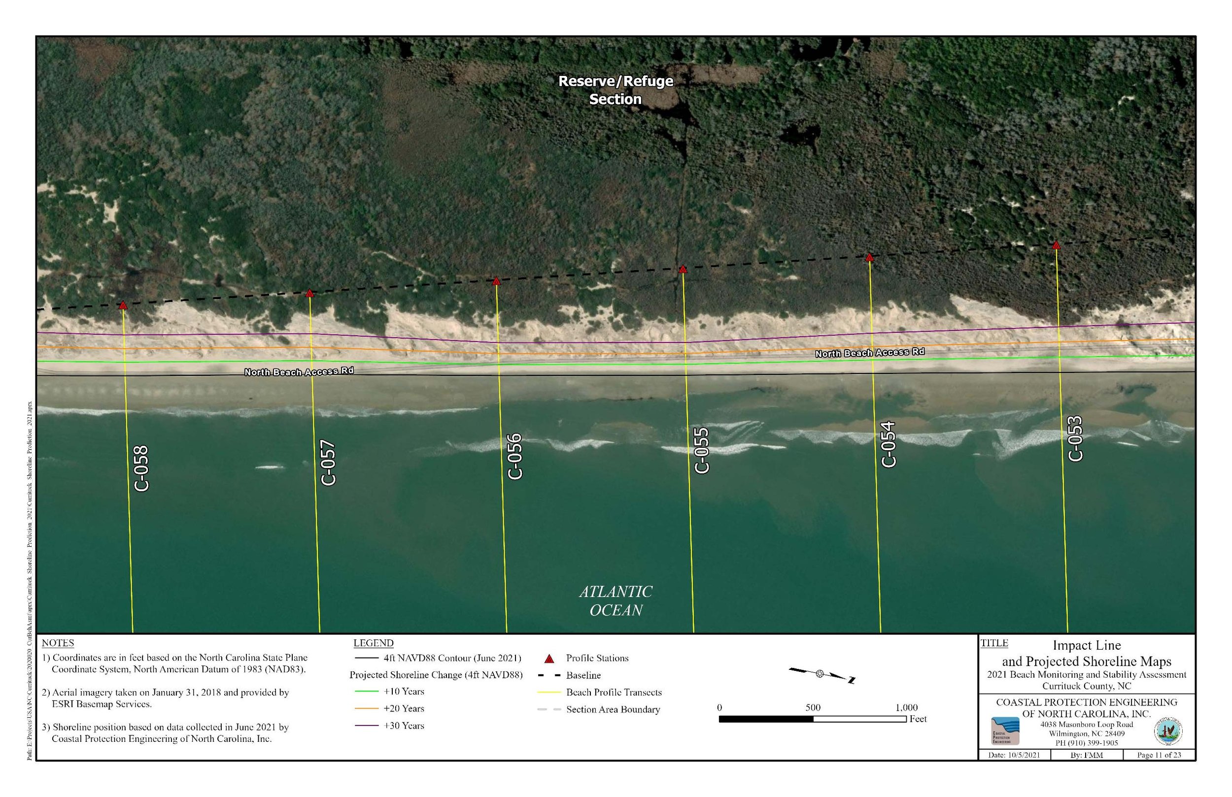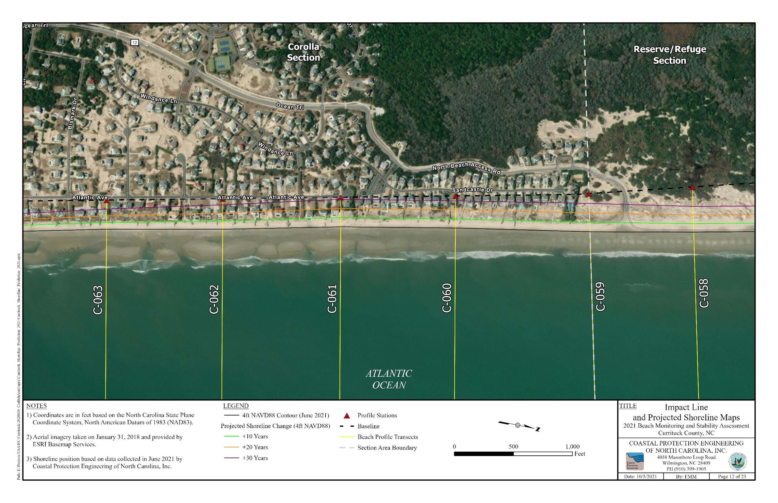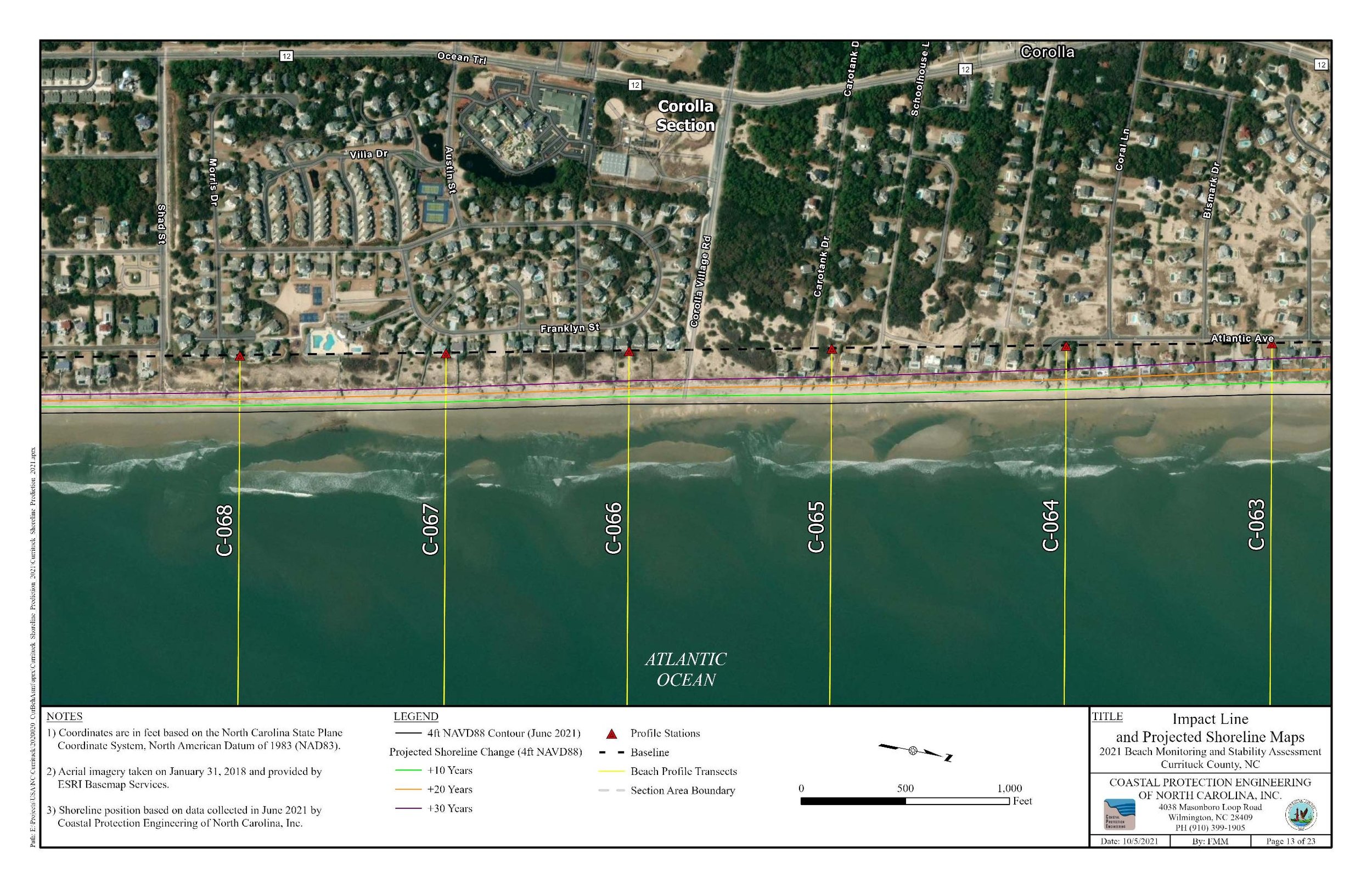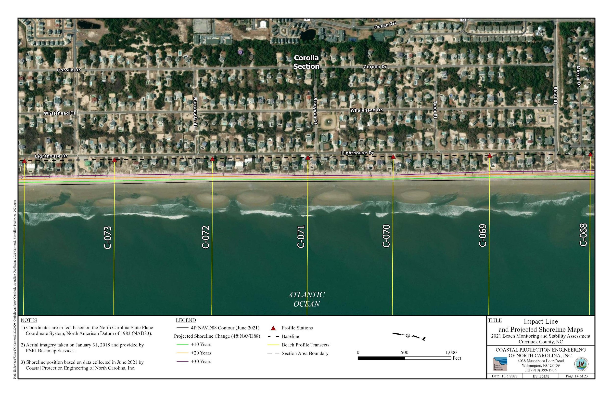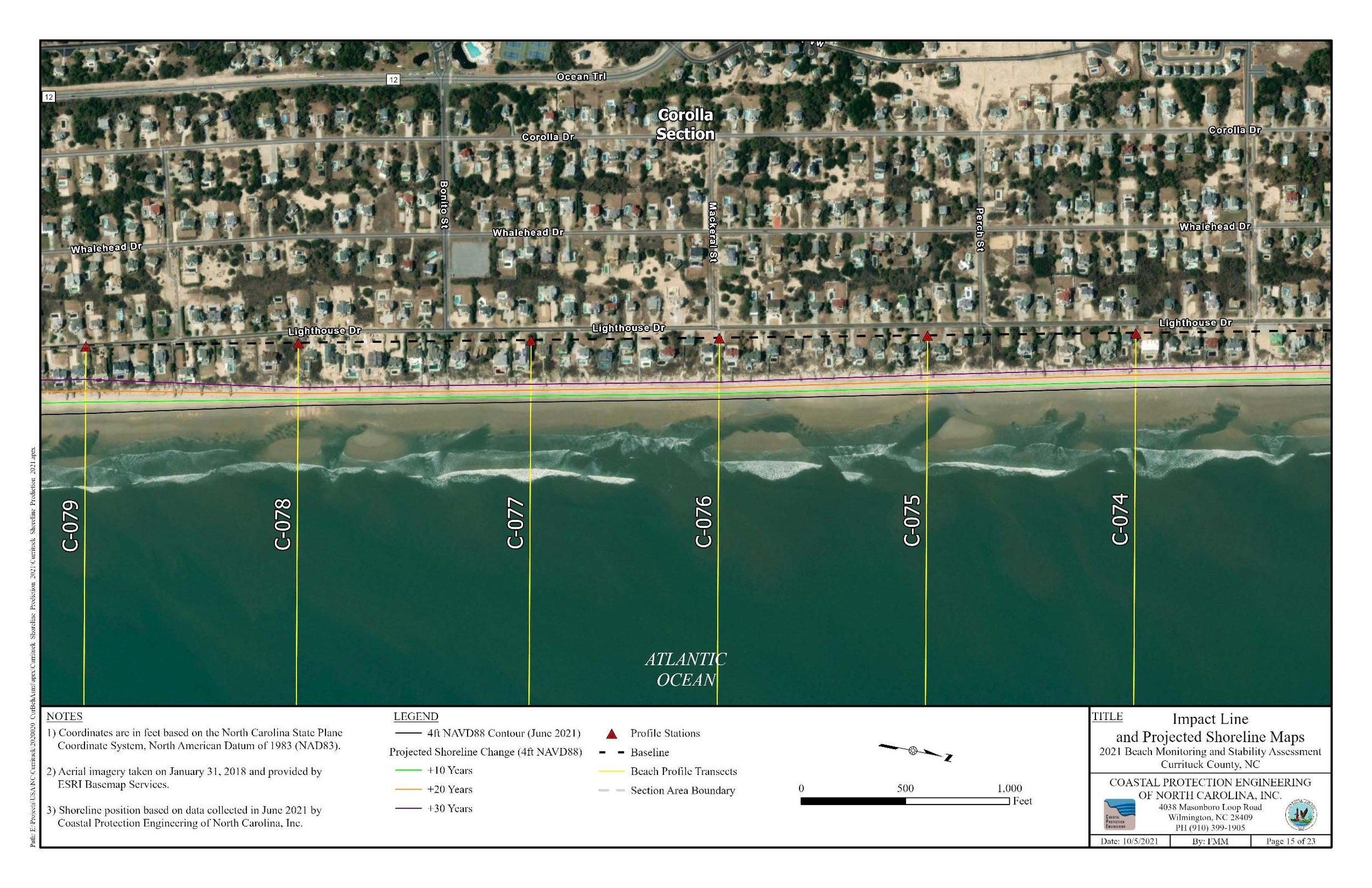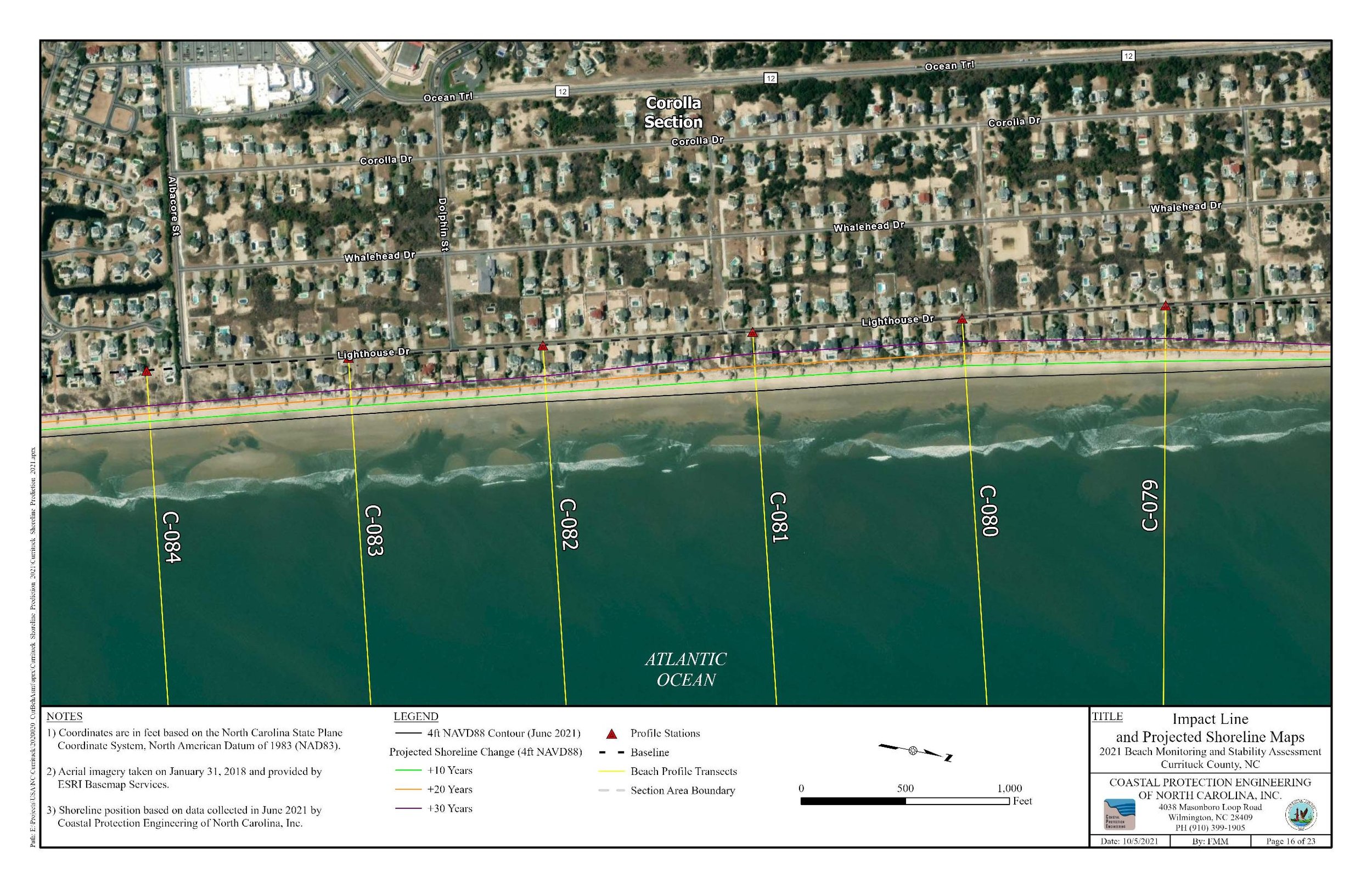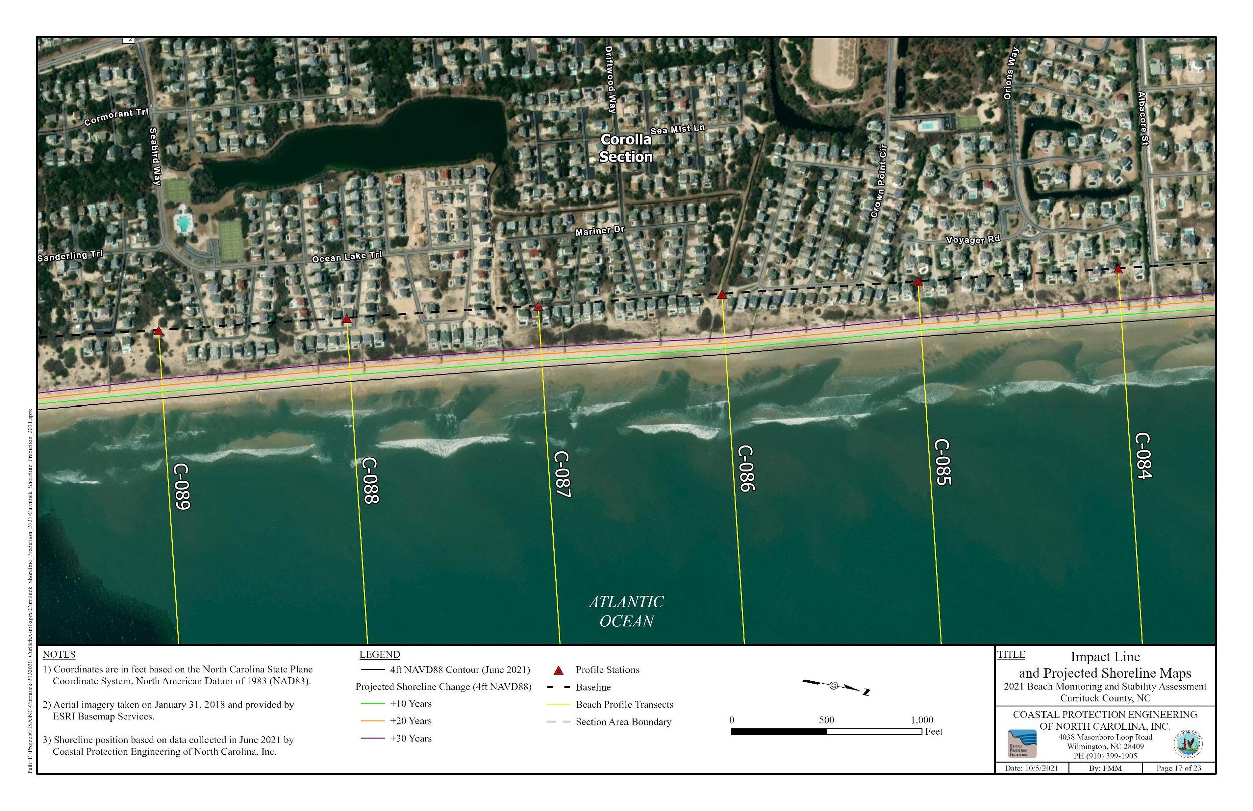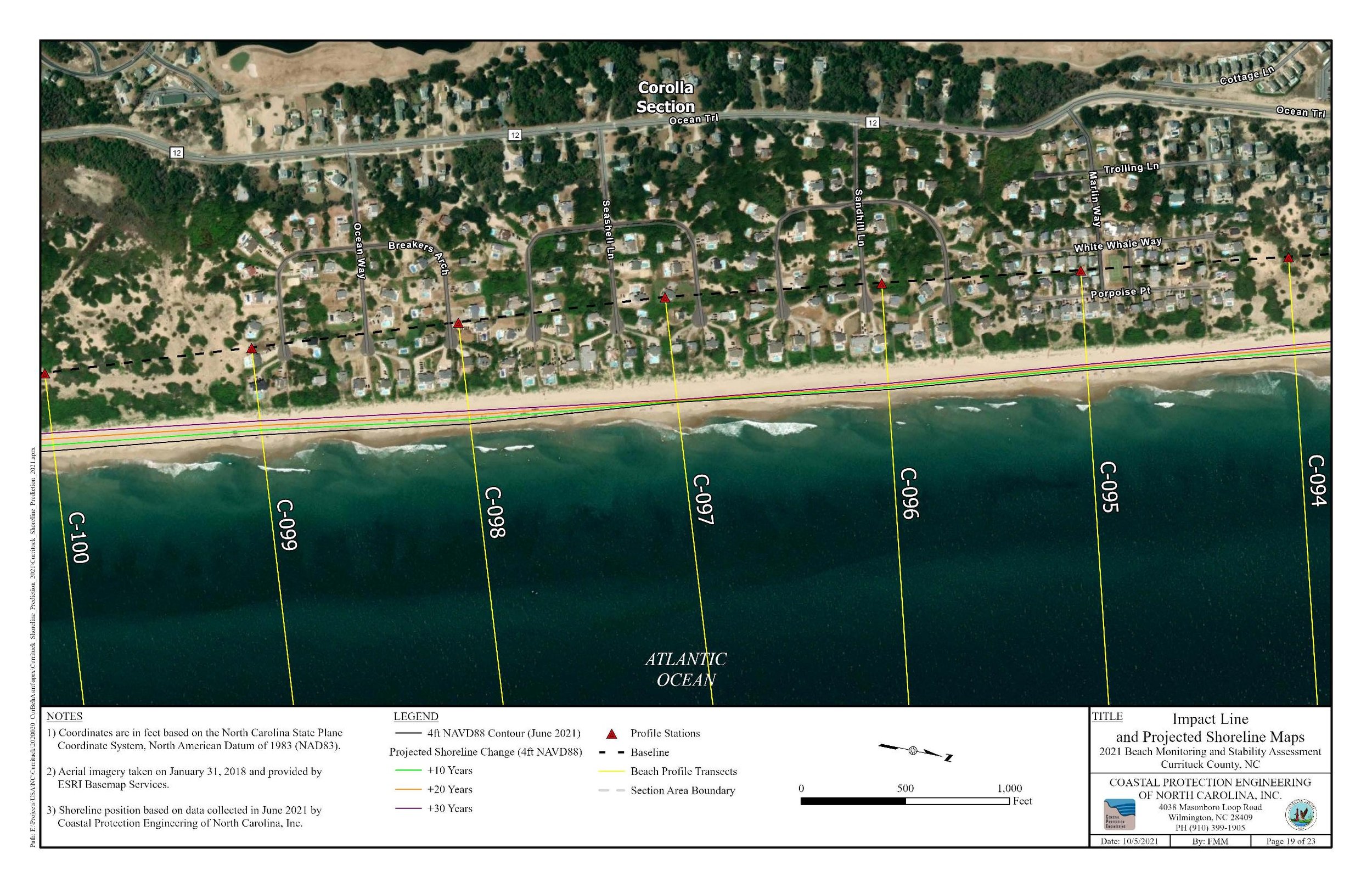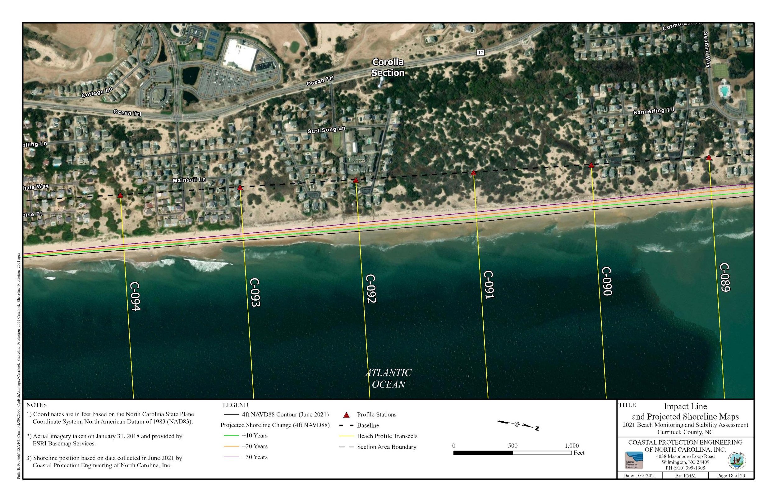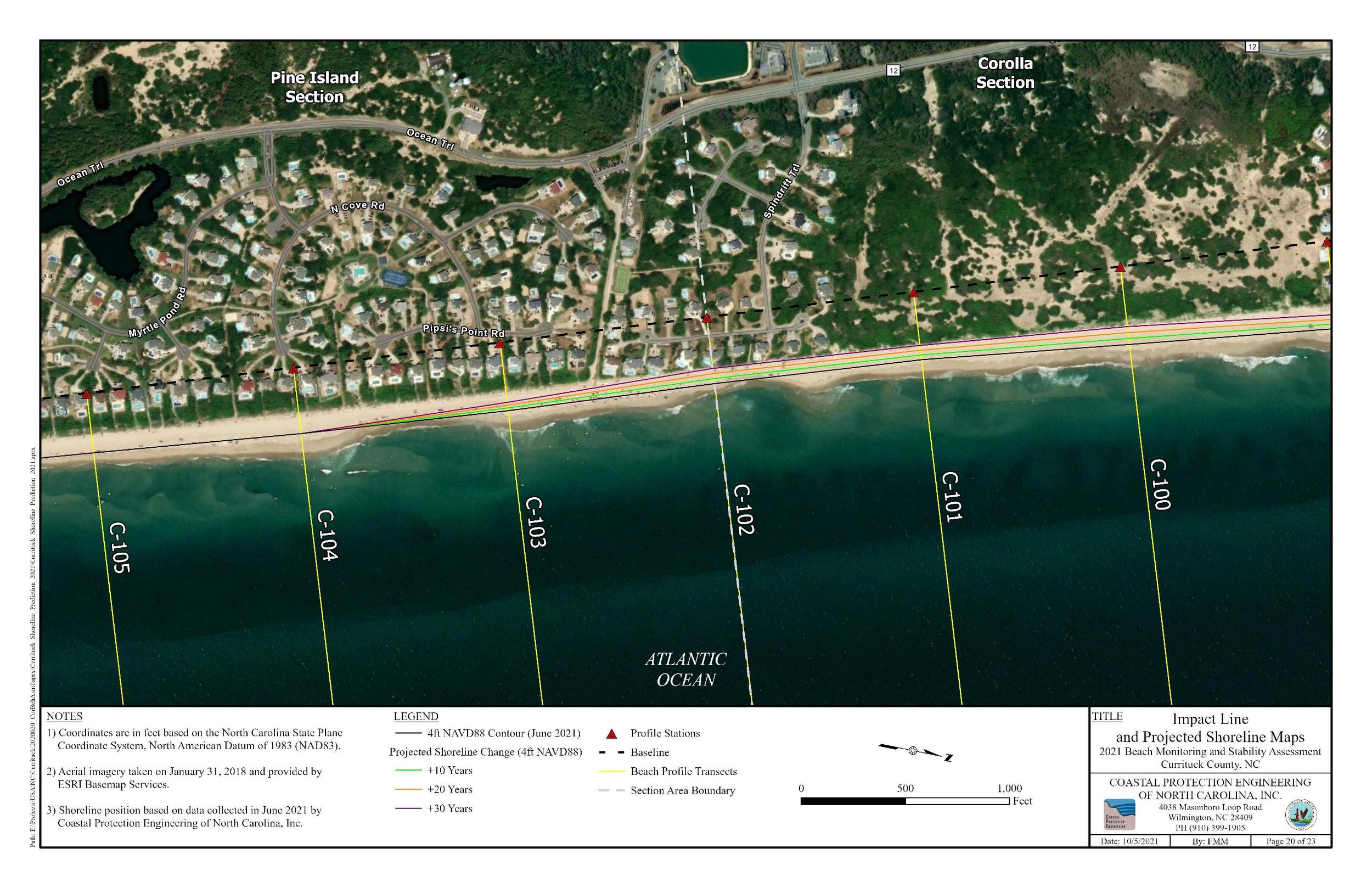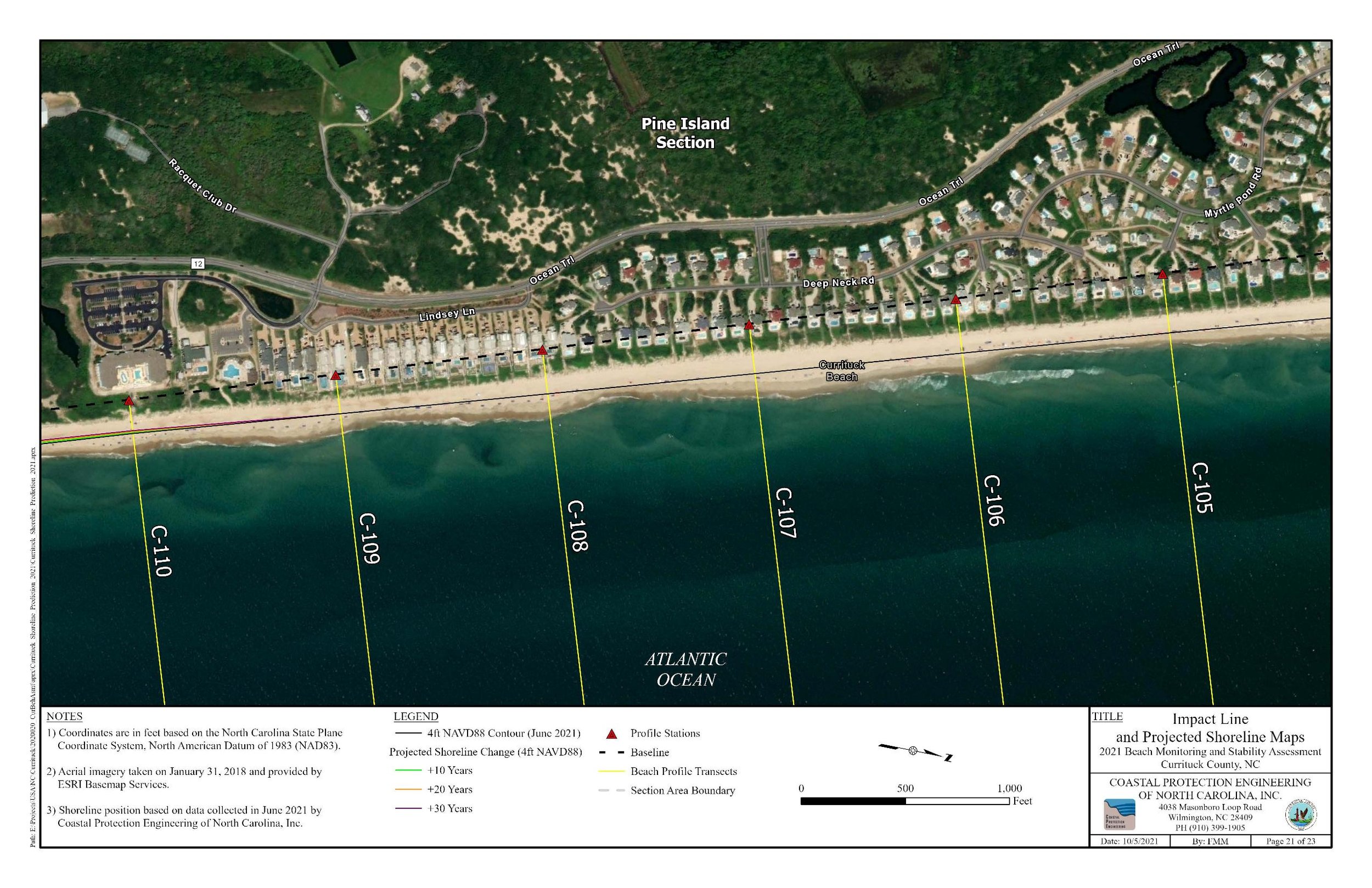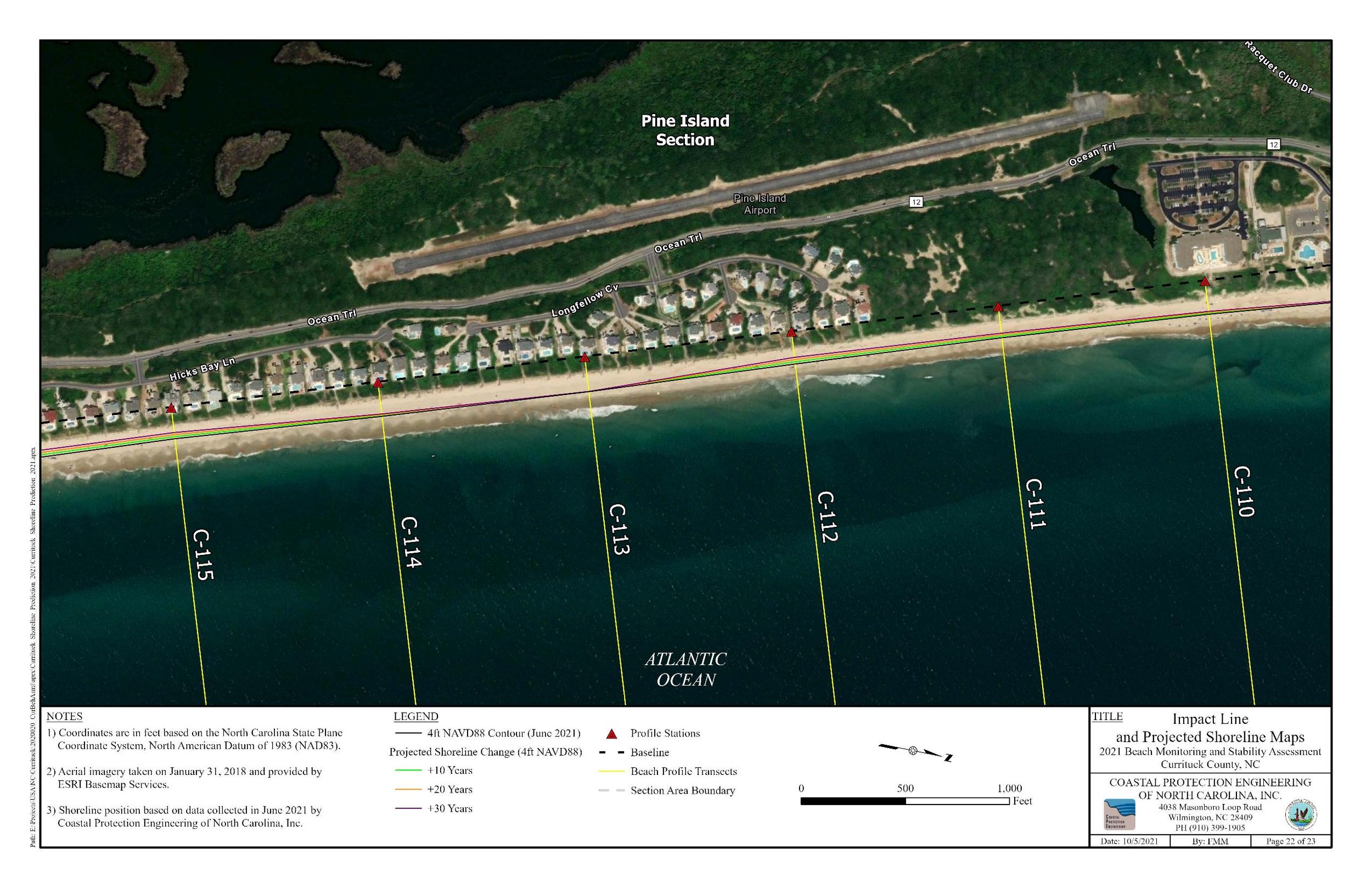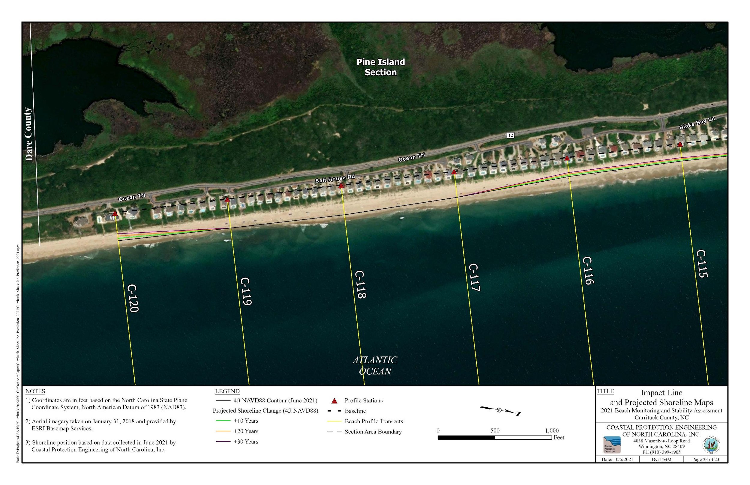
The shoreline maps indicate the location of the 4 ft above sea level high tide line in the future based on current estimates of the normal erosion rate. Note that a major storm like Hurricane Isabel in 2003 has demonstrated the ability to create ten years erosion in only a few days.